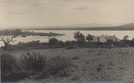
Most of the papers consist of notes made about historical queries, a rough draft of his book, and correspondence with East Coast residents and others requesting information. There is also a collection of newspaper cuttings and pamphlets relating to the history of Tasmania, especially the East Coast and some photographs and snapshots. Dr Parker also collected some original historical documents~ chiefly from East Coast families (although those of Dr Storey and the Cotton families have now been returned to the Cotton archives (ref. C.7). Dr Parker's collection of Walch's Almanacs has been supplemented by others received from Walch's and is kept up to date and now forms a complete record set for Walch's records (kept for reference in the Archives Reading Room). Some early newspapers (including Colonial Times, Southern Cross, Launceston Courier) were transferred to the State Archives to fill gaps in their collection .
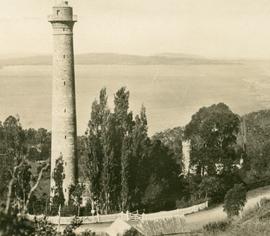
Photograph of the Shot Tower, Browns River Road, Hobart, with the Derwent River and South Arm in the background. Photograph may have been taken by George Musgrave Parker.
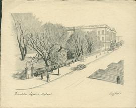
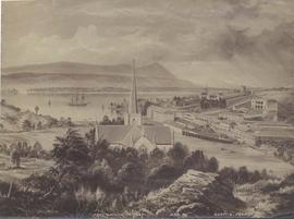
Sketch of Franklin Square, Hobart, by Roy Cox. Roy Cox (1903-1976) was a Tasmanian artist and print maker. He originally worked for Cox Kay printers in Hobart.
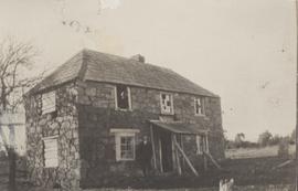
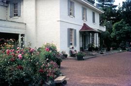
Photograph of Apsley House. Originally a single storey sandstone Georgian house built in the 1840's on land granted to John Lyne who was MHA for Glamorgan in the period 1843-1865. Small kodak prints. ?G.M.P photographer thought to be taken c1920's - (See also book ch.3, P1/35 (262)
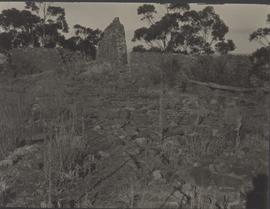
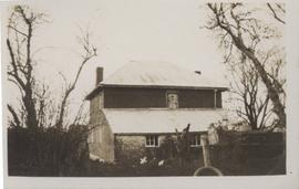
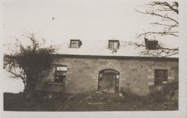
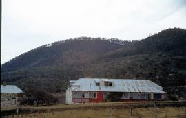
Photograph, thought to have been taken in the 1930's, of the rebuilt Milton Farm house. In 1826, young John Allen applied for and received a grant of land on Tasmania's east coast: four hundred acres on the west bank of Cygnet River. He named the property Milton, after his home village in England. In February 1828, he reaped his first harvest, but in that same month, an Aboriginal raiding party attacked the (undefended) property, after previously harassing Allen's neighbours John Lyne and George Meredith. Allen's house was robbed and torched and his wheat stack burnt; damage was estimated at £300. Subsequently awarded a two hundred acre extension to his land grant 'as a remuneration for the Aforesaid Loss', he set to work rebuilding, this time a two-storey house of stone.
Photograph, thought to have been taken in the 1930's, of the rear of the rebuilt Milton Farm house. In 1826, young John Allen applied for and received a grant of land on Tasmania's east coast: four hundred acres on the west bank of Cygnet River. He named the property Milton, after his home village in England. In February 1828, he reaped his first harvest, but in that same month, an Aboriginal raiding party attacked the (undefended) property, after previously harassing Allen's neighbours John Lyne and George Meredith. Allen's house was robbed and torched and his wheat stack burnt; damage was estimated at £300. Subsequently awarded a two hundred acre extension to his land grant 'as a remuneration for the Aforesaid Loss', he set to work rebuilding, this time a two-storey house of stone
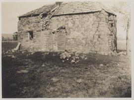
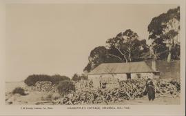
Postcard produced by Swansea photographer, Miss F.M. Kennedy, (c1880-c1950s) of titled Harbottle's at Swansea, Tasmania. This Cottage has also been know as Harbottle's Cottage and Caulfield Cottage. This single storey, sandstone rubble building with a corrugated iron hipped roof was listed by the National Trust in 1976 as it demonstrated the principal characteristics of a single storey, sandstone Victorian Georgian domestic building . Located at 45 Shaw Street, Swansea, Tasmania
Photograph of front view of Apslawn House. A sandstone Georgian house built in the 1840's on 640 acres of land granted to John Lyne, MHA for Glamorgan ,1843-1865. Located on the Tasman Highway, Apslawn, 13km south-west of Bicheno.
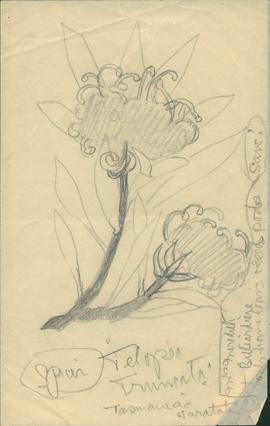
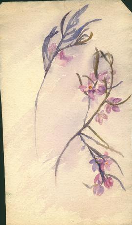
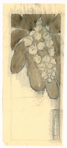
Indian ink with some colour sketch on tracing paper made by Olive Pink between 1940 and 1941. From a collection of sketches made in New South Wales, Tasmania and a few in Queensland.
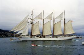
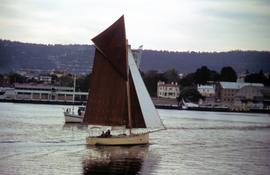
Colour photograph of the Spanish Armada training ship Juan Sebastian de Elcano, a four-masted barque, sailing on the Derwent River during the Tall Ships event held in 1988
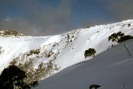
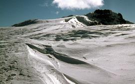
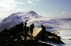
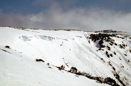
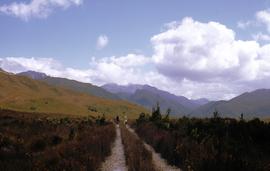
Colour photograph of party of snow climbers nearing a ridge with evidence of recent avalanches, possibly near Mount Field National Park, photograph taken 1968
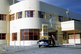
Photograph depicts forecourt of Wrest Point Hotel, Sandy Bay, showing front door with decorative masonry, with five dolphins, ship with St George Cross atop front door. Man in brown uniform standing alongside a Holden FX with dark body paintwork and a yellow painted roof, a taxi affiliated with Hobart's Yellow Cabs, Tasmanian licence plate WXG 772.
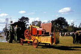
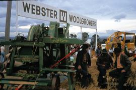
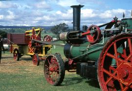
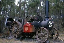
Colour photograph of Aveling & Porter Limited steam engine, painted green, towing yellow and red baler in a paddock with people and other machinery on display.
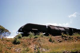
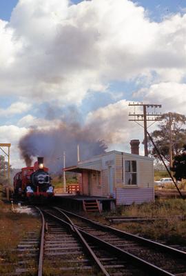
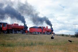
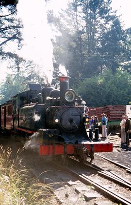
Colour photograph depicts red C Class steam locomotive, steaming on line approaching Relbia Station railway platform, near Launceston, between Western Junction and Inveresk. The words: ?CENTENARY TRAIN 1871-1971? emblazoned on front of boiler.
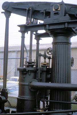
Colour photograph of beam engine in Hobart, purportedly the oldest McNaught Beam Engine in existence, originally built 1854 in Paisley Scotland, by A.W. Smith and used by Risby’s Sawmill in Hobart until 1955; photograph possibly taken at Moonah public works depot
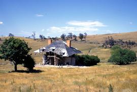
Colour photograph of abandoned farmhouse, with only a rickety timber roof frame, some internal walls and floors, three dormer windows and two orange brick chimneys intact; external brickwork has collapsed entirely into to piles of rubble; mature European trees planted surrounding house; electricity poles erected through property and roadside cutting across hillside shows line of road, possibly Midland Hwy, featuring white guide posts. Photograph file is named Bishton, possibly referring to Bishton Creek, near Jericho.
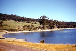
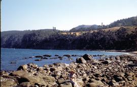
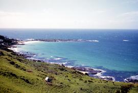
Colour photograph of beach, rocks and paddocks leading to shore at Boat Harbour, west of Wynyard, looking out to sea. Photograph taken north-west over Boat Harbour Beach, also known as Jacobs Boat Harbour.
Colour photograph shows a woman seated on park bench outside main house at Brickendon, historic 465ha estate established and farmed by William Archer and descendants since 1824, who invited tourists to their property from the late 20th century.
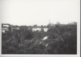
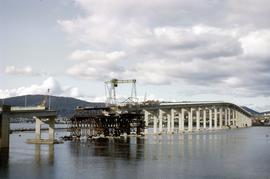
Colour photograph shows site of repair work to Tasman Bridge, damaged by the crash of the ore carrier Lake Illawarra in January 1975. Photo taken from Eastern Shore of Derwent.
Photograph in colour, taken from Eastern Shore of Derwent River, depicting repairs to roadway and pylons damaged in January 1975 crash of bulk ore carrier Lake Illawarra. Mount Wellington in background.
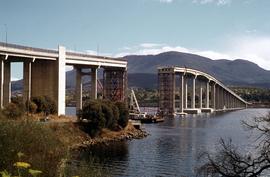
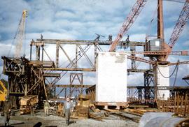
Construction site on riverbank as work begins on Tasman Bridge; cranes, steel scaffolding and brickwork evident. Workers in hard hats; one man striding towards camera, wearing gumboots is poking his tongue out at the photographer.
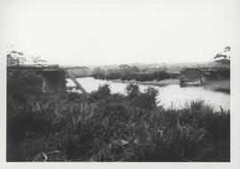
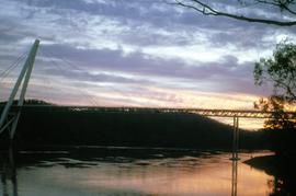
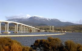
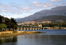
Colour photograph of two bridges across the Derwent River, the Hobart Bridge, right, and the Tasman Bridge, left, as viewed from the eastern shore of the Derwent in August 1964. Snow caps Mount Wellington in the background.
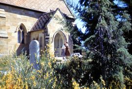
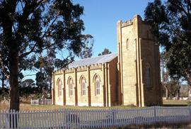
Colour photograph of two people standing on steps of St John the Baptist Church at Buckland, a sandstone church built in the 1840s; with headstones and flowering plants in foreground.
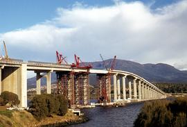
Colour photograph shows construction of a temporary traffic span of the new Tasman Bridge, as viewed from the western shore of the Derwent River, in 1964; the floating Hobart Bridge upstream is visible in background.
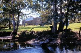
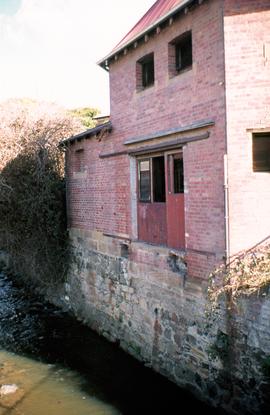
Colour photograph of bank of Buxton River at Mayfield; substantial double-storey freestone building in background. Title of photograph erroneously refers to Buxton Creek.
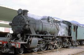
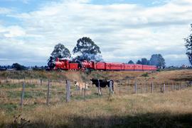
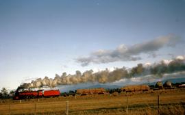
Colour photograph shows a farmer and sheepdog in a paddock, watching the Centenary Train, pulled by two Tasmanian Government Railways steam locomotives.
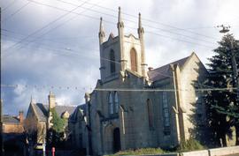
Colour photograph of a church building, constructed in greying sand stone, with ivy climbing up wall on attached building; originally the Chalmer’s Free Church and Manse, in Hobart, on the corner of Harrington and Bathurst streets, later the Chalmer’s Presbyterian Church; congregation merged with St Andrew’s in Hobart to form, Scots Church; Chalmers church building sold in 1954 to Neptune Oil Company, which demolished it to construct a fuel station.
Colour photograph of Cleburne Homestead, also known as the Mount Direction Homestead, a dwelling built in the 1830s at Risdon and threatened with demolition during the construction of the nearby Bowen Bridge.
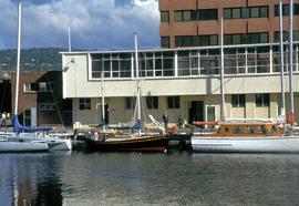
Colour photograph of boats moored at Constitution Dock, Hobart, early 1970s, with distinctive 11-storey brown clad Marine Board of Hobart building, visible in background. Image was erroneously labelled as being taken in 1954, but Marine Board of Hobart building was constructed between 1970 and 1972.
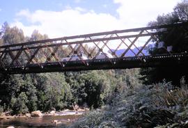
Colour photograph shows a person and two motor vehicles on the span of steel truss bridge built for the North Mount Lyell railway to cross the King River, near Crotty, taken in 1970; bridge later submerged by Lake Burbury.
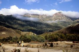
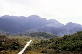
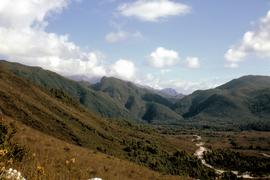
Colour photograph shows three people standing on a former industrial site at Crotty, in front of Mount Jukes, a rocky mountaintop with heavily timbered foothills.
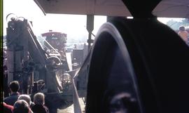
Colour photograph shows people in railyard standing near switch equipment and stationary steam locomotive. Piles of several dozen railway sleepers stacked on side of rail line excavation.