- AU TAS UTAS SPARC Pr-Bro-27
- Unidad documental simple
- 1960
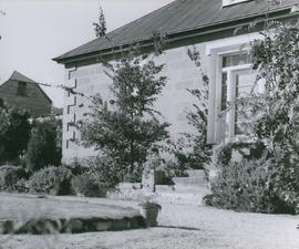
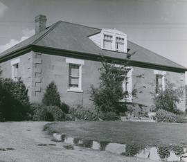
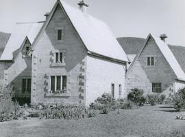
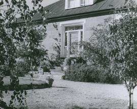
Photograph of the front door of Roydon, Broadmarsh. Taken April 1960. Located at 58 Clifton Vale Road, Elderslie. Sandstone farm house with a central door and flanking double hung windows, an attic level and weatherboard addition to the rear. The building has a hipped roof and narrow boxed eaves. The sandstone stables feature a half hipped roof, sandstone walls and an iron roof. The building is a floor and a half and is still in use as a stable. There are some other early buildings on the site.