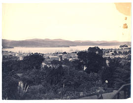
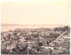
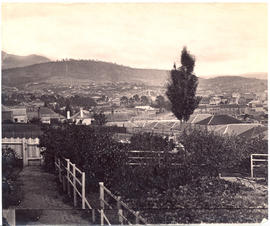
Photograph from the collection of James Backhouse Walker of a view of Hobart looking towards the Eastern Shore. The panorama has been taken from Mr. Roberts' garden with various shrubs and a Norfolk Island pine in the foreground. Henry Hall Baily is the photographer. He had studios in Elizabeth and Liverpool Streets Hobart from 1865 until 1918.
Various photographs of Harrington Street - St. Marys Cathedral, Wilmot Terrace; Pressland House (formerly J P Cowles School); Goulburn St. ; St John the Baptist Church. Photographs by Winter Baily and Anson Bros.
Photographs of Maatsuyker Island located 5.5 kilometres off the south coast of Tasmania. The island comprises part of the Southwest National Park and is a Tasmanian Wilderness World Heritage Site. The Maatsuyker Island Lighthouse, the southernmost Australian lighthouse, is located on the southern tip of the island
Photographs of Lake St. Clair at the southern end of the Cradle Mountain-Lake St Clair National Park. Is part of the Tasmanian Wilderness World Heritage Area. The Cradle Mountain-Lake St Clair area was declared a scenic reserve in 1922, a wildlife reserve in 1927, a national park in 1947 and a world heritage area from 1982.