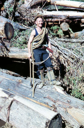
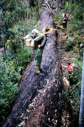
Rigger in the Florentine Valley
- AU TAS UTAS ITCCD 2017/2-205
- Item
Parte de Arthur Knight Slides
Colour photograph shows timber worker wearing hard hat, chaps and holding ropes and an axe, standing on fallen logs in the Florentine Valley
Rigger in the Florentine Valley
Parte de Arthur Knight Slides
Colour photograph shows timber worker wearing hard hat, chaps and holding ropes and an axe, standing on fallen logs in the Florentine Valley
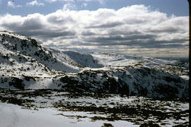
Parte de Arthur Knight Slides
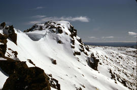
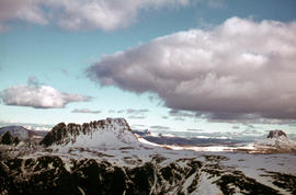
Colour photograph shows snow cover on the Rodway Range
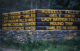
Signs at entrance to Mount Field National Park
Parte de Arthur Knight Slides
Colour photograph shows signs posted at entrance of Mount Field National Park, with distances and estimated travel times to Lake Dobson (9 1/4 miles), Lake Fenton (7 1/4 miles), Lady Barron Falls (1 1/2 mile), Camping Ground (250 yds), Rangers Cottage (150 Yds), Russell Falls 1/2 MILE 10 MIN, Lady Barron Falls Round Trip 3 1/2 MILES 1H 45 MIN
Parte de Arthur Knight Slides
Colour photograph shows snow covering Tarn Shelf in Mount Field National Park
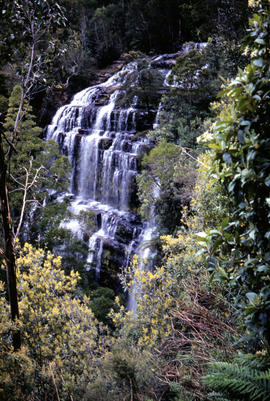
Parte de Arthur Knight Slides
Colour photograph shows Russell Falls as viewed from elevated vantage point in rainforest
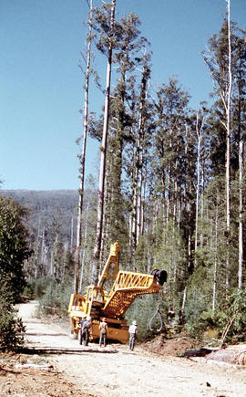
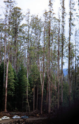
Four men standing around Skagit loader
Parte de Arthur Knight Slides
Colour photograph shows timber workers in hard hats standing around an unladen Skagit loader with an operator visible in the cabin, on a dirt track in the bush
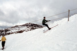
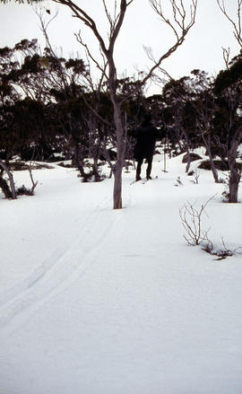
Snow skier plays trick on camera
Parte de Arthur Knight Slides
Colour photograph shows the tracks of a snow skier, dressed in dark clothing, going around both sides of a tree on a snow-covered, lightly wooded hill
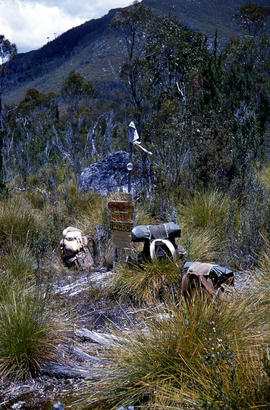
Marker on South Gordon walking track
Parte de Arthur Knight Slides
Colour photograph shows unusual sign for South Gordon walking track turnoff, fashioned out of number plates, with three backpacks resting on ground nearby
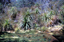
Parte de Arthur Knight Slides
Colour photograph shows mossy ground surrounding a group of pandani plants
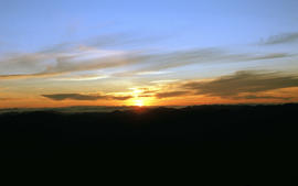
Parte de Arthur Knight Slides
Colour photograph shows setting sun from the summit of Mount Field West
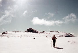
Man skiing downhill on Mount Field West
Parte de Arthur Knight Slides
Colour photograph shows man skiing downhill at Mount Field West, with two other figures behind him near the summit of mountain
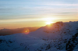
View of sunset from Rodway Range
Parte de Arthur Knight Slides
Colour photograph shows sunset as viewed from Rodway Range
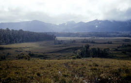
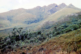
View of heathland near Mount Bowes
Parte de Arthur Knight Slides
Colour photograph shows heathland looking southwest from near Mount Bowes
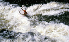
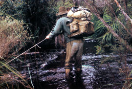
Paddler in the Cruncher at Bradys Lake
Parte de Arthur Knight Slides
Colour photograph shows a paddler of a kayak in the Cruncher a segment of water on the Bradys Lake whitewater course
The Druids near Huon River crossing
Parte de Arthur Knight Slides
Colour photograph shows The Druids from near the Huon River crossing
The Druids as viewed from Woody Island
Parte de Arthur Knight Slides
Colour photograph shows The Druids as viewed from Woody Island
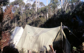
Tents pitched at Mount Bowes campsite
Parte de Arthur Knight Slides
Colour photograph shows two canvas tents pitched in hilly scrubland at Mount Bowes
Parte de Arthur Knight Slides
Colour photograph shows The Watcher
Parte de Arthur Knight Slides
Colour photograph shows bushwalker with backpack in heath and woodland walking towards the Gordon River
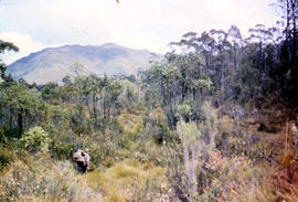
Bushwalking near Sandfly Creek
Parte de Arthur Knight Slides
Colour photograph shows two bushwalkers with backpacks near a track to Sandfly Creek
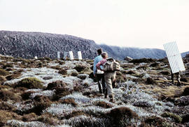
Walkers carrying building materials to K Col
Parte de Arthur Knight Slides
Colour photograph shows walkers carrying building materials to build a hut to shelter bushwalkers
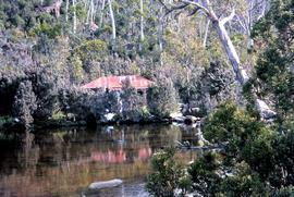
Parte de Arthur Knight Slides
Colour photograph shows the rusting red roofing iron on hut visible above trees on the edge of Twilight Tarn
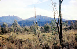
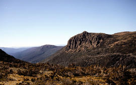
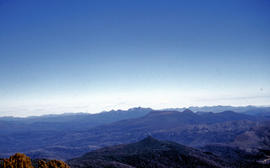
View of mountain ranges west of Mt. Lord
Parte de Arthur Knight Slides
Colour photograph of mountain ranges west of Mt. Lord
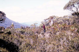
Parte de Arthur Knight Slides
Colour photograph shows man in red and black check bush shirt standing in bush on Mount Lord, looking west. Man is standing amid tall specimens of Pandani, Richea pandanifolia
Parte de Arthur Knight Slides
Colour photograph shows bushwalker with backpack wading through Sandfly Creek
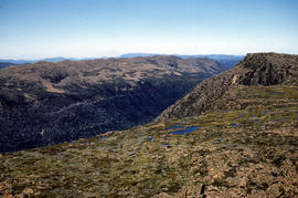
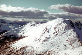
View from Mount Field West across glacial valley
Parte de Arthur Knight Slides
Colour photograph shows glacial valley from atop Mount Field West
Parte de Arthur Knight Slides
Colour photograph shows view of mountain range to the west of Mount Field West
Parte de Arthur Knight Slides
Colour photograph shows rusted International Harvester locomotive on disused rails covered with bracken in a semi-cleared area of land
Parte de Arthur Knight Slides
Colour photograph shows two people standing upright on the frozen surface of Lake Dobson, 1954
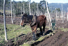
Man and horse ploughing at Westerway
Parte de Arthur Knight Slides
Colour photograph shows a farmer ploughing a paddock at Westerway in a field strung with trellis frames for hop cultivation with a draught horse and plough
Shoreline of Great Lake at Breona
Parte de Arthur Knight Slides
Colour photograph depicts northern shoreline of Great Lake and settlement of Breona
Arthur Knight
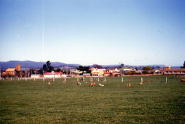
Paddocks on outskirts of Campbell Town
Parte de Arthur Knight Slides
Colour photograph shows sheep in paddocks on outskirts of Campbell Town
Arthur Knight
Snow on Cradle Mountain and Barn Bluff
Parte de Arthur Knight Slides
Colour photograph shows snowfall on Cradle Mountain and Bluff
Arthur Knight
Snow cover on Mount Olympus above Lake St Clair
Parte de Arthur Knight Slides
Colour photograph shows snow above the treeline on Mount Olympus
Arthur Knight
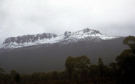
Parte de Arthur Knight Slides
Colour photograph shows snow cover on Mount Ossa
Arthur Knight
Parte de Arthur Knight Slides
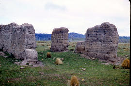
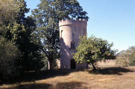
Colour photograph shows ruins of former probation station and convict labour accommodation at Jericho, built with rammed mud walls
Arthur Knight
Parte de Arthur Knight Slides
Colour photograph shows brick birdhouse, or dovecote, on the grounds of Burlington, Cressy
Arthur Knight
Parte de Arthur Knight Slides
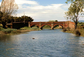
Colour photograph shows the Red Bridge, a convict built arch bridge across Elizabeth River at Campbell Town
Arthur Knight
Parte de Arthur Knight Slides
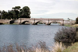
Colour photograph shows the arches of the sandstone bridge at Ross that leads across the Macquarie River
Arthur Knight
Parte de Arthur Knight Slides
Colour photograph shows fast-flowing water of the Macquarie River at the Ross Bridge
Arthur Knight
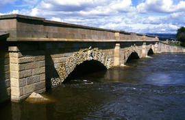
Macquarie River at Ross Bridge
Parte de Arthur Knight Slides
Colour photograph shows Ross Bridge across Macquarie River
Arthur Knight
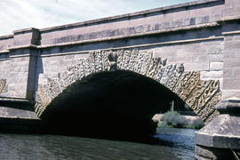
Carvings on Ross Bridge archway
Parte de Arthur Knight Slides
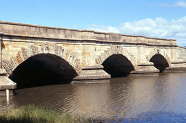
Colour photograph shows the sandstone relief carving in the keystone and other carvings in the voussoir stones of an arch of the Ross Bridge across the Macquarie River
Arthur Knight
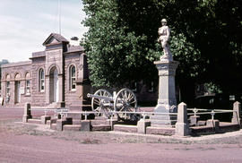
Parte de Arthur Knight Slides
Colour photograph shows the Ross War Memorial
Arthur Knight
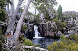
Parte de Arthur Knight Slides
Colour photograph shows waterfall flowing across rock face in Central Highlands, with pencil pines surrounding rock pool
Arthur Knight
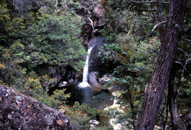
Waterfall on track to Meander Valley Falls
Parte de Arthur Knight Slides
Colour photograph shows water spilling into a pool beside track to Meander Falls, with overhanging trees and vegetation surrounding stream
Arthur Knight
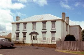
Former Coffee Palace, doctor’s surgery and hotel at Bothwell
Parte de Greg Dickens Photographic Collection
Colour photograph of former coffee palace, hotel and doctor’s surgery at 90 Dalrymple Street Bothwell. Citation on National heritage register: “A two storey brick and stucco Georgian building with a stone rear section, licensed as the Young Queen from 1851-1877 when the name was changed to Maskell's Hotel. The building appears in a book on Colonial architecture by Hardy Wilson with a crinolined lady at the doorway with luggage and bird cage. The building is an important townscape element.”
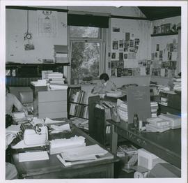
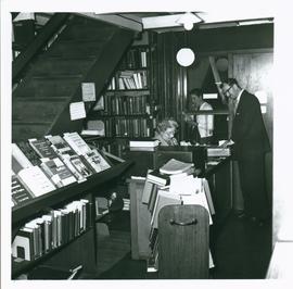
Parte de University Library Photographs
One small black and white photograph of Library workroom at Domain House taken in November 1960. Staff identified as J. Reynolds
University of Tasmania
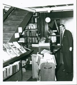
Parte de University Library Photographs
Photograph of the Librarian, D H Borchardt at Loans desk with Mrs Kemp 1960
University of Tasmania
Parte de University Library Photographs
Photograph of the Librarian, D H Borchardt at Loans desk with Mrs Kemp 1960
University of Tasmania
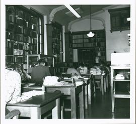
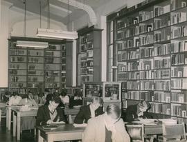
Parte de University Library Photographs
Photograph of the main reading area of the Library, Domain, House . Taken in November 1960 showing students working at desks. Honour board on wall.
University of Tasmania
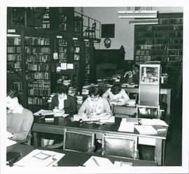
Parte de University Library Photographs
Photograph of the main reading area of the Library, Domain, House . Taken in November 1960 showing students working at desks. Fire place and mantel on rear wall.
University of Tasmania
Parte de University Library Photographs
Photograph of the entrance area and cloakroom of the Library, Domain, House.
University of Tasmania
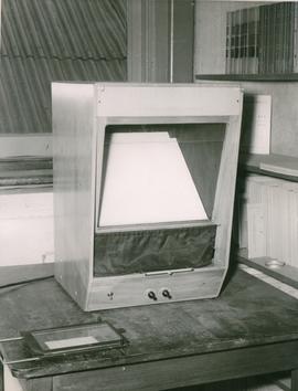
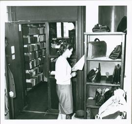
Parte de University Library Photographs
Photograph of a microfilm reader in the University library at Domain House
University of Tasmania
Parte de University Library Photographs
Photograph of the main reading area of the University library at Domain House
University of Tasmania
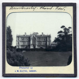
Parte de Photographic reproduction collection
Front view of the University of Tasmania building, Domain House, located on the Queen's Domain, Hobart.
John Watt Beattie
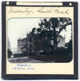
Parte de Photographic reproduction collection
View from the right of the University of Tasmania building, Domain House, located on the Queen's Domain, Hobart.
John Watt Beattie
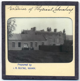
Exterior of physical laboratory at the rear of Domain House
Parte de Photographic reproduction collection
Exterior of physical laboratory at the rear of Domain House, Hobart.
John Watt Beattie
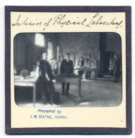
Interior of physical laboratory at the rear of Domain House
Parte de Photographic reproduction collection
Interior of physical laboratory at the rear of Domain House, Hobart.
John Watt Beattie
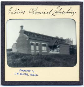
Exterior of chemical laboratory at Domain House
Parte de Photographic reproduction collection
Exterior of chemical laboratory, Domain House, Hobart.
John Watt Beattie
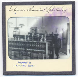
Interior of chemical laboratory at Domain House
Parte de Photographic reproduction collection
Interior of chemical laboratory, Domain House, Hobart.
John Watt Beattie
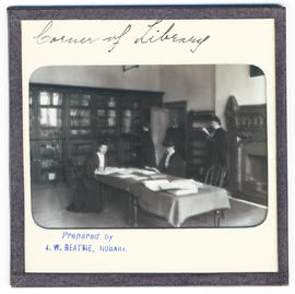
Corner of the library at Domain House
Parte de Photographic reproduction collection
Corner of the library, Domain House, Hobart. Showing staff and students. Registrar in doorway
John Watt Beattie
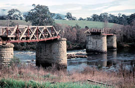
Missing rail section across River Derwent at Macquarie Plains bridge
Parte de Arthur Knight Slides
Colour photograph from bank of River Derwent shows twisted railway track
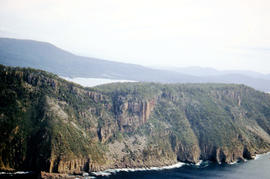
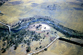
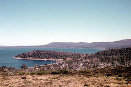
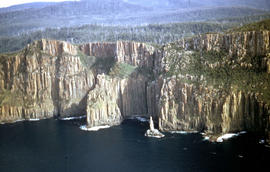
Aerial view of Fluted Cape, South Bruny Island
Parte de Arthur Knight Slides
Colour aerial photograph of Fluted Cape, South Bruny Island, 1956
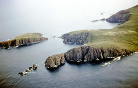
Aerial view of Cape Bruny from south-east
Parte de Arthur Knight Slides
Colour photograph of Cape Bruny taken from the air. Photograph depicts coastline of South Bruny Island including lighthouse, Courts Island, Lighthouse Bay
View of Cape Connella from the air
Parte de Arthur Knight Slides
Colour aerial photograph of cliffs of Cape Connella, viewed from the air.
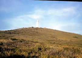
View of lighthouse at Cape Bruny
Parte de Arthur Knight Slides
Colour photograph of Bruny Island lighthouse looking south
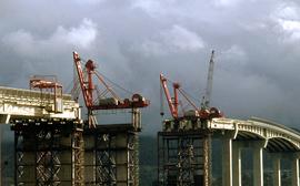
Cranes repairing Tasman Bridge
Parte de Hal Wyatt Collection
Colour photograph shows cranes atop pylons at the site of repair work to Tasman Bridge, damaged by the crash of the ore carrier Lake Illawarra in January 1975; missing pylons being replaced.

Collection consists of personal and business correspondence, financial records, scrapbook and cuttings scripts of broadcasts, stories and plays. Theatre programs, photographs and pins and badges. There is also material collected by Francis Ruby Fuller and Edwin Charles Fuller
William Edwin Fuller
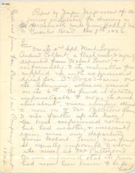
Parte de Meston Papers
Copies of diaries of Jorgen Jorgensen, including Journey to Ouse Plateau, Repat of Jorgensen to V.D.L. Co. on route between Hobart and Circular Head, and Journal kept while exploring from Circular Head to the Pieman River, 1826-7.
Archibald Lawrence Meston
Parte de Mitchell Papers
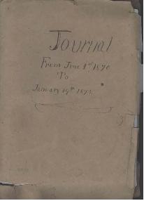
Diary of Sarah E.E. Mitchell of Lisdillon on the East Coast of Tasmania from June 1st 1870 to January 19th 1872. From the age of thirteen she daily noted in her journal the state of the weather, her routine activities about the house and property and visits of friends.
Sarah E.E. Mitchell
Parte de Mitchell Papers
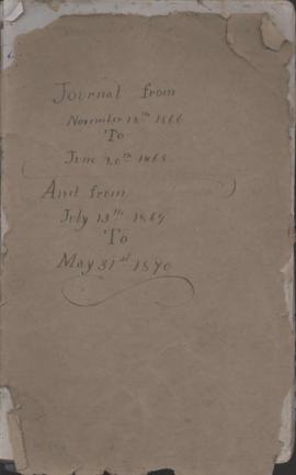
Diary of Sarah E.E. Mitchell of Lisdillon on the East Coast of Tasmania from November 12th 1866 to June 20th 1868 and from July 13 1869 to May 31st 1870. From the age of thirteen she daily noted in her journal the state of the weather, her routine activities about the house and property and visits of friends.
Sarah E.E. Mitchell
Parte de Mitchell Papers
Diary of Sarah E.E. Mitchell of Lisdillon on the East Coast of Tasmania from January 1872 - December 1873. From the age of thirteen she daily noted in her journal the state of the weather, her routine activities about the house and property and visits of friends.
Sarah E.E. Mitchell
Parte de Mitchell Papers
Diary of Sarah E.E. Mitchell of Lisdillon on the East Coast of Tasmania - 1874. From the age of thirteen she daily noted in her journal the state of the weather, her routine activities about the house and property and visits of friends.
Sarah E.E. Mitchell
Parte de Mitchell Papers
Diary of Sarah E.E. Mitchell of Lisdillon on the East Coast of Tasmania -1875. From the age of thirteen she daily noted in her journal the state of the weather, her routine activities about the house and property and visits of friends.
Sarah E.E. Mitchell
Parte de Mitchell Papers
Diary of Sarah E.E. Mitchell of Lisdillon on the East Coast of Tasmania - 1876. From the age of thirteen she daily noted in her journal the state of the weather, her routine activities about the house and property and visits of friends.
Sarah E.E. Mitchell
Parte de Mitchell Papers
Diary of Sarah E.E. Mitchell of Lisdillon on the East Coast of Tasmania - 1877. From the age of thirteen she daily noted in her journal the state of the weather, her routine activities about the house and property and visits of friends.
Sarah E.E. Mitchell
Parte de Mitchell Papers
Diary of Sarah E.E. Mitchell of Lisdillon on the East Coast of Tasmania - 1878. From the age of thirteen she daily noted in her journal the state of the weather, her routine activities about the house and property and visits of friends.
Sarah E.E. Mitchell
Parte de Mitchell Papers
Diary of Sarah E.E. Mitchell of Lisdillon on the East Coast of Tasmania - 1879. From the age of thirteen she daily noted in her journal the state of the weather, her routine activities about the house and property and visits of friends.
Sarah E.E. Mitchell
Parte de Mitchell Papers
Diary of Sarah E.E. Mitchell of Lisdillon on the East Coast of Tasmania - 1880. From the age of thirteen she daily noted in her journal the state of the weather, her routine activities about the house and property and visits of friends.
Sarah E.E. Mitchell
Parte de Mitchell Papers
Diary of Sarah E.E. Mitchell of Lisdillon on the East Coast of Tasmania - 1882. From the age of thirteen she daily noted in her journal the state of the weather, her routine activities about the house and property and visits of friends.
Sarah E.E. Mitchell
Parte de Mitchell Papers
Diary of Sarah E.E. Mitchell of Lisdillon on the East Coast of Tasmania - 1881. From the age of thirteen she daily noted in her journal the state of the weather, her routine activities about the house and property and visits of friends.
Sarah E.E. Mitchell
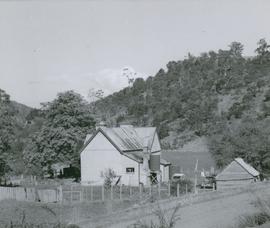
Photograph of barn at house on Windsor Road
Parte de Photographic reproduction collection
Photograph of barn at house on Windsor Road Broadmarsh, Tasmania. Taken April 1960
Parte de Photographic reproduction collection
Photograph of the schoolhouse, Broadmarsh, Tasmania. Taken April 1960
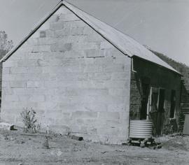
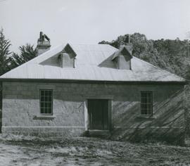
Photograph of the old prison station
Parte de Photographic reproduction collection
Photograph of the old prison station, Broadmarsh, Tasmania. Taken April 1960. In 1842 Invercarron became the site of the Broadmarsh Convict Probation Station, which was deemed to be such a disaster [La Trobe’s 1847 report cited ‘utter abandonment of all order and decency’] that it was closed in 1847
Photograph of the schoolhouse - front view
Parte de Photographic reproduction collection
Photograph of the front view of the schoolhouse, Broadmarsh, Tasmania. Taken April 1960
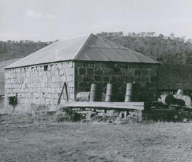
Photograph of the stable at the old prison station
Parte de Photographic reproduction collection
Photograph of the stable at the old prison station, Broadmarsh, Tasmania. Taken April 1960. In 1842 Invercarron became the site of the Broadmarsh Convict Probation Station, which was deemed to be such a disaster [La Trobe’s 1847 report cited ‘utter abandonment of all order and decency’] that it was closed in 1847.
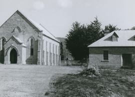
Photograph of St Augustine's Anglican Church and rectory
Parte de Photographic reproduction collection
Photograph of St Augustine's Anglican Church and rectory, Broadmarsh, Tasmania. Taken April 1960
Consecrated 15 September 185. Located 1 2 Grahams Creek Road, Broadmarsh, now a private residence.
Photograph of the old prison station
Parte de Photographic reproduction collection
Photograph of the old prison station, Broadmarsh, Tasmania. Taken April 1960. In 1842 Invercarron became the site of the Broadmarsh Convict Probation Station, which was deemed to be such a disaster [La Trobe’s 1847 report cited ‘utter abandonment of all order and decency’] that it was closed in 1847.
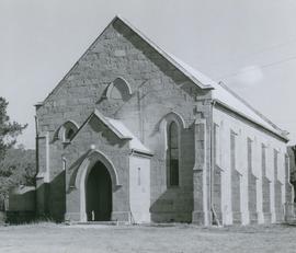
Photograph of front view of St Augustine's Anglican Church
Parte de Photographic reproduction collection
Photograph of font view of St Augustine's Anglican Church, Broadmarsh, Tasmania. Taken April 1960
Consecrated 15 September 185. Located 1 2 Grahams Creek Road, Broadmarsh, now a private residence.
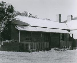
Photograph of the rectory of St Augustine's Anglican Church
Parte de Photographic reproduction collection
Photograph of the rectory of St Augustine's Anglican Church, Broadmarsh, Tasmania. Taken April 1960
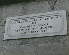
Photograph of the plaque on side of the rectory of St Augustine's Anglican Church
Parte de Photographic reproduction collection
Photograph of the plaque on side of the rectory of St Augustine's Anglican Church, Broadmarsh, Tasmania. Taken April 1960. " "Benjamin Ball Clericus. et Carolus Mann. Aliis Adjuv's Aedific A.D. MDCCCLXIV"
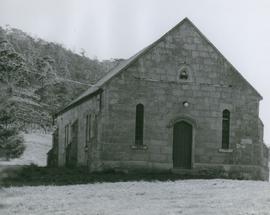
Photograph of the Congregational Church
Parte de Photographic reproduction collection
Photograph of the Congregational Church, Broadmarsh, Tasmania. Taken April 1960.
Two churches were established at Broadmarsh, an Anglican church, St Augustine's in 1847 and a Congregational church in1861.
Location 1497 Elderslie Road. The Broadmarsh Uniting (Congregational) Church was built in 1861 on land owned by William Gunn, at ‘Arndell’.
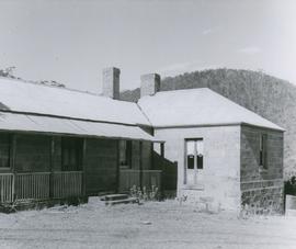
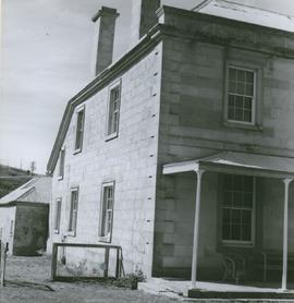
Photograph of doorway at Braeside
Parte de Photographic reproduction collection
Photograph of doorway at Braeside, Broadmarsh. Taken April 1960. Now known as Stonefield' , 'Braeside' was built in 1824, located at 266 Elderslie Rd, Lower Broadmarsh. A good example of a two storey Georgian home with a separate kitchen wing
Photograph of northern wall of Braeside
Parte de Photographic reproduction collection
Photograph of northern wall of Braeside, Broadmarsh. Taken April 1960. Now known as Stonefield' , 'Braeside' was built in 1824, located at 266 Elderslie Rd, Lower Broadmarsh. A good example of a two storey Georgian home with a separate kitchen wing
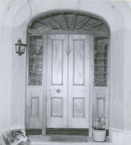
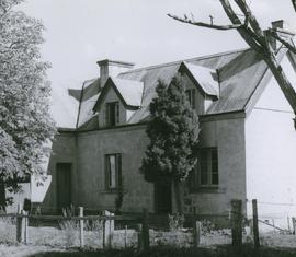
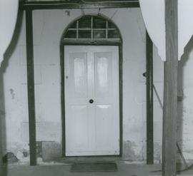
Photograph of doorway at Strathelie
Parte de Photographic reproduction collection
Photograph of doorway at Strathelie, Broadmarsh. Taken April 1960. Located at 974 Elderslie Road Broadmarsh. Strathelie is a very impressive late Georgian house thought to be built by Thomas Johnston in 1851. Constructed of silver grey sandstone, featuring a parapeted facade, enclosed rear courtyard, fine front door and front verandah with slender iron columns. The house is complemented by particularly fine outbuildings comprising stone barn with arched openings and brick stable forming a u-shape about a central yard.
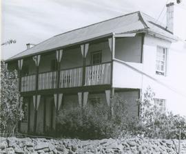
Photograph of front view of Braeside
Parte de Photographic reproduction collection
Photograph of front view of Braeside, Broadmarsh. Taken April 1960. Now known as Stonefield' , 'Braeside' was built in 1824, located at 266 Elderslie Rd, Lower Broadmarsh. A good example of a two storey Georgian home with a separate kitchen wing
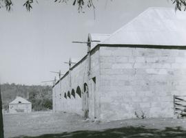
Photograph of stables at Strathelie
Parte de Photographic reproduction collection
Photograph of stables at Strathelie, Broadmarsh. Taken April 1960. Located at 974 Elderslie Road Broadmarsh. Strathelie is a very impressive late Georgian house thought to be built by Thomas Johnston in 1851. Constructed of silver grey sandstone, featuring a parapeted facade, enclosed rear courtyard, fine front door and front verandah with slender iron columns. The house is complemented by particularly fine outbuildings comprising stone barn with arched openings and brick stable forming a u-shape about a central yard.
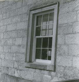
Photograph of window at Strathelie
Parte de Photographic reproduction collection
Photograph of window at Strathelie, Broadmarsh. Taken April 1960. Located at 974 Elderslie Road Broadmarsh. Strathelie is a very impressive late Georgian house thought to be built by Thomas Johnston in 1851. Constructed of silver grey sandstone, featuring a parapeted facade, enclosed rear courtyard, fine front door and front verandah with slender iron columns. The house is complemented by particularly fine outbuildings comprising stone barn with arched openings and brick stable forming a u-shape about a central yard.
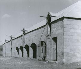
Photograph of stables at Strathelie
Parte de Photographic reproduction collection
Photograph of stables at Strathelie, Broadmarsh. Taken April 1960. Located at 974 Elderslie Road Broadmarsh. Strathelie is a very impressive late Georgian house thought to be built by Thomas Johnston in 1851. Constructed of silver grey sandstone, featuring a parapeted facade, enclosed rear courtyard, fine front door and front verandah with slender iron columns. The house is complemented by particularly fine outbuildings comprising stone barn with arched openings and brick stable forming a u-shape about a central yard.
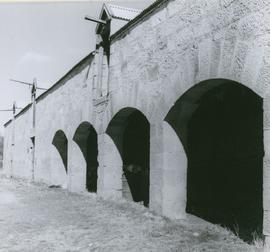
Photograph of stables at Strathelie
Parte de Photographic reproduction collection
Photograph view of arches at the stables, Strathelie, Broadmarsh. Taken April 1960. Located at 974 Elderslie Road Broadmarsh. Strathelie is a very impressive late Georgian house thought to be built by Thomas Johnston in 1851. Constructed of silver grey sandstone, featuring a parapeted facade, enclosed rear courtyard, fine front door and front verandah with slender iron columns. The house is complemented by particularly fine outbuildings comprising stone barn with arched openings and brick stable forming a u-shape about a central yard.