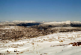
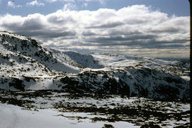
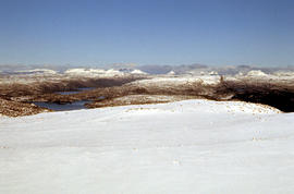
Lake Loane under snow cover 1978
- AU TAS UTAS ITCCD 2017/2-296
- Item
- 1978
Part of Arthur Knight Slides
Colour photograph shows Lake Loane beneath blanket of snow, from near the Horse Track 1978
Lake Loane under snow cover 1978
Part of Arthur Knight Slides
Colour photograph shows Lake Loane beneath blanket of snow, from near the Horse Track 1978

Part of Arthur Knight Slides
Colour photograph shows waves and white caps on the surface of Lake Myrtle GIS: Latitude -4188 Longitude 14618 Gazetteer Australia Record_ID TAS02073
Part of Arthur Knight Slides
Colour photograph shows silhouette of Mount Anne, viewed at sunset
Part of Arthur Knight Slides
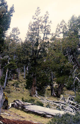
Colour photograph shows Pencil Pines growing in alpine forest near Dixons Kingdom hut
Tarn and Pencil Pines near Mountains of Jupiter
Part of Arthur Knight Slides
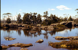
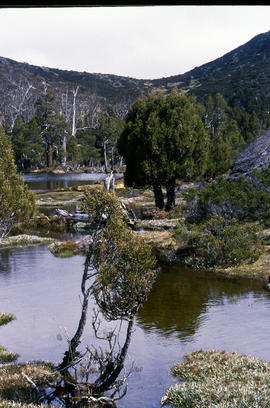
Colour photograph shows alpine vegetation surrounding Pool of Bethesda GIS: Latitude -4181 Longitude 14630 Gazetteer Record_ID TAS12063
Part of Arthur Knight Slides
Colour photograph shows patterned bark of snow gum near Cathedral Mountain
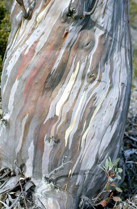
Bark of snow gum near Cathedral Mountain
Part of Arthur Knight Slides
Colour photograph shows ice formations on tufts of native grass
Part of Arthur Knight Slides
Colour photograph shows snow covering alpine vegetation
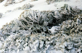
Part of Arthur Knight Slides
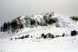
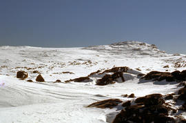
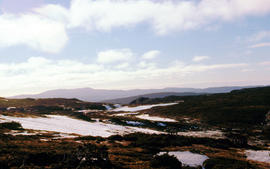
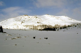
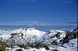
Colour photograph shows snow cover around Mount Rogoona
Snow on plateau below Mount Rogoona
Part of Arthur Knight Slides
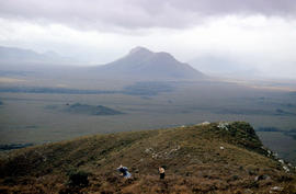
Colour photograph shows southern shore of Lake Timk
Summit of West Wall at Mount Jerusalem
Part of Arthur Knight Slides
Colour photograph shows sunrise at Cradle Mountain 1976
Part of Arthur Knight Slides
Colour photograph shows view of mountain range to the west of Mount Field West
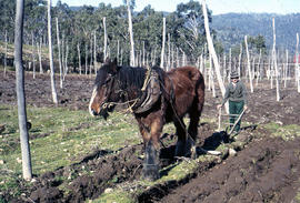
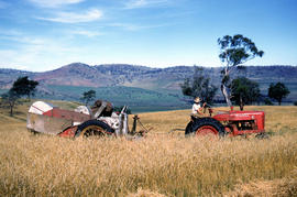
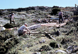
Man and horse ploughing at Westerway
Part of Arthur Knight Slides
Colour photograph shows a farmer ploughing a paddock at Westerway in a field strung with trellis frames for hop cultivation with a draught horse and plough
Part of Arthur Knight Slides
Colour photograph shows snow on Mount Olympus as viewed from near Narcissus hut, near Lake St Clair
Arthur Knight
Part of Arthur Knight Slides
Colour photograph shows snow cover on Mount Ossa
Arthur Knight
Part of Arthur Knight Slides
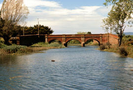
Colour photograph shows the Red Bridge, a convict built arch bridge across Elizabeth River at Campbell Town
Arthur Knight
Part of Arthur Knight Slides
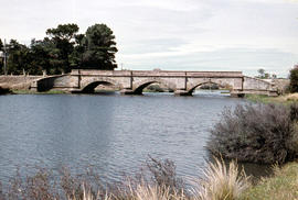
Colour photograph shows the arches of the sandstone bridge at Ross that leads across the Macquarie River
Arthur Knight
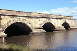
Part of Arthur Knight Slides
Colour photograph shows fast-flowing water of the Macquarie River at the Ross Bridge
Arthur Knight
Part of Arthur Knight Slides
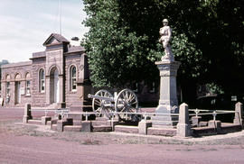
Colour photograph shows the Ross War Memorial
Arthur Knight
Part of Arthur Knight Slides
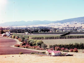
Colour photograph shows hop fields in at Glenora, 1959
Part of Arthur Knight Slides
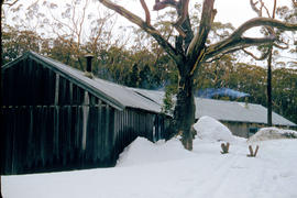
Colour photograph shows smoke curling out of the flue from a woodheater or fireplace of the Hobart Walking Club timber hut at Mount Field National Park, with snowdrifts banked halfway up the walls of the hut
Farmer harvests grain at Glen Dhu
Part of Arthur Knight Slides
Colour photograph shows a farmer driving an International Harvester Farmall M tractor, with the Australian model name AM, pulling a trailed harvester in a paddock of rye at Glen Dhu, 1956. Placename distinct from other Glen Dhu, near Launceston.
Heading a tree in the Florentine Valley
Part of Arthur Knight Slides
Colour portrait format photograph shows the head of a tall eucalypt tree falling when a timber worker chopped it down after scaling the three
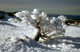
Shrub frozen at Mount Field West
Part of Arthur Knight Slides
Colour photograph shows ice formation on branches of shrub at Mount Field West, 1968
Part of Arthur Knight Slides
Colour photograph shows a person standing on ice at Lake Dobson, with ridge of snow above treeline
Part of Arthur Knight Slides
Colour photograph shows people assembling the roof frame of a Hobart Walking Club hut at K Col, later named the FA. Peterson Memorial Hut and officially opened in 1960 by New Zealand adventurer Sir Edmund Hilary
Part of Arthur Knight Slides
Colour photograph shows snow cover on K Col, 1963
Rusted locomotive in bush near Sharpes Siding
Part of Arthur Knight Slides
Colour photograph shows rusted locomotive with vertical boiler in bush near Sharpes Siding, a siding near Lake Tyenna Valley railway.
Part of Arthur Knight Slides
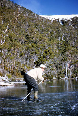
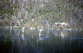
Colour photograph shows people ice skating on frozen surface of Lake Dobson
Oast houses and hop fields at Macquarie Plains
Part of Arthur Knight Slides
Colour photograph shows hop fields and kilns, or oast houses, at Macquarie Plains, with rail wagons and railway line in foreground
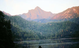
Mount Bowes from Sandfly Creek
Part of Arthur Knight Slides
Colour photograph shows Mount Bowes as viewed from Sandfly Creek
Mount Field West under snow as viewed from Rodway Range
Part of Arthur Knight Slides
Colour photograph from bank of River Derwent shows twisted railway track

Mount Field West from Rodway Range
Part of Arthur Knight Slides
Colour photograph shows Mount Field West from the Rodway Range
View of Mount Mawson from Florentine Peak saddle
Part of Arthur Knight Slides
Colour photograph shows Mount Mawson viewed from saddle of Florentine Peak, with partial snow cover
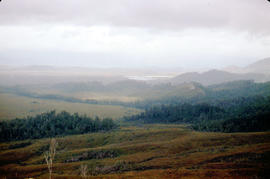
Mount Mueller from beyond Damper Inn hut
Part of Arthur Knight Slides
Colour photograph shows lightly timbered woodland near Mount Mueller
Part of Arthur Knight Slides
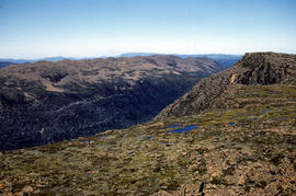
Colour photograph taken from elevated mountain ridge, shows valley floor looking west to Mount Solitary and original shoreline of Lake Pedder
Walkers on ridge overlooking Mount Solitary
Part of Arthur Knight Slides
Colour photograph shows some bushwalkers on a ridge overlooking the valley towards Mount Solitary
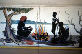
Mural in Hobart Walking Club hut
Part of Arthur Knight Slides
Colour photograph shows a mural in the Hobart Walking Club hut at Lake Dobson Source
Part of Arthur Knight Slides
Colour photograph shows snow skiers on Mount Mawson, one using a tow rope to climb uphill
Signs at entrance to Mount Field National Park
Part of Arthur Knight Slides
Colour photograph shows signs posted at entrance of Mount Field National Park, with distances and estimated travel times to Lake Dobson (9 1/4 miles), Lake Fenton (7 1/4 miles), Lady Barron Falls (1 1/2 mile), Camping Ground (250 yds), Rangers Cottage (150 Yds), Russell Falls 1/2 MILE 10 MIN, Lady Barron Falls Round Trip 3 1/2 MILES 1H 45 MIN
Part of Arthur Knight Slides
Colour photograph shows snow covering Tarn Shelf in Mount Field National Park
Marker on South Gordon walking track
Part of Arthur Knight Slides
Colour photograph shows unusual sign for South Gordon walking track turnoff, fashioned out of number plates, with three backpacks resting on ground nearby
Paddler in the Cruncher at Bradys Lake
Part of Arthur Knight Slides
Colour photograph shows a paddler of a kayak in the Cruncher a segment of water on the Bradys Lake whitewater course
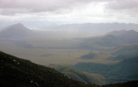
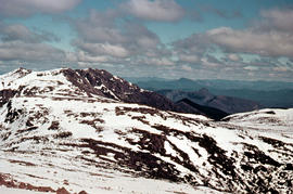
View of mountain ranges west of Mt. Lord
Part of Arthur Knight Slides
Colour photograph of mountain ranges west of Mt. Lord
Part of Arthur Knight Slides
Colour photograph shows rusted International Harvester locomotive on disused rails covered with bracken in a semi-cleared area of land
Shoreline of Great Lake at Breona
Part of Arthur Knight Slides
Colour photograph depicts northern shoreline of Great Lake and settlement of Breona
Arthur Knight
Snow cover on Mount Olympus above Lake St Clair
Part of Arthur Knight Slides
Colour photograph shows snow above the treeline on Mount Olympus
Arthur Knight
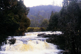
Waterfall on track to Meander Valley Falls
Part of Arthur Knight Slides
Colour photograph shows water spilling into a pool beside track to Meander Falls, with overhanging trees and vegetation surrounding stream
Arthur Knight
Part of Arthur Knight Slides
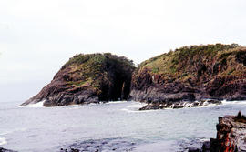
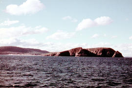
Arch island on Bruny Island
Arthur Knight
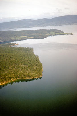
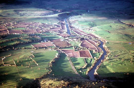
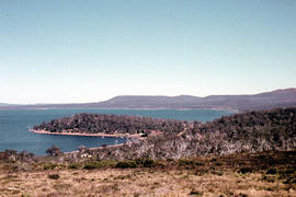
Aerial picture of Barnes Bay, 1950s
Part of Arthur Knight Slides
Aerial photograph of Barnes Bay on eastern side of Bruny Island.
Part of Arthur Knight Slides
Colour photograph, taken at sea, looking towards Cape Queen Elizabeth, Bruny Island
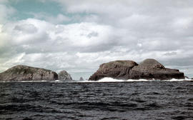
View of the Friars, off South Bruny Island
Part of Arthur Knight Slides
Colour photograph of Friars island group
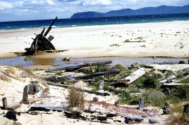
Wreck on beach near Mars Bluff
Part of Arthur Knight Slides
Colour photograph of rotting timbers from wreck of boat, half-buried in the sand near shallow creek on beach near Mars Bluff, Bruny Island, Photograph possibly taken 1963.

Part of Arthur Knight Slides
Colour photograph of Bare Mountain, with evidence of past bushfire damage to trees on lower slope GIS: Latitude -4149 Longitude 14590 Gazetteer Australia Record_ID TAS23466

Black jay perches on dozer at Cradle Mountain
Part of Arthur Knight Slides
Colour photograph shows a black jay perched on exhaust pipe of a John Deere earthmoving machinery near Waldheim Chalet car park at Cradle Mountain

Central Highlands from cirque ridgeline
Part of Arthur Knight Slides
Colour photograph shows mountains from the Cirque near Cradle Mountain

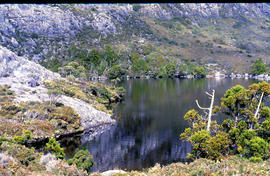
Chalice Lake and Mount Rogoona
Part of Arthur Knight Slides
Colour photograph of Chalice Lake and Mount Rogoona GIS: Latitude -4188 Longitude 14619 Gazetteer Record_ID TAS02032

View of Cradle Mountain ridgeline from Hansons Peak
Part of Arthur Knight Slides
Colour photograph of Cradle Mountain from Hansons Peak

Part of Arthur Knight Slides
Colour photograph shows a steel-plated culvert beneath a road at Foggs Flat

Part of Arthur Knight Slides
Colour photograph shows two sets of skis and backpacks outside an alpine hut, covered in a snowdrift

Du Cane Range from Mountains of Jupiter
Part of Arthur Knight Slides
Colour photograph shows Du Cane Range as viewed from Mountains of Jupiter

Du Cane Range and Mount Ossa under snow
Part of Arthur Knight Slides
Colour photograph of Du Cane Range and Mount Ossa

Part of Arthur Knight Slides
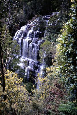
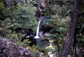
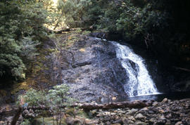
Colour photograph shows Grail Falls

Part of Arthur Knight Slides
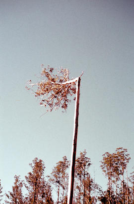
Colour photograph shows ice formed on plants, location unknown

Part of Arthur Knight Slides
Colour portrait format photograph shows Lake Wilks and Little Horn near Cradle Mountain

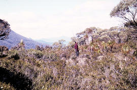
Walkers on Mountains of Jupiter
Part of Arthur Knight Slides
Colour photograph of bushwalkers at Mountains of Jupiter near the Walls of Jerusalem
Part of Arthur Knight Slides
Colour photograph shows Mount Anne at sunrise as viewed from across Lake Timk

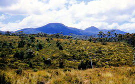
Mount Geyron from Cathedral Mountain
Part of Arthur Knight Slides
Colour photograph shows Lake Payanna and Mount Ida
Snow cover at near Walls of Jerusalem looking to Mount Olympus and Mount Gould
Part of Arthur Knight Slides
Colour photograph shows snow skier standing on Mount Jerusalem
Part of Arthur Knight Slides
Colour photograph shows whitewater section of Pencil Pine Creek
Pencil Pines near Dixons Kingdom
Part of Arthur Knight Slides
Colour photograph shows Piesse Vale at Ben Lomond plateau dusted with snow GIS Latitude -4154 Longitude 14763 Gazetteer Record_ID TAS13722
Part of Arthur Knight Slides
Colour photograph shows creek running through snow and ice on plateau above Cradle Mountain
Part of Arthur Knight Slides
Colour photograph shows snow covering the Pool of Siloam near The Temple below Mount Jerusalem
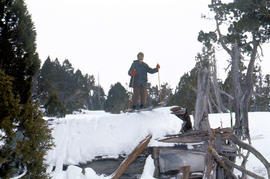
Skiing on the roof of Dixons Kingdom
Part of Arthur Knight Slides
Colour photograph shows buildings on Ben Lomond
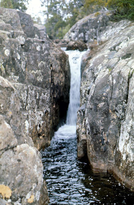
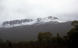
Small waterfall above Grail Falls
Part of Arthur Knight Slides
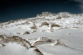
Colour photograph shows snow formation at Jaffa Gate
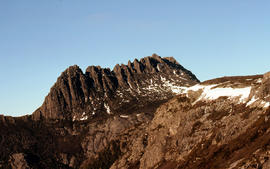
Summit of Cradle Mountain 1976
Part of Arthur Knight Slides
Colour photograph shows summit of West Wall, at Mount Jerusalem
The Temple near Mount Jerusalem
Part of Arthur Knight Slides
Colour photograph shows snow cover along the Wailing Wall near Mount Jerusalem
The Temple and Mount Jerusalem 1978
Part of Arthur Knight Slides
Colour photograph shows the Temple near Mount Jerusalem

Part of Arthur Knight Slides
Colour photograph shows alpine vegetation and snowcover below Mount Ophel
Waterfall at western end of Lake Timk 1974
Part of Arthur Knight Slides
Colour photograph shows West Wall

Part of Arthur Knight Slides
Colour photograph shows snow cover surround Lake Thor and Western Bluff
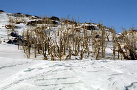
Dead alpine trees in snow at Wailing Wall
Part of Arthur Knight Slides
Colour photograph shows impact of bushfire that left dead vegetation in an alpine area at the Wailing Wall
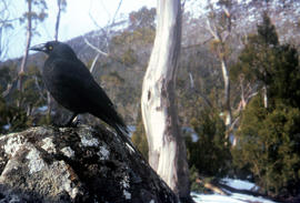
Part of Arthur Knight Slides
Colour photograph shows a black jay, or black currawong, resting on a rock near Lake Dobson
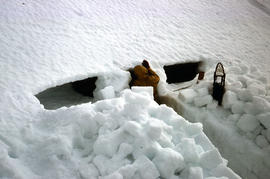
Part of Arthur Knight Slides
Colour photograph shows person excavating blocks of snow to build a snow cave
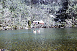
Moving firewood at Lake Dobson
Part of Arthur Knight Slides
Colour photographs shows three people in a small boat laden with firewood being moved from one side of Lake Dobson to another. Hut visible on shore and cleared path of zig-zag track up hill visible in background
Part of Arthur Knight Slides
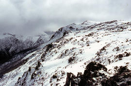
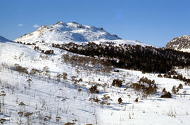
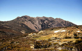
Colour photograph shows snow cover on Florentine Peak
Part of Arthur Knight Slides
Colour photograph shows ridge line of Florentine Peak, with small patches of snow in foreground
Part of Arthur Knight Slides
Colour photograph shows partial snow cover on Florentine Peak, looking west across mountains in distance