- AU TAS UTAS ITCCD 2017/2-173
- Pièce
Fait partie de Arthur Knight Slides
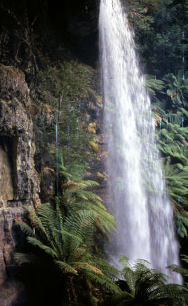
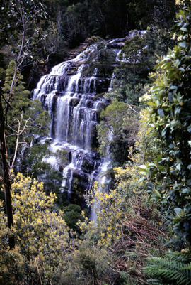
Colour portrait format photograph shows the vertical drop of Marriotts Falls
Fait partie de Arthur Knight Slides
Colour portrait format photograph shows the vertical drop of Marriotts Falls
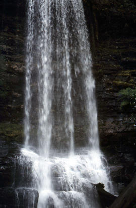
Side view of water flowing over Marriotts Falls
Fait partie de Arthur Knight Slides
Colour portrait format photograph shows side view of the vertical drop of Marriotts Falls
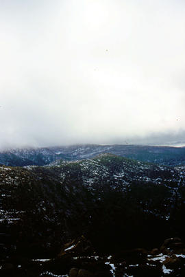
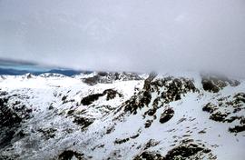
Fait partie de Arthur Knight Slides
Colour portrait format photograph shows low cloud over Mount Bridges, with patches of snow on the ground
Low visibility on Mount Mawson plateau
Fait partie de Arthur Knight Slides
Colour photograph shows ice and snow amid rocky outcrops on Mount Mawson plateau
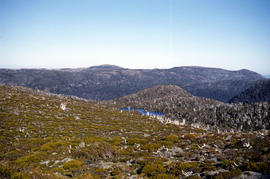
Fait partie de Arthur Knight Slides
Colour photograph shows Lake Newdegate
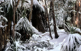
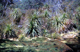
Fait partie de Arthur Knight Slides
Colour photograph shows leaves of Pandani covered by snowfall
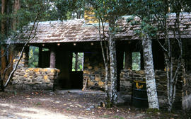
Picnic hut near National Park entrance
Fait partie de Arthur Knight Slides
Colour photograph shows picnic hut near road entrance of Mount Field National Park
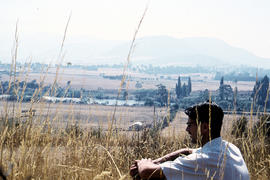
Man sitting in long grass at Plenty
Fait partie de Arthur Knight Slides
Colour photograph shows many with dark hair and spectacles sitting on the edge of cleared farmland at Plenty beside river
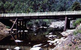
Timber bridge across Plenty River
Fait partie de Arthur Knight Slides
Colour photograph shows the timber frame of the bridge across the Plenty River
Fait partie de Arthur Knight Slides
Colour photograph shows snow cover on the Rodway Range
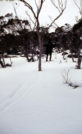
Man skiing downhill on Mount Field West
Fait partie de Arthur Knight Slides
Colour photograph shows man skiing downhill at Mount Field West, with two other figures behind him near the summit of mountain
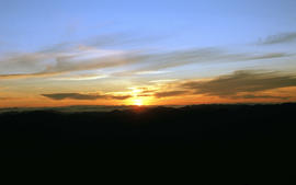
View of sunset from Rodway Range
Fait partie de Arthur Knight Slides
Colour photograph shows sunset as viewed from Rodway Range
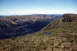
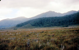
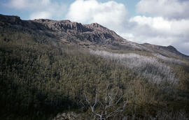
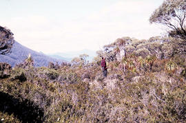
View of heathland near Mount Bowes
Fait partie de Arthur Knight Slides
Colour photograph shows heathland looking southwest from near Mount Bowes
The Druids as viewed from Woody Island
Fait partie de Arthur Knight Slides
Colour photograph shows The Druids as viewed from Woody Island
Fait partie de Arthur Knight Slides
Colour photograph shows The Watcher
Fait partie de Arthur Knight Slides
Colour photograph shows view of mountain range to the west of Mount Field West
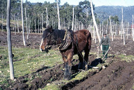
Man and horse ploughing at Westerway
Fait partie de Arthur Knight Slides
Colour photograph shows a farmer ploughing a paddock at Westerway in a field strung with trellis frames for hop cultivation with a draught horse and plough
Fait partie de Hal Wyatt Collection
Colour aerial photograph shows snow on Florentine Peak and Mount Field West
Florentine Peak from Mawson Plateau
Fait partie de Hal Wyatt Collection
Colour photograph shows Florentine Peak from Mawson Plateau, 1968.
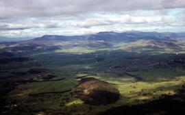
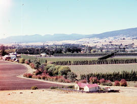
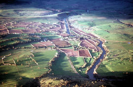
Aerial view of farmland at Glenora
Fait partie de Hal Wyatt Collection
Colour aerial photograph of farmland at Glenora
Fait partie de Hal Wyatt Collection
Colour aerial photograph of Golden Stairs on Mount Mawson
Ice on bushes at Newdegate Pass
Fait partie de Hal Wyatt Collection
Colour photograph of ice on bushes at Newdegate Pass, 1970

Fait partie de Hal Wyatt Collection
Colour photograph of people skiing at Mount Mawson
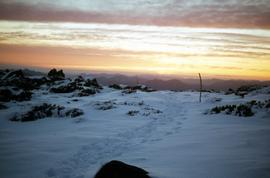
Footsteps in snow at Sunset atop Naturalist Peak, 1973
Fait partie de Hal Wyatt Collection
Colour photograph of footsteps in the snow at sunset atop Naturalist Peak
Fait partie de Hal Wyatt Collection
Colour aerial photograph of Wombat Moor, Mount Field National Park
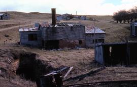
Ruins of Langloh Coal Mine near Hamilton
Fait partie de Greg Dickens Photographic Collection
Colour photograph shows ruins of Langloh colliery near Hamilton
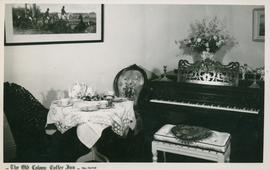
Postcard of the Old Colony Coffee Inn
Fait partie de Olive Pink Collection
Black and white postcard of the interior of the Old Colonial Coffee Inn, New Norfolk, Tasmania
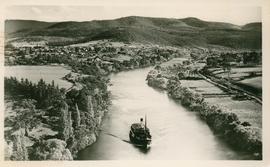
Postcard of a ferry on the Upper Derwent
Fait partie de Olive Pink Collection
Black and white postcard of a ferry on the Upper Derwent River below New Norfolk, Tasmania
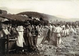
Fait partie de Photographs of Edward Verrell
Black-and-white photograph shows men, women and children stripping hop cones into hessian-covered troughs, carrying baskets and sacks of harvested hops on the extensive hop grounds. The plant was cultivated widely at Glenorchy, Margate, Kingston and the Upper Derwent Valley area.
Fait partie de Arthur Knight Slides
Colour photograph shows hop fields in at Glenora, 1959
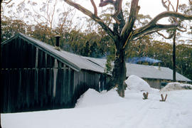
Fait partie de Arthur Knight Slides
Colour photograph shows smoke curling out of the flue from a woodheater or fireplace of the Hobart Walking Club timber hut at Mount Field National Park, with snowdrifts banked halfway up the walls of the hut
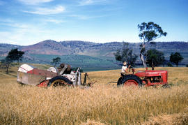
Farmer harvests grain at Glen Dhu
Fait partie de Arthur Knight Slides
Colour photograph shows a farmer driving an International Harvester Farmall M tractor, with the Australian model name AM, pulling a trailed harvester in a paddock of rye at Glen Dhu, 1956. Placename distinct from other Glen Dhu, near Launceston.
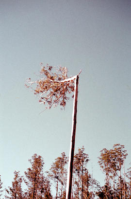
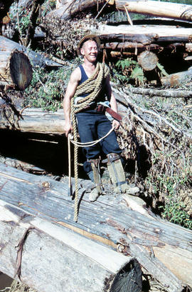
Heading a tree in the Florentine Valley
Fait partie de Arthur Knight Slides
Colour portrait format photograph shows the head of a tall eucalypt tree falling when a timber worker chopped it down after scaling the three
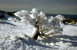
Shrub frozen at Mount Field West
Fait partie de Arthur Knight Slides
Colour photograph shows ice formation on branches of shrub at Mount Field West, 1968
Fait partie de Arthur Knight Slides
Colour photograph shows a person standing on ice at Lake Dobson, with ridge of snow above treeline
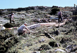
Fait partie de Arthur Knight Slides
Colour photograph shows people assembling the roof frame of a Hobart Walking Club hut at K Col, later named the FA. Peterson Memorial Hut and officially opened in 1960 by New Zealand adventurer Sir Edmund Hilary
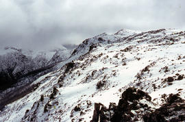
Fait partie de Arthur Knight Slides
Colour photograph shows snow cover on K Col, 1963
Rusted locomotive in bush near Sharpes Siding
Fait partie de Arthur Knight Slides
Colour photograph shows rusted locomotive with vertical boiler in bush near Sharpes Siding, a siding near Lake Tyenna Valley railway.
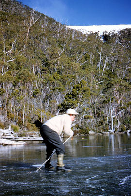
Fait partie de Arthur Knight Slides
Colour photograph shows people ice skating on frozen surface of Lake Dobson
Oast houses and hop fields at Macquarie Plains
Fait partie de Arthur Knight Slides
Colour photograph shows hop fields and kilns, or oast houses, at Macquarie Plains, with rail wagons and railway line in foreground
Mount Bowes from Sandfly Creek
Fait partie de Arthur Knight Slides
Colour photograph shows Mount Bowes as viewed from Sandfly Creek
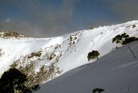
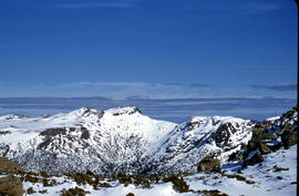
Mount Field West under snow as viewed from Rodway Range
Fait partie de Arthur Knight Slides
Colour photograph from bank of River Derwent shows twisted railway track

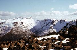
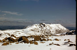
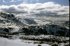
Mount Field West from Rodway Range
Fait partie de Arthur Knight Slides
Colour photograph shows Mount Field West from the Rodway Range
View of Mount Mawson from Florentine Peak saddle
Fait partie de Arthur Knight Slides
Colour photograph shows Mount Mawson viewed from saddle of Florentine Peak, with partial snow cover
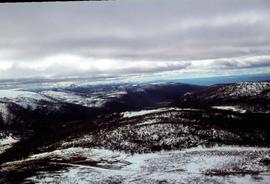
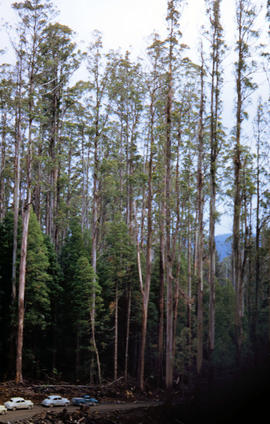
Mount Mueller from beyond Damper Inn hut
Fait partie de Arthur Knight Slides
Colour photograph shows lightly timbered woodland near Mount Mueller
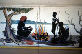
Mural in Hobart Walking Club hut
Fait partie de Arthur Knight Slides
Colour photograph shows a mural in the Hobart Walking Club hut at Lake Dobson Source
Fait partie de Arthur Knight Slides
Colour photograph shows snow skiers on Mount Mawson, one using a tow rope to climb uphill
Signs at entrance to Mount Field National Park
Fait partie de Arthur Knight Slides
Colour photograph shows signs posted at entrance of Mount Field National Park, with distances and estimated travel times to Lake Dobson (9 1/4 miles), Lake Fenton (7 1/4 miles), Lady Barron Falls (1 1/2 mile), Camping Ground (250 yds), Rangers Cottage (150 Yds), Russell Falls 1/2 MILE 10 MIN, Lady Barron Falls Round Trip 3 1/2 MILES 1H 45 MIN
Fait partie de Arthur Knight Slides
Colour photograph shows snow covering Tarn Shelf in Mount Field National Park
Marker on South Gordon walking track
Fait partie de Arthur Knight Slides
Colour photograph shows unusual sign for South Gordon walking track turnoff, fashioned out of number plates, with three backpacks resting on ground nearby
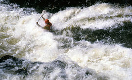
Paddler in the Cruncher at Bradys Lake
Fait partie de Arthur Knight Slides
Colour photograph shows a paddler of a kayak in the Cruncher a segment of water on the Bradys Lake whitewater course
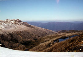
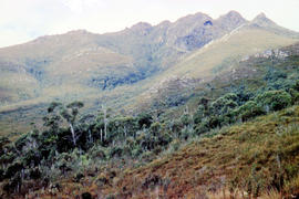
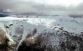
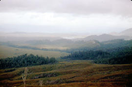
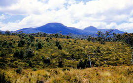
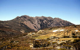
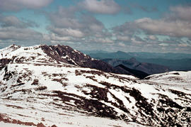
View of mountain ranges west of Mt. Lord
Fait partie de Arthur Knight Slides
Colour photograph of mountain ranges west of Mt. Lord
Fait partie de Arthur Knight Slides
Colour photograph shows rusted International Harvester locomotive on disused rails covered with bracken in a semi-cleared area of land
Golden Stairs ski run at Mount Mawson
Fait partie de Hal Wyatt Collection
Colour photograph of snow on the Golden Stairs, a ski run near Mount Field
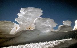
Fait partie de Hal Wyatt Collection
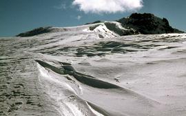
Colour photograph of waves of ice, known as sastrugi, formed near the top of Naturalist Peak, photographed in 1971
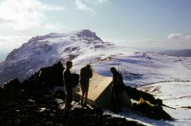
Campsite near snow-capped summit of Florentine Peak
Fait partie de Hal Wyatt Collection
Colour photograph shows three people standing outside a canvas tent pitched near the snow-capped summit of Florentine Peak
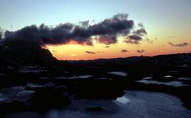
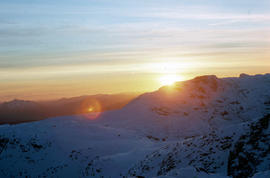
Sunset at Newdegate Pass, 1969
Fait partie de Hal Wyatt Collection
Colour photograph of setting sun behind mountains at Newdegate Pass, 1969
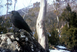
Fait partie de Arthur Knight Slides
Colour photograph shows a black jay, or black currawong, resting on a rock near Lake Dobson
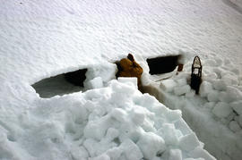
Fait partie de Arthur Knight Slides
Colour photograph shows person excavating blocks of snow to build a snow cave
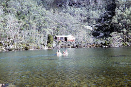
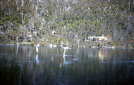
Moving firewood at Lake Dobson
Fait partie de Arthur Knight Slides
Colour photographs shows three people in a small boat laden with firewood being moved from one side of Lake Dobson to another. Hut visible on shore and cleared path of zig-zag track up hill visible in background
Fait partie de Arthur Knight Slides
Colour photograph shows snow cover on Florentine Peak
Fait partie de Arthur Knight Slides
Colour photograph shows ridge line of Florentine Peak, with small patches of snow in foreground
Fait partie de Arthur Knight Slides
Colour photograph shows partial snow cover on Florentine Peak, looking west across mountains in distance