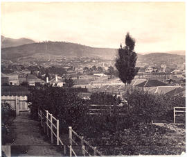
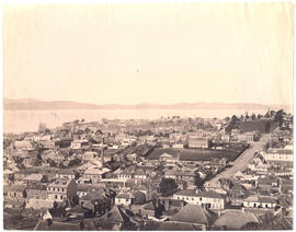
Photograph from the collection of James Backhouse Walker of Hobart viewing over St. Davids Park, probably from Hampden Road, (in about 1878 according to a note on the reverse). The photographer is Henry Hall Baily who had studios in Elizabeth and Liverpool Streets Hobart from 1865 until 1918.
Various photographs of Harrington Street - St. Marys Cathedral, Wilmot Terrace; Pressland House (formerly J P Cowles School); Goulburn St. ; St John the Baptist Church. Photographs by Winter Baily and Anson Bros.
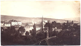
Various photographs of Macquarie Street, looking north taken c1877-1893-4. Photographed by Beattie (electric tram car), Winter, Anson Bros, and H H Baily
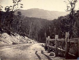
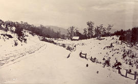
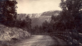
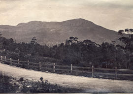
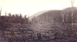
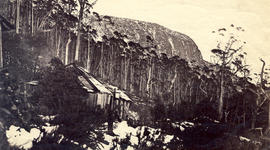
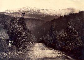
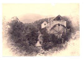
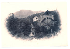
Photographs of Mt Wellington, Huon Road, Fern Tree Bower, Waterworks. Taken c1870-1882 by photographers Anson Bros., Baily and Albert Sargeant Photographers
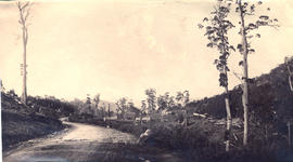
Photograph of road to Mt Wellington showing man with a gun hunting. Taken in about 1870 by Alfred Winter, who had studios in Bathurst, Elizabeth and Liverpool Streets from 1869 until 1891.
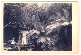
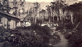
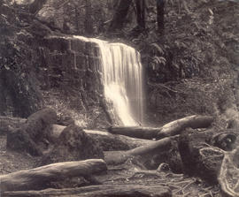
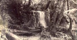
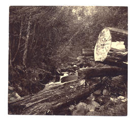
Photographs of Silver Falls, Fern Tree Bower, Mount Wellington c.1880 taken by Anson Brothers who had studios in Liverpool, Collins, and Elizabeth Streets between 1878 and 1891.
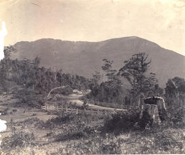
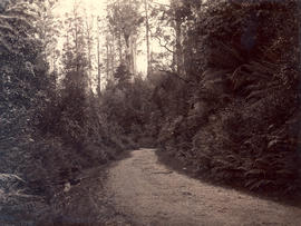
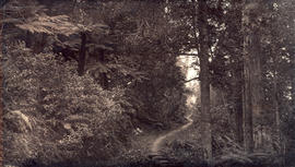
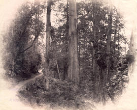
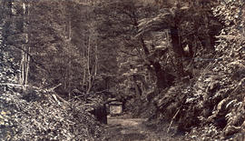
Photograph of the track to Fern Tree Bower, Mount Wellington before taken prior to 1879 by Anson Brothers who had studios in Liverpool, Collins, and Elizabeth Streets between 1878 and 1891.
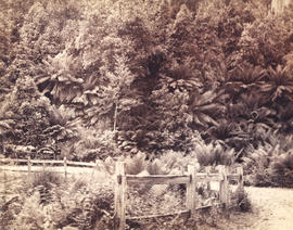
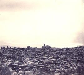
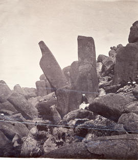
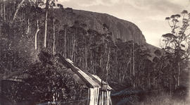
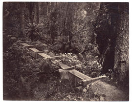
Photographs of Cook's Monument, Fern Tree Bower, Mount Wellington. Memorial stones commemorate Mayor Henry Cook and the Hobart Town Corporation Waterworks erected in 1861.
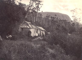
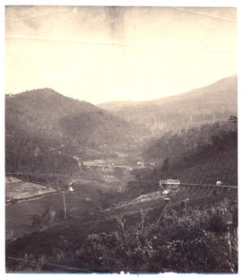
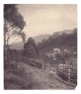
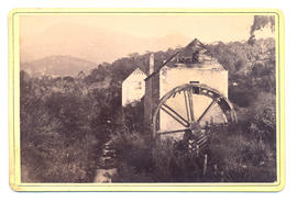
Photograph of Stony Steps or Waterworks Valley, Hobart, Tasmania with Livingstone's house Marydale in the foreground and the Waterworks dam in the background, c.1870.
Photographs of Maatsuyker Island located 5.5 kilometres off the south coast of Tasmania. The island comprises part of the Southwest National Park and is a Tasmanian Wilderness World Heritage Site. The Maatsuyker Island Lighthouse, the southernmost Australian lighthouse, is located on the southern tip of the island
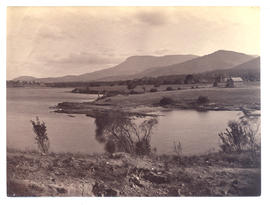
Photographs of Lake St. Clair at the southern end of the Cradle Mountain-Lake St Clair National Park. Is part of the Tasmanian Wilderness World Heritage Area. The Cradle Mountain-Lake St Clair area was declared a scenic reserve in 1922, a wildlife reserve in 1927, a national park in 1947 and a world heritage area from 1982.
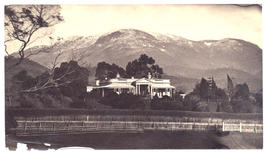
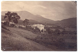
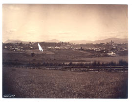
Two photographs of Sunnyside, New Town, Tasmania, home of Thomas Daniel Chapman 1815-1884, Politician. Mt Wellington in distance. The photographer was Henry Hall Baily who had studios in Elizabeth and Liverpool Streets, Hobart from 1865 until 1918.
Photograph of Austins Ferry, Hobart, Tasmania, with Austin's old Inn to the right. The photographer was Alfred Winter who had studios in Bathurst, Elizabeth and Liverpool Streets from 1869 until 1891.
Photograph of Derwentwater, Sandy Bay, Tasmania, home of Captain Langdon Swan, c.1881. The photographer was Alfred Winter who had studios in Bathurst, Elizabeth and Liverpool Streets from 1869 until 1891.
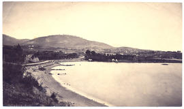
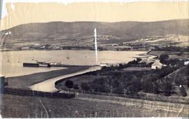
Photograph of Battery Point from Sandy Bay, Tasmania, with St. Helena, later Wrest Point, in foreground, St Georges Church in the distance, c.1881. The photographer was Alfred Winter who had studios in Bathurst, Elizabeth and Liverpool Streets from 1869 until 1891.
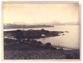
Photograph of Queenborough, Sandy Bay, Tasmania, c.1881. The photographer was Alfred Winter who had studios in Bathurst, Elizabeth and Liverpool Streets from 1869 until 1891.
Two Parliamentary Papers entitled : • Walker, J.B. "Deportation of the Norfolk Islanders to the Derwent in 1808" (Parl. Paper, 1895). • "Discovery of Van Diemen's Land in 1642". (Parl. Paper, 1891).