
- AU TAS UTAS ITCCD 2017/2-285
- Item
- 1977
Part of Arthur Knight Slides
Colour photograph shows hut at Lake Meston built of logs, shingles and with tin plate chimney People sitting outside hut eating

Part of Arthur Knight Slides
Colour photograph shows hut at Lake Meston built of logs, shingles and with tin plate chimney People sitting outside hut eating

Part of Arthur Knight Slides
Colour photograph shows ice formed on plants, location unknown
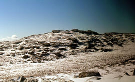
Ice formation on rocks at Ben Lomond 1962
Part of Arthur Knight Slides
Colour photograph shows ice formation on rocks atop Ben Lomond 1962

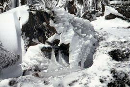
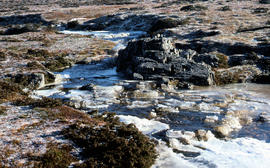
Ice formation near Herods Gate 1978
Part of Arthur Knight Slides
Colour photograph shows ice formation on cliff face near Herods Gate, with snow covering alpine vegetation

Part of Arthur Knight Slides
Colour photograph shows icicles formed on Little Horn 1985

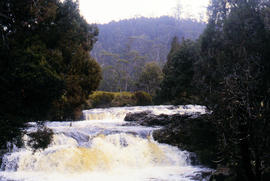
Knyvet Falls near Cradle Mountain
Colour photograph shows water flowing over Knyvet Falls in the Cradle Valley
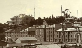
Part of Photographs of Edward Verrell
Black-and-white photograph shows stone buildings along Salamanca Place, timber stacked on New Wharf and masts of ships docked at the wharf; signs on buildings for “A.E. Lord Wool Merchant” and “W.D. Peacock and Co.”, historic home Lenna and eastern conservatory visible on hilltop behind towards Battery Point; maritime signal station with the Time Ball that was dropped automatically at 1pm, after a relayed telegraph signal from the Melbourne Observatory.
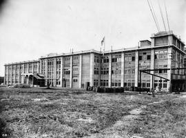
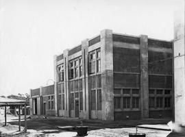
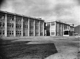
Large multi-storied building forming part of the Cadbury factory under construction. Wooden barrels can be seen on grass in front.
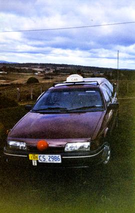
Ford taxi cab, marked Car 1309, Area 2. Car sporting red plastic nose, possibly in support of Red Nose Day which aims to raise awareness of SIDS
Graeme Raphael
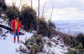
Part of Hal Wyatt Collection
Colour photograph of man looking down Mount Wellington, with skis, from Milles Track
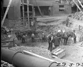
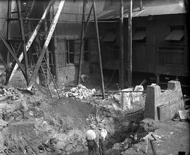
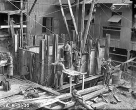
Excavation for Derwent Prime furnace at E.Z. Co. Zinc Works
Black-and-white photograph shows workmen digging earth and rubble to be loaded into a horse-drawn cart at excavation site for new Derwent Prime furnace being built at E.Z Co. Zinc Works 1930
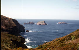
View of the Friars from shore near Pine Log Bight
Part of Arthur Knight Slides
Colour photograph of the Friars, a small group of islands, off southern shore of Bruny Island, taken from shore near Pine Log Bight.
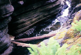
Water flowing in base of Leven Canyon
Part of Arthur Knight Slides
Colour photograph shows logs in base of Leven Canyon

Snowfall at Jaffa Vale and Mount Olympus
Part of Arthur Knight Slides
Colour photograph shows tracks of snow skiers at Jaffa Vale and Mount Olympus

Part of Arthur Knight Slides
Colour photograph shows snow at Jaffa Vale

Part of Arthur Knight Slides
Colour photograph of limited water flow across Knyvet Falls 1984 GIS: Latitude -4159 Longitude 14593 Gazetteer Australia Record_ID TAS06008

Part of Arthur Knight Slides
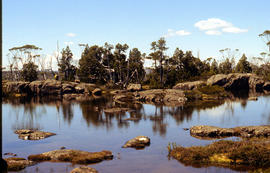
Colour photograph shows shoreline of Lake Adelaide

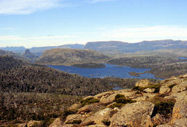
Lake Lea from Prospect Mountain
Part of Arthur Knight Slides
Colour photograph shows Lake Lea from Prospect Mountain near Vale of Belvoir

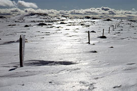
Lake Loane under snow cover 1978
Part of Arthur Knight Slides
Colour photograph shows Lake Loane beneath blanket of snow, from near the Horse Track 1978

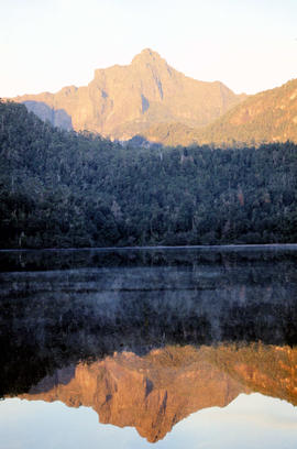
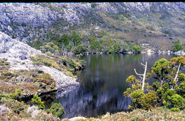
Reflections upon surface of Lake Chalice 1979
Part of Arthur Knight Slides
Colour photograph shows reflections of alpine vegetation in Chalice Lake 1979 GIS: Lake Latitude -4188 Longitude 14615 Gazetteer Australia Record_ID TAS02044

Shoreline of Lake Chalice 1979
Part of Arthur Knight Slides
Colour photograph shows the rocky shoreline of Chalice Lake GIS: Latitude -4188 Longitude 14615 Gazetteer Australia Record_ID TAS02044

Part of Arthur Knight Slides
Colour photograph shows waves and white caps on the surface of Lake Myrtle GIS: Latitude -4188 Longitude 14618 Gazetteer Australia Record_ID TAS02073
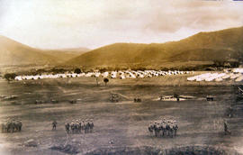
Soldiers being drilled at Claremont Military Camp
Soldiers being drilled in front of large group of military tents, part of the Claremont military camp.
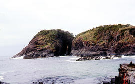
Part of Arthur Knight Slides
Arch island on Bruny Island
Arthur Knight
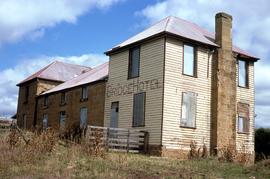
Colour landscape photograph shows exterior of derelict Bridge Hotel at Ouse, situated in the crook of the Ouse River, a sandstone, weatherboard and tin structure, with windows boarded up

View of the Post Office, Queenstown, Tasmania
Part of Images of West Coast Tasmania
Image contains text identifying the subject. Possibly originally a post card.
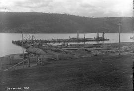
Construction of new Risdon wharf
Black-and-white photograph shows construction of wharf at E.Z. Co. Zinc Works at Risdon
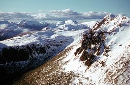
Part of Hal Wyatt Collection
Colour photograph shows snow on mountains in Tasmania’s Central Highlands
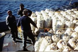
Bags of scallops on deck of fishing boat
Large number of bags filled with scallops on deck of boat with three men looking on
Graeme Raphael
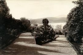
Walking path in Royal Botanical Gardens
Part of Photographs of Edward Verrell
Black-and-white photograph shows gravel walking path in Royal Botanical Gardens
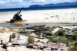
Wreck on beach near Mars Bluff
Part of Arthur Knight Slides
Colour photograph of rotting timbers from wreck of boat, half-buried in the sand near shallow creek on beach near Mars Bluff, Bruny Island, Photograph possibly taken 1963.
Excavation work for construction of furnace at E.Z. Co. Zinc Works
Black-and-white photograph shows workmen beginning excavation of site for new Derwent Prime furnace
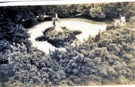
View from above of John Franklin Statue and Fountain, Franklin Square, Hobart.
Graeme Raphael
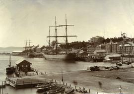
Ships docked at New Wharf, Hobart
Part of Photographs of Edward Verrell
Black-and-white photograph shows sailing ships moored at New Wharf, Hobart, in front of Salamanca Place, with milled timber stacked on edge of wharf
Snow and ice on grove of Pandanus trees
Part of Hal Wyatt Collection
Colour photograph of ice on grove of Pandanus trees
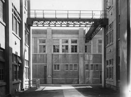
Multi-story buildings, Cadbury Factory
Courtyard and paths between multi-storied buildings, Cadbury factory.
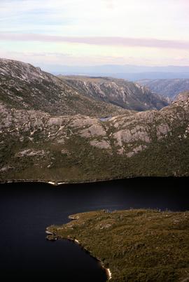
Lake Hanson near Cradle Mountain
Colour photograph shows Lake Hanson, near Cradle Mountain
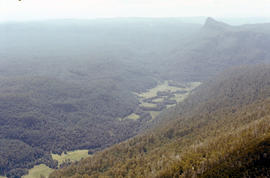
Lees Paddock and Mount Pillinger
Part of Arthur Knight Slides
Colour photograph shows the cleared land of Lees Paddocks in the upper Mersey Valley, surrounded by bush with Mount Pillinger in the background
Part of Arthur Knight Slides
Colour photograph shows Legges Tor, the highest peak of Ben Lomond, with skiers visible on the nearby ski field
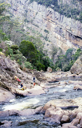
Sitting on ledge beside Leven River
Part of Arthur Knight Slides
Colour photograph shows walkers resting on rock ledge beside Leven River in the Leven Canyon
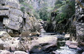
Part of Arthur Knight Slides
Colour photograph shows whitewater in narrow section of Leven Canyon
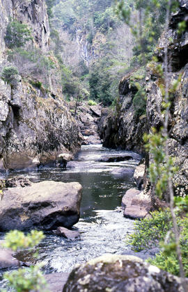
Part of Arthur Knight Slides
Colour photograph shows rockpools in the Leven River at Leven Canyon, surrounded by steep rockwalls and temperate rainforest
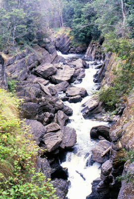
Portrait format photograph of Leven Canyon
Part of Arthur Knight Slides
Colour portrait format photograph shows Leven River spilling in to narrow gorge in the part of the river known as Leven Canyon

Part of Arthur Knight Slides
Colour portrait format photograph shows Lake Wilks and Little Horn near Cradle Mountain
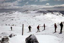
Snow skiers on Ben Lomond 1962
Part of Arthur Knight Slides
Colour photograph shows snow skiing on Ben Lomond at Markham Heights
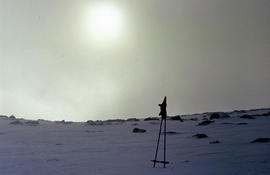
Morning mist on Ben Lomond 1962
Part of Arthur Knight Slides
Colour photograph shows pair of gloves on a set of ski poles pitched into snow atop Ben Lomond, with mist covering the sun

Walkers on Mountains of Jupiter
Part of Arthur Knight Slides
Colour photograph of bushwalkers at Mountains of Jupiter near the Walls of Jerusalem
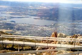
Glenorchy from Mount Wellington
View of Glenorchy and surrounds taken from Mt Wellington. Bowen Bridge visible. The photographic print features a lighter band visible on the scanned digital version.
Graeme Raphael
Derwent Prime furnace jacket assembled at E.Z. Co. Zinc Works
Black-and-white photograph shows men assembling Derwent Prime furnace at E.Z. Co. Zinc Works at Risdon
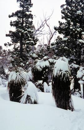
Snow and ice on Pandanus and native pine trees
Part of Hal Wyatt Collection
Colour, portrait-shaped photograph of ice and snow on pandanus trees and native pines, 1970
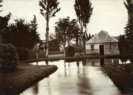
Part of Photographs of Edward Verrell
Photograph showing the first hatchery building built in 1870 at the Salmon Ponds at Plenty surrounded by landscaped grounds filled with exotic trees.
Multi-storied building with lettering reading Westway on corner, forming part of Cadbury factory.
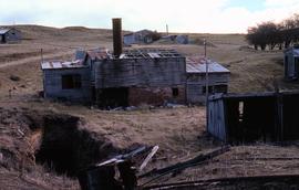
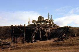
Ruins of Langloh Coal Mine near Hamilton
Colour photograph shows ruins of Langloh colliery near Hamilton

Part of Arthur Knight Slides
Colour photograph shows Lake Timk and Mount Anne in distance GIS: Latitude -4293 Longitude 14646 Gazetteer Australia Record_ID TAS16882
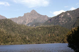
Cliffs of Mount Anne above Lake Timk
Part of Arthur Knight Slides
Colour photograph shows the cliffs of Mount Anne above Lake Timk
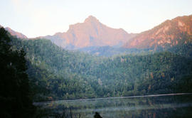
Part of Arthur Knight Slides
Colour photograph shows Mount Anne at sunrise as viewed from across Lake Timk
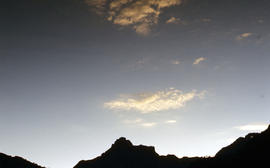
Part of Arthur Knight Slides
Colour photograph shows silhouette of Mount Anne, viewed at sunset
Part of Arthur Knight Slides
Colour photograph shows afternoon reflection of Mount Anne on the surface of water of Lake Timk

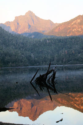
Reflection of Mount Anne on surface of Lake Timk
Part of Arthur Knight Slides
Colour portrait format photograph shows reflection of Mount Anne on the surface of Lake Timk
Portrait format view of reflection of Mount Anne on surface of Lake Timk
Part of Arthur Knight Slides
Colour photograph shows peaks in the Du Cane mountain range including Mount Geyron, as viewed from Cathedral Mountain

Mount Geyron from Cathedral Mountain
Part of Arthur Knight Slides
Colour photograph shows Lake Payanna and Mount Ida
Mount Ida and Lake Payanna 1979
Part of Arthur Knight Slides
Colour photograph shows cloud encircling Mount Ossa and clear skies around nearby Cathedral Mountain

Mount Ossa and Cathedral Mountain
Part of Arthur Knight Slides
Colour photograph shows rocky peak of Mount Rogoona, with alpine plain in foreground
Two large three story buildings forming part of Cadbury factory.
Ruins of structure at Langloh Coal Mine near Hamilton
Colour photograph shows fallen timber structures at Langloh coal mine and colliery near Hamilton
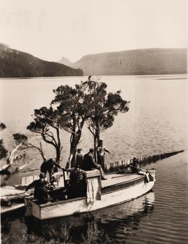
Boating on a lake in the mountains
Small wooden boat with several people on board, next to jetty on shore of Lake St Clair. Mountains in background, including the taller peak of Mount Ida.
Graeme Raphael
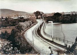
Sandy Bay Road looking towards Hobart
Part of Photographs of Edward Verrell
Black-and-white photograph shows Sandy Bay Road, with tram tracks on riverside of road, electric wires for Hobart Electric Tramway, carriage wheelmarks in the unpaved road surface, electricity transmission wires strung from poles mounted with porcelain insulators
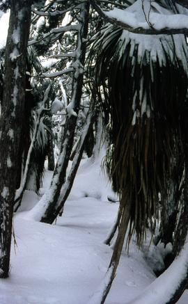
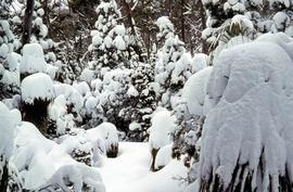
Snow and ice beneath rainforest trees
Part of Hal Wyatt Collection
Colour photograph of ice and snow beneath rainforest plants, 1970
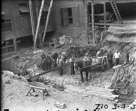
Horse and cart used in excavation of Derwent Prime furnace site at E.Z. Co. Zinc Works
Black-and-white photograph shows horse and cart positioned in pit while men excavate the site of the Derwent Prime furnace by hand at the E.Z. Co Zinc Works 1930

Part of Arthur Knight Slides
Colour photograph shows Mount Rogoona with Lake Myrtle obscured by light alpine forest vegetation on ridge

Panoramic view of Mount Rogoona
Part of Arthur Knight Slides
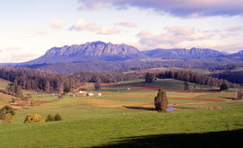
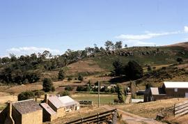
Colour photograph shows farmland in the Kentish area with Mount Roland in background
Part of Arthur Knight Slides
Colour photograph shows cloud above mountain ranges, looking west to Mount Heemskirk from Mount Murchison
View from Mount Murchison to Mount Heemskirk
Part of Arthur Knight Slides
Colour photograph shows snow skier at Piesse Vale on Ben Lomond plateau GIS Latitude -4154 Longitude 14763 Gazetteer Record_ID TAS13722 Source: https://wwwparkstasgovau/fileaspx?id=6392
Part of Arthur Knight Slides
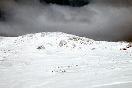
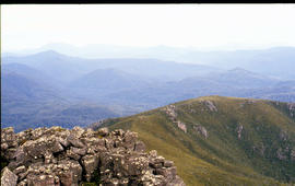
Colour photograph of view from snow capped Cradle Mountain looking north

View across Cradle Mountain ridges to the north
Part of Arthur Knight Slides
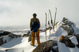
Colour photograph shows people standing outside Northern Tasmanian Alpine Club hut at Ben Lomond, one holding snow skis and poles
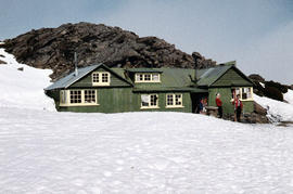
Northern Tasmanian Alpine Club hut on Ben Lomond
Part of Arthur Knight Slides
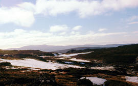
Colour photograph shows snow cover near Walls of Jerusalem looking to Mount Olympus and Mount Gould
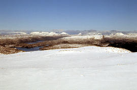
Snow cover at near Walls of Jerusalem looking to Mount Olympus and Mount Gould
Part of Arthur Knight Slides
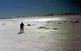
Colour photograph shows snow skier standing on Mount Jerusalem
Snow skier on Mt Jerusalem 1978
Part of Arthur Knight Slides
Colour photograph shows snow skier standing on Mount Jerusalem, near the West Wall summit
Snow skier near West Wall, Mount Jerusalem
Part of Arthur Knight Slides
Colour photograph shows Paddys Lake GIS: Latitude -4145 Longitude 14596 Gazetteer Record_ID TAS07938
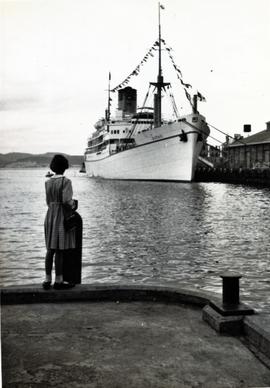
Royal ship Gothic at Princes Wharf, Hobart
Passenger liner The Gothic at Princess Wharf Photograph possibly take during the Royal visit of Queen Elizabeth II to Tasmania. Ship part of the Shaw, Savill & Albion Line. Built 1948.
Graeme Raphael
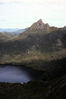
View of Little Horn of Cradle Mountain and Dove Lake
Colour photograph of Little Horn and Dove Lake, Cradle Mountain
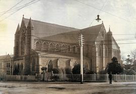
Part of Photographs of Edward Verrell
Black-and-white photograph of St David’s Cathedral, Hobart, including original fence of St David’s Church, which occupied the site until the 1860s
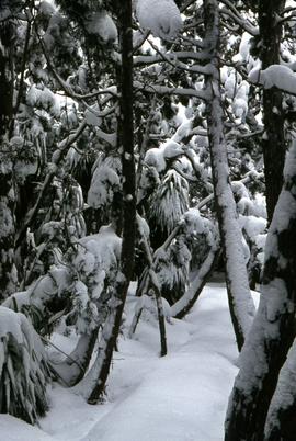
Snow and ice beneath grove of Pandanus trees
Part of Hal Wyatt Collection
Colour photograph of ice and snow cloaking the leaves and trunks of Pandanus and other Tasmanian highland rainforest plants
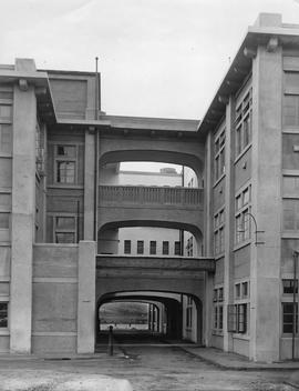
External Walkways, Cadbury Factory
Two multi-story buildings connected by walkways with road running through middle at ground level giving glimpse of water, forming part of the Cadbury factory.
Building foundations for Derwent Prime furnace at E.Z. Co. Zinc Works
Black-and-white photograph shows workmen building foundations of Derwent Prime furnace at E.Z. Co Zinc Works at Risdon 1930
Part of Arthur Knight Slides
Colour photograph shows whitewater section of Pencil Pine Creek
Part of Arthur Knight Slides
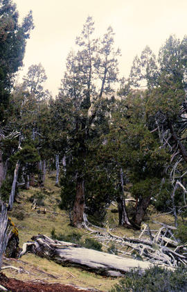
Colour photograph shows Pencil Pines growing in alpine forest near Dixons Kingdom hut
Pencil Pines near Dixons Kingdom
Part of Arthur Knight Slides
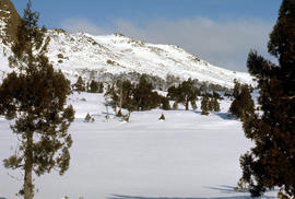
Colour photograph shows Piesse Vale at Ben Lomond plateau dusted with snow GIS Latitude -4154 Longitude 14763 Gazetteer Record_ID TAS13722
Piesse Vale on Ben Lomond plateau
Part of Arthur Knight Slides
Colour photograph shows plateau near Cradle Mountain
Part of Arthur Knight Slides
Colour photograph shows creek running through snow and ice on plateau above Cradle Mountain
Creek on plateau above Cradle Mountain
Part of Arthur Knight Slides
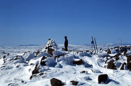
Colour photograph shows plateau near summit of Ben Lomond
Plateau near summit of Ben Lomond
Part of Arthur Knight Slides
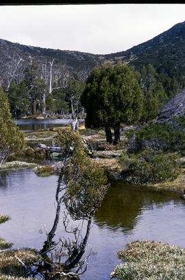
Colour photograph shows reflections of alpine vegetation in tarn near Mountains of Jupiter
Tarn and Pencil Pines near Mountains of Jupiter
Part of Arthur Knight Slides
Colour photograph shows alpine vegetation surrounding Pool of Bethesda GIS: Latitude -4181 Longitude 14630 Gazetteer Record_ID TAS12063
Part of Arthur Knight Slides
Colour photograph shows snow covering the Pool of Siloam near The Temple below Mount Jerusalem
Pool of Siloam & The Temple 1978
Part of Arthur Knight Slides
Colour photograph shows snow covering Pool of Siloam near the West Wall of Mount Jerusalem
Farm buildings at Meadsfield near Bothwell
Colour photograph of farm buildings at Meadsfield near Bothwell
Part of Photographs of Edward Verrell
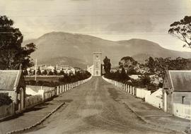
Black-and-white photograph looking up St John’s Avenue, towards St John’s Church, New Town
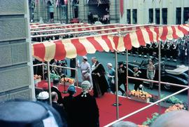
Queen Mother arrives at Hobart Town Hall
Part of Hal Wyatt Collection
Colour photograph of Queen Mother arriving at Hobart Town Hall, on Friday, April 30, accompanied by Lord Mayor of Hobart, Sir Archibald Park
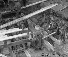
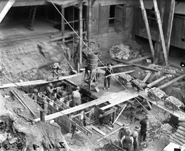
Boxing for foundations of Derwent Prime furnace at E.Z. Co. Zinc Works
Black-and-white photograph shows workmen building box work for foundations of Derwent Prime furnace at E.Z. Co Zinc Works at Risdon 1930
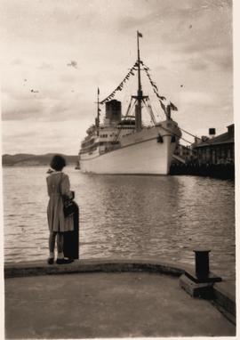
Passenger liner Gothic at Princess Wharf, Hobart
Graeme Raphael