
- AU TAS UTAS ITCCD 2017/2-283
- Item
- 1978
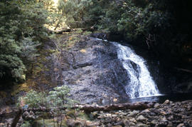
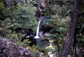
Parte de Arthur Knight Slides
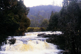
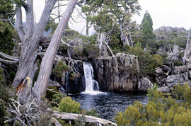
Colour photograph shows Grail Falls

Parte de Arthur Knight Slides
Colour photograph shows Grail Falls

Parte de Arthur Knight Slides
Colour photograph shows hut at Lake Meston built of logs, shingles and with tin plate chimney People sitting outside hut eating

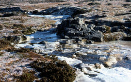
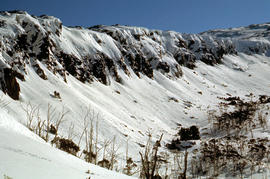
Ice formation near Herods Gate 1978
Parte de Arthur Knight Slides
Colour photograph shows ice formation on cliff face near Herods Gate, with snow covering alpine vegetation

Parte de Arthur Knight Slides
Colour photograph shows icicles formed on Little Horn 1985

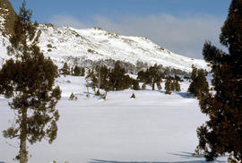
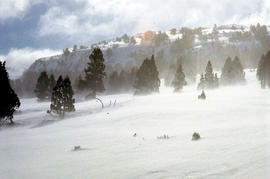
Snowfall at Jaffa Vale and Mount Olympus
Parte de Arthur Knight Slides
Colour photograph shows tracks of snow skiers at Jaffa Vale and Mount Olympus

Parte de Arthur Knight Slides
Colour photograph shows snow at Jaffa Vale

Parte de Arthur Knight Slides
Colour photograph of limited water flow across Knyvet Falls 1984 GIS: Latitude -4159 Longitude 14593 Gazetteer Australia Record_ID TAS06008

Parte de Arthur Knight Slides
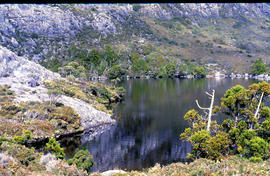
Colour photograph shows shoreline of Lake Adelaide

Lake Lea from Prospect Mountain
Parte de Arthur Knight Slides
Colour photograph shows Lake Lea from Prospect Mountain near Vale of Belvoir

Lake Loane under snow cover 1978
Parte de Arthur Knight Slides
Colour photograph shows Lake Loane beneath blanket of snow, from near the Horse Track 1978

Reflections upon surface of Lake Chalice 1979
Parte de Arthur Knight Slides
Colour photograph shows reflections of alpine vegetation in Chalice Lake 1979 GIS: Lake Latitude -4188 Longitude 14615 Gazetteer Australia Record_ID TAS02044

Shoreline of Lake Chalice 1979
Parte de Arthur Knight Slides
Colour photograph shows the rocky shoreline of Chalice Lake GIS: Latitude -4188 Longitude 14615 Gazetteer Australia Record_ID TAS02044

Parte de Arthur Knight Slides
Colour photograph shows waves and white caps on the surface of Lake Myrtle GIS: Latitude -4188 Longitude 14618 Gazetteer Australia Record_ID TAS02073

Parte de Arthur Knight Slides
Colour portrait format photograph shows Lake Wilks and Little Horn near Cradle Mountain

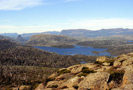
Walkers on Mountains of Jupiter
Parte de Arthur Knight Slides
Colour photograph of bushwalkers at Mountains of Jupiter near the Walls of Jerusalem

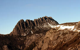
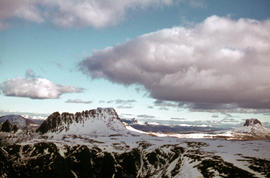
Mount Geyron from Cathedral Mountain
Parte de Arthur Knight Slides
Colour photograph shows Lake Payanna and Mount Ida
Mount Ida and Lake Payanna 1979
Parte de Arthur Knight Slides
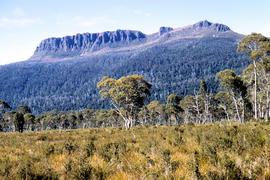
Colour photograph shows cloud encircling Mount Ossa and clear skies around nearby Cathedral Mountain

Mount Ossa and Cathedral Mountain
Parte de Arthur Knight Slides
Colour photograph shows rocky peak of Mount Rogoona, with alpine plain in foreground

Parte de Arthur Knight Slides
Colour photograph shows Mount Rogoona with Lake Myrtle obscured by light alpine forest vegetation on ridge

Panoramic view of Mount Rogoona
Parte de Arthur Knight Slides
Colour photograph shows farmland in the Kentish area with Mount Roland in background

View across Cradle Mountain ridges to the north
Parte de Arthur Knight Slides
Colour photograph shows people standing outside Northern Tasmanian Alpine Club hut at Ben Lomond, one holding snow skis and poles
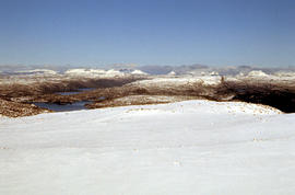
Snow cover at near Walls of Jerusalem looking to Mount Olympus and Mount Gould
Parte de Arthur Knight Slides
Colour photograph shows snow skier standing on Mount Jerusalem
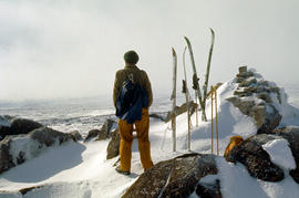
Snow skier on Mt Jerusalem 1978
Parte de Arthur Knight Slides
Colour photograph shows snow skier standing on Mount Jerusalem, near the West Wall summit
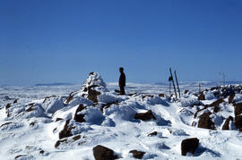
Snow skier near West Wall, Mount Jerusalem
Parte de Arthur Knight Slides
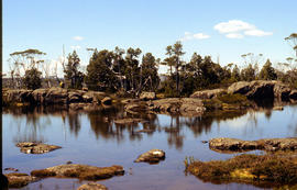
Colour photograph shows Paddys Lake GIS: Latitude -4145 Longitude 14596 Gazetteer Record_ID TAS07938
Parte de Arthur Knight Slides
Colour photograph shows whitewater section of Pencil Pine Creek
Parte de Arthur Knight Slides
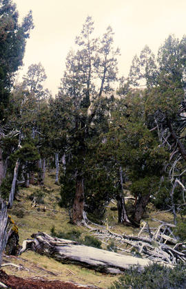
Colour photograph shows Pencil Pines growing in alpine forest near Dixons Kingdom hut
Pencil Pines near Dixons Kingdom
Parte de Arthur Knight Slides
Colour photograph shows Piesse Vale at Ben Lomond plateau dusted with snow GIS Latitude -4154 Longitude 14763 Gazetteer Record_ID TAS13722
Parte de Arthur Knight Slides
Colour photograph shows creek running through snow and ice on plateau above Cradle Mountain
Creek on plateau above Cradle Mountain
Parte de Arthur Knight Slides
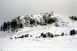
Colour photograph shows plateau near summit of Ben Lomond
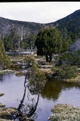
Tarn and Pencil Pines near Mountains of Jupiter
Parte de Arthur Knight Slides
Colour photograph shows alpine vegetation surrounding Pool of Bethesda GIS: Latitude -4181 Longitude 14630 Gazetteer Record_ID TAS12063
Parte de Arthur Knight Slides
Colour photograph shows snow covering the Pool of Siloam near The Temple below Mount Jerusalem
Pool of Siloam & The Temple 1978
Parte de Arthur Knight Slides
Colour photograph shows snow covering Pool of Siloam near the West Wall of Mount Jerusalem
Pool of Siloam and the West Wall of Mount Jerusalem
Parte de Arthur Knight Slides
Colour photograph shows dolerite peak of Ragged Jack, near Ben Lomond, viewed across from lightly timbered farmland
Parte de Arthur Knight Slides
Colour photograph shows man in skis atop snow-covered roof of Dixons Kingdom hut
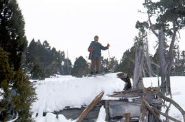
Skiing on the roof of Dixons Kingdom
Parte de Arthur Knight Slides
Colour photograph shows buildings on Ben Lomond
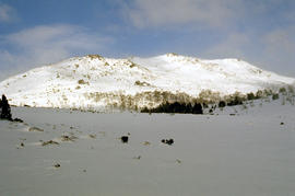
Small waterfall above Grail Falls
Parte de Arthur Knight Slides
Colour photograph shows snow formation at Jaffa Gate
Snow formation at Jaffa Gate 1978
Parte de Arthur Knight Slides
Colour photograph shows snow near summit of Ben Lomond 1962
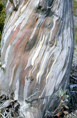
Bark of snow gum near Cathedral Mountain
Parte de Arthur Knight Slides
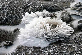
Colour photograph shows ice formations on tufts of native grass
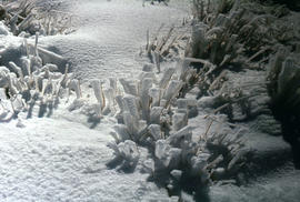
Snow and ice formations on tufts of grass
Parte de Arthur Knight Slides
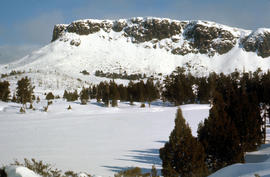
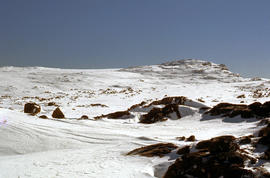
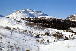
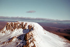
Colour photograph shows snow atop Mount Ophel
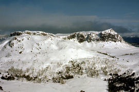
Parte de Arthur Knight Slides
Colour photograph shows snow covering alpine vegetation
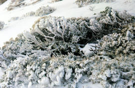
Parte de Arthur Knight Slides
Colour photograph shows snow cover around Mount Rogoona
Snow on plateau below Mount Rogoona
Parte de Arthur Knight Slides
Colour photograph shows southern shore of Lake Timk
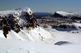
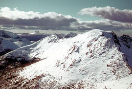
Summit of Cradle Mountain 1976
Parte de Arthur Knight Slides
Colour photograph shows summit of West Wall, at Mount Jerusalem
Summit of West Wall at Mount Jerusalem
Parte de Arthur Knight Slides
Colour photograph shows sunrise at Cradle Mountain 1976
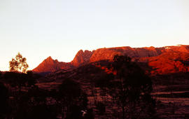
Sunrise at Cradle Mountain 1976
Parte de Arthur Knight Slides
Colour photograph shows sunrise at Cradle Mountain 1976
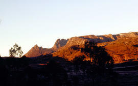
Sunrise at Cradle Mountain, photographed 1976
Parte de Arthur Knight Slides
Colour photograph shows snow vehicle travelling uphill south west of the summit of Ben Lomond
Snow cover on the Temple and West Wall at Mount Jerusalem
Parte de Arthur Knight Slides
Colour photograph shows a snow vehicle taking a skier uphill at Ben Lomond 1960
The Temple and Mount Jerusalem 1978
Parte de Arthur Knight Slides
Colour photograph shows the Temple near Mount Jerusalem
The Temple near Mount Jerusalem
Parte de Arthur Knight Slides
Colour photograph shows snow cover along the Wailing Wall near Mount Jerusalem
Parte de Arthur Knight Slides
Colour photograph shows skier standing outside trapper's hut in the snow
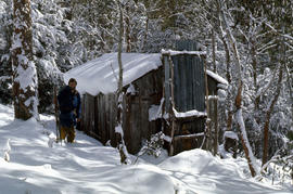
Parte de Arthur Knight Slides
Colour photograph shows three snow skiers outside a trapper's hut in the snow

Parte de Arthur Knight Slides
Colour photograph shows alpine vegetation and snowcover below Mount Ophel
Parte de Arthur Knight Slides
Colour photograph shows snow cover above thick alpine forest at the Wailing Wall near Mount Jerusalem
Snow cover on Wailing Wall near Mount Jerusalem
Parte de Arthur Knight Slides
Colour photograph shows lilies on surface of Lake Meston
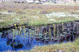
Water lilies at Lake Meston 1977
Parte de Arthur Knight Slides
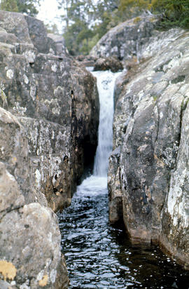
Colour photograph shows water spilling from western end of Lake Timk
Waterfall at western end of Lake Timk 1974
Parte de Arthur Knight Slides
Colour photograph shows West Wall
Parte de Arthur Knight Slides
Colour photograph shows heavy snow cover on forest at West Wall near Mount Jerusalem

Parte de Arthur Knight Slides
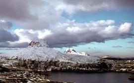
Colour photograph shows snow cover surround Lake Thor and Western Bluff
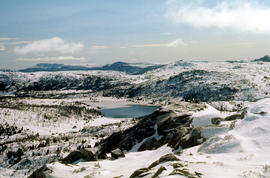
Western Bluff & Lake Thor 1978
Parte de Arthur Knight Slides
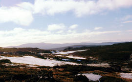
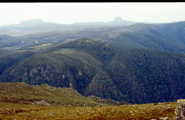
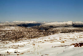
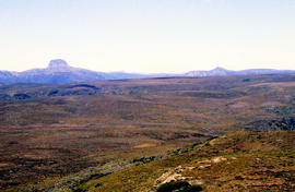
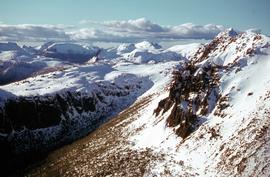
Colour photograph shows view west from Back Mountain 1983
Parte de Arthur Knight Slides
Colour photograph shows people on western shore of Lake Timk 1974
Shoreline of Great Lake at Breona
Parte de Arthur Knight Slides
Colour photograph depicts northern shoreline of Great Lake and settlement of Breona
Arthur Knight
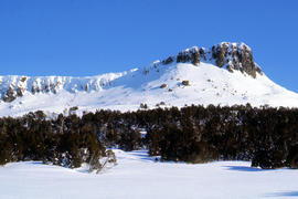
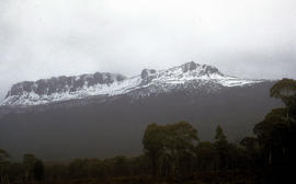
Snow on Cradle Mountain and Barn Bluff
Parte de Arthur Knight Slides
Colour photograph shows snowfall on Cradle Mountain and Bluff
Arthur Knight
Parte de Arthur Knight Slides
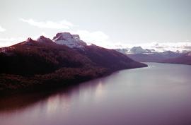
Colour photograph shows Lake St Clair as viewed from Mount Manfred
Arthur Knight
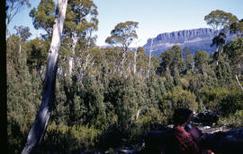
Walkers rest in bush below Mount Olympus
Parte de Arthur Knight Slides
Colour photograph shows snow on Mount Olympus
Arthur Knight
Parte de Arthur Knight Slides
Colour photograph shows profile of Mount Olympus
Arthur Knight
Parte de Arthur Knight Slides
Colour photograph shows snow on Mount Olympus as viewed from near Narcissus hut, near Lake St Clair
Arthur Knight
Snow cover on Mount Olympus above Lake St Clair
Parte de Arthur Knight Slides
Colour photograph shows snow above the treeline on Mount Olympus
Arthur Knight
Snow on Mount Olympus from Narcissus hut
Parte de Arthur Knight Slides
Colour photograph shows walkers resting in the bush below Mount Olympus
Arthur Knight
Parte de Arthur Knight Slides
Colour photograph shows snow cover on Mount Ossa
Arthur Knight
Parte de Arthur Knight Slides
Colour photograph shows waterfall flowing across rock face in Central Highlands, with pencil pines surrounding rock pool
Arthur Knight
Waterfall on track to Meander Valley Falls
Parte de Arthur Knight Slides
Colour photograph shows water spilling into a pool beside track to Meander Falls, with overhanging trees and vegetation surrounding stream
Arthur Knight
Parte de Hal Wyatt Collection
Colour photograph of snow-capped mountains beside Lake St Clair
Parte de Hal Wyatt Collection
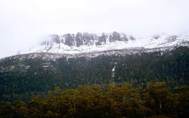
Colour photograph shows patchy snow covering Barn Bluff and Cradle Mountain, photograph taken 1970.
Parte de Hal Wyatt Collection
Colour photograph shows snow on mountains in Tasmania’s Central Highlands
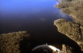
Wall of Clark Dam and Lake King William
Parte de Hal Wyatt Collection
Colour aerial photograph of Clark Dam and Lake King William
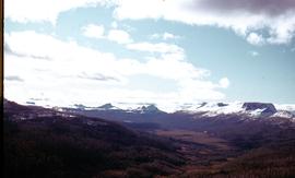
Aerial view of snow at Cuvier Valley
Parte de Hal Wyatt Collection
Colour aerial photograph of Cuvier Valley and surrounding mountain range topped by snow
Parte de Hal Wyatt Collection
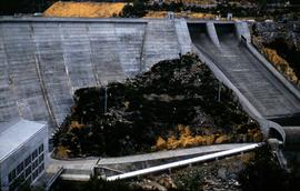
Colour photograph shows spillway and Butlers Gorge Power Station beneath the Clark Dam wall, completed on the Derwent River in the 1940s.
Hal Wyatt
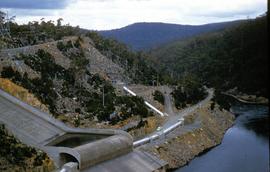
Downstream at Butlers Gorge Power Station
Parte de Hal Wyatt Collection
Colour photograph of waterways beyond Butlers Gorge Power Station, Lake King William and Clark Dam on the Hydro Electric Commission’s Derwent Scheme.
Hal Wyatt
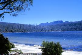
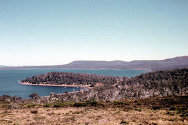
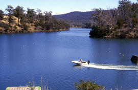
Boats on shore of Lake St Clair at Cynthia Bay
Parte de Hal Wyatt Collection
Colour photograph shows boats on beach at Cynthia Bay, at southern end of Lake St Clair, near slipway rails leading to water.
Hal Wyatt