Mostrando 241 resultados

Descripción archivística
Arthur Knight Australia Con objetos digitales
Imprimir vista previa Ver :

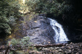
Signs at entrance to Mount Field National Park

Colour photograph shows signs posted at entrance of Mount Field National Park, with distances and estimated travel times to Lake Dobson (9 1/4 miles), Lake Fenton (7 1/4 miles), Lady Barron Falls (1 1/2 mile), Camping Ground (250 yds), Rangers Cottage (150 Yds), Russell Falls 1/2 MILE 10 MIN, Lady Barron Falls Round Trip 3 1/2 MILES 1H 45 MIN

Marker on South Gordon walking track

Colour photograph shows unusual sign for South Gordon walking track turnoff, fashioned out of number plates, with three backpacks resting on ground nearby

Rails in the forest

Colour photograph shows rusted International Harvester locomotive on disused rails covered with bracken in a semi-cleared area of land

Wrest Point Hotel 1952

Photograph depicts forecourt of Wrest Point Hotel, Sandy Bay, showing front door with decorative masonry, with five dolphins, ship with St George Cross atop front door. Man in brown uniform standing alongside a Holden FX with dark body paintwork and a yellow painted roof, a taxi affiliated with Hobart's Yellow Cabs, Tasmanian licence plate WXG 772.

Hal Wyatt

Bare Mountain

Colour photograph of Bare Mountain, with evidence of past bushfire damage to trees on lower slope GIS: Latitude -4149 Longitude 14590 Gazetteer Australia Record_ID TAS23466

Chalice Lake and Mount Rogoona

Colour photograph of Chalice Lake and Mount Rogoona GIS: Latitude -4188 Longitude 14619 Gazetteer Record_ID TAS02032

Culvert at Foggs Flat

Colour photograph shows a steel-plated culvert beneath a road at Foggs Flat

Skiing shelter

Colour photograph shows two sets of skis and backpacks outside an alpine hut, covered in a snowdrift

Mount Anne at sunrise

Colour photograph shows Mount Anne at sunrise as viewed from across Lake Timk

Paddys Lake

Colour photograph shows whitewater section of Pencil Pine Creek

Pencil Pines near Dixons Kingdom

Colour photograph shows Piesse Vale at Ben Lomond plateau dusted with snow GIS Latitude -4154 Longitude 14763 Gazetteer Record_ID TAS13722

Pool of Bethesda

Colour photograph shows snow covering the Pool of Siloam near The Temple below Mount Jerusalem

Trappers hut in snow

Colour photograph shows alpine vegetation and snowcover below Mount Ophel

West Wall 1978

Colour photograph shows snow cover surround Lake Thor and Western Bluff

Black jay on a rock

Colour photograph shows a black jay, or black currawong, resting on a rock near Lake Dobson

Building a snow cave

Colour photograph shows person excavating blocks of snow to build a snow cave

Moving firewood at Lake Dobson

Colour photographs shows three people in a small boat laden with firewood being moved from one side of Lake Dobson to another. Hut visible on shore and cleared path of zig-zag track up hill visible in background

Ridge of Florentine Peak

Colour photograph shows ridge line of Florentine Peak, with small patches of snow in foreground

Snow on Florentine Peak

Colour photograph shows partial snow cover on Florentine Peak, looking west across mountains in distance

Resultados 201 a 241 de 241