
Wildflowers on Cathedral Mountain
- AU TAS UTAS ITCCD 2017/2-280
- Unidad documental simple
- 1978
Parte deArthur Knight Slides
Colour photograph of wildflower in alpine environment
Wildflowers on Cathedral Mountain
Parte deArthur Knight Slides
Colour photograph of wildflower in alpine environment

Snowfall at Jaffa Vale and Mount Olympus
Parte deArthur Knight Slides
Colour photograph shows tracks of snow skiers at Jaffa Vale and Mount Olympus

Parte deArthur Knight Slides
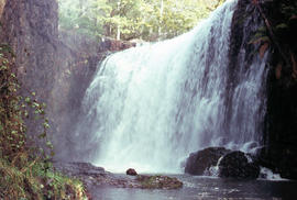
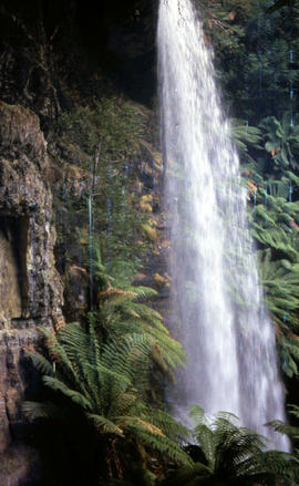
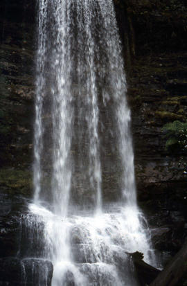
Colour photograph of limited water flow across Knyvet Falls 1984 GIS: Latitude -4159 Longitude 14593 Gazetteer Australia Record_ID TAS06008

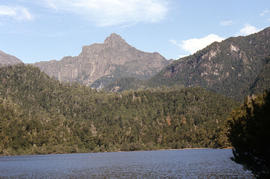
Shoreline of Lake Chalice 1979
Parte deArthur Knight Slides
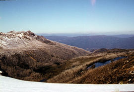
Colour photograph shows the rocky shoreline of Chalice Lake GIS: Latitude -4188 Longitude 14615 Gazetteer Australia Record_ID TAS02044
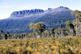
Cliffs of Mount Anne above Lake Timk
Parte deArthur Knight Slides
Colour photograph shows the cliffs of Mount Anne above Lake Timk

Parte deArthur Knight Slides
Colour photograph shows Lake Timk and Mount Anne in distance GIS: Latitude -4293 Longitude 14646 Gazetteer Australia Record_ID TAS16882

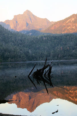
Reflection of Mount Anne on surface of Lake Timk
Parte deArthur Knight Slides
Colour portrait format photograph shows reflection of Mount Anne on the surface of Lake Timk

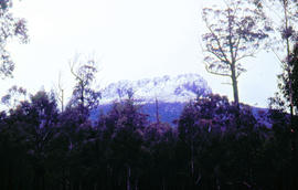
Mount Ossa and Cathedral Mountain
Parte deArthur Knight Slides
Colour photograph shows rocky peak of Mount Rogoona, with alpine plain in foreground

Parte deArthur Knight Slides
Colour photograph shows Mount Rogoona with Lake Myrtle obscured by light alpine forest vegetation on ridge

Panoramic view of Mount Rogoona
Parte deArthur Knight Slides
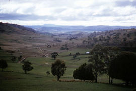
Colour photograph shows farmland in the Kentish area with Mount Roland in background

View across Cradle Mountain ridges to the north
Parte deArthur Knight Slides
Colour photograph shows people standing outside Northern Tasmanian Alpine Club hut at Ben Lomond, one holding snow skis and poles
Creek on plateau above Cradle Mountain
Parte deArthur Knight Slides
Colour photograph shows plateau near summit of Ben Lomond
Pool of Siloam & The Temple 1978
Parte deArthur Knight Slides
Colour photograph shows snow covering Pool of Siloam near the West Wall of Mount Jerusalem
Pool of Siloam and the West Wall of Mount Jerusalem
Parte deArthur Knight Slides
Colour photograph shows dolerite peak of Ragged Jack, near Ben Lomond, viewed across from lightly timbered farmland
Parte deArthur Knight Slides
Colour photograph of Strickland Valley near Ben Lomond, with partial snow cover, 1960
Parte deArthur Knight Slides
Colour photograph shows heavy snow cover on forest at West Wall near Mount Jerusalem
Western Bluff & Lake Thor 1978
Parte deArthur Knight Slides
Colour photograph shows view west from Back Mountain 1983
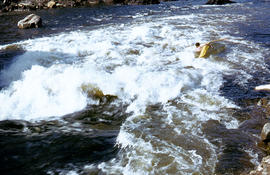
Parte deArthur Knight Slides
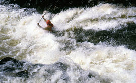
Colour photograph shows a kayaker falling into the Derwent River, below the site of the Repulse Dam, in 1964
Parte deArthur Knight Slides
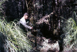
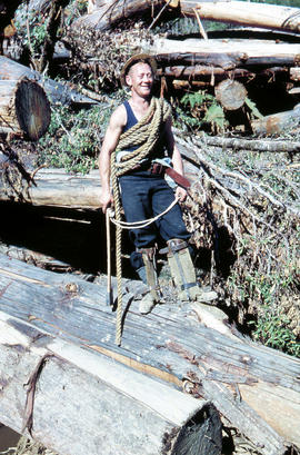
Colour photograph shows man repairing boots in shade of forest
Parte deArthur Knight Slides
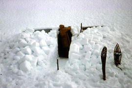
Colour photograph shows a snow cave excavation
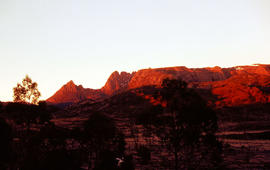
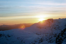
Sunrise at Cradle Mountain 1976
Parte deArthur Knight Slides
Colour photograph shows sunrise at Cradle Mountain 1976
Snow cover on the Temple and West Wall at Mount Jerusalem
Parte deArthur Knight Slides
Colour photograph shows a snow vehicle taking a skier uphill at Ben Lomond 1960
Parte deArthur Knight Slides
Colour photograph shows snow cover above thick alpine forest at the Wailing Wall near Mount Jerusalem
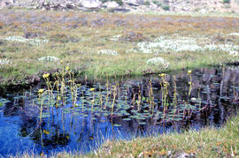
Water lilies at Lake Meston 1977
Parte deArthur Knight Slides
Colour photograph shows water spilling from western end of Lake Timk
Parte deArthur Knight Slides
Colour photograph shows people on western shore of Lake Timk 1974
Snow skier near West Wall, Mount Jerusalem
Parte deArthur Knight Slides
Colour photograph shows Paddys Lake GIS: Latitude -4145 Longitude 14596 Gazetteer Record_ID TAS07938
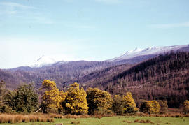
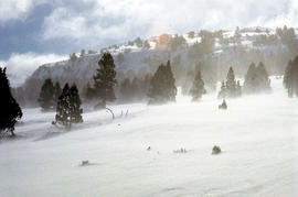
Blossom and snow at Fitzgerald
Parte deArthur Knight Slides
Colour photograph shows yellow blossoms on a stand of wattle trees in foreground and snow on hills behind, at Fitzgerald, near Maydena
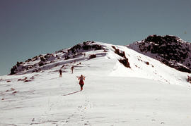
Climbing Naturalist Peak in snow
Parte deArthur Knight Slides
Colour photograph shows five figures in the snow, walking or skiing to the top of Naturalist Peak near Mount Field West, in Mount Field National Park. Some marks on original physical scanned image
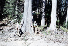
Tree felling in Florentine Valley
Parte deArthur Knight Slides
Colour photograph shows three bushmen, one operating a chainsaw, cutting into the butt of a mature eucalyptus tree, working in the Florentine Valley
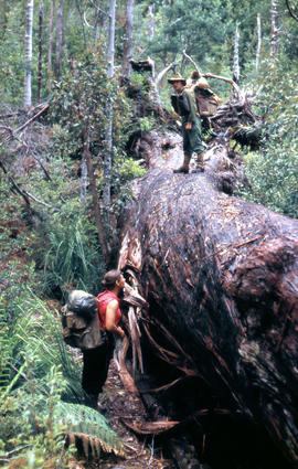
Bushwalkers alongside fallen tree
Parte deArthur Knight Slides
Colour photograph shows two bushwalkers alongside a fallen tree in the bush near Russell River
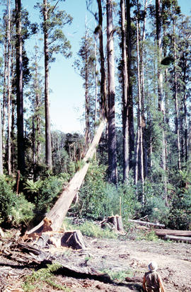
Tree falls in Florentine Valley
Parte deArthur Knight Slides
Colour photograph shows tree falling
Tree cut down in Florentine Valley
Parte deArthur Knight Slides
Colour photographs shows timber worker in hard hat standing clear of a falling tree in a clearing of the Florentine Valley
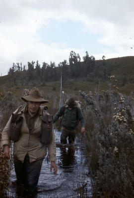
Flooded track near Sandfly Creek
Parte deArthur Knight Slides
Colour photograph shows two bushwalkers wading in knee-high water on a flooded track near Sandfly Creek
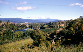
Parte deArthur Knight Slides
Colour photograph shows hop fields and stretch of the River Derwent at Gretna, 1956
Parte deArthur Knight Slides
Colour photograph shows Guide Falls near Burnie, 1963
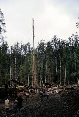
People gather in timber work site
Parte deArthur Knight Slides
Colour photograph shows people in travelling clothes gathered at a timber work site clearing in the Florentine Valley
Parte deArthur Knight Slides
An out-of-focus colour photograph shows Horseshoe Falls on the Russell River, above Russell Falls
Parte deArthur Knight Slides
Colour photograph shows farmland at Hunting Ground.
Forest road in Florentine Valley
Parte deArthur Knight Slides
Colour portrait format photograph shows vehicles parked beside gravel road in Florentine Valley
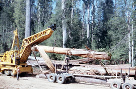
Crane lifts trailer onto semi in Florentine Valley
Parte deArthur Knight Slides
Colour photograph shows a crane being used to load up a semi-trailer to carry logs from the Florentine Valley, inscription on driver's door reads L.J. Reynolds, HAULAGE CONTRACTOR, Maydena, Phone 217
Missing rail section across River Derwent at Macquarie Plains bridge
Parte deArthur Knight Slides
Colour photograph from bank of River Derwent shows twisted railway track
Parte deArthur Knight Slides
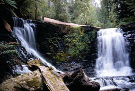
Colour portrait format photograph shows the vertical drop of Marriotts Falls
Side view of water flowing over Marriotts Falls
Parte deArthur Knight Slides
Colour portrait format photograph shows side view of the vertical drop of Marriotts Falls
Parte deArthur Knight Slides
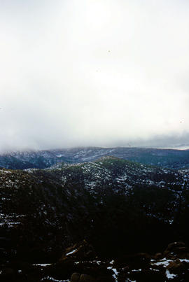
Colour portrait format photograph shows low cloud over Mount Bridges, with patches of snow on the ground
Low visibility on Mount Mawson plateau
Parte deArthur Knight Slides
Colour photograph shows ice and snow amid rocky outcrops on Mount Mawson plateau
Parte deArthur Knight Slides
Colour photograph shows Lake Newdegate
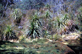
Parte deArthur Knight Slides
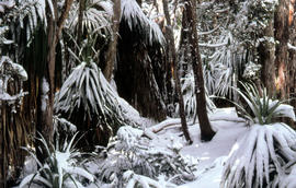
Colour photograph shows leaves of Pandani covered by snowfall
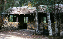
Picnic hut near National Park entrance
Parte deArthur Knight Slides
Colour photograph shows picnic hut near road entrance of Mount Field National Park
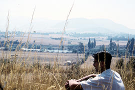
Man sitting in long grass at Plenty
Parte deArthur Knight Slides
Colour photograph shows many with dark hair and spectacles sitting on the edge of cleared farmland at Plenty beside river
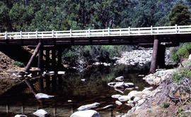
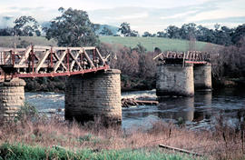
Timber bridge across Plenty River
Parte deArthur Knight Slides
Colour photograph shows the timber frame of the bridge across the Plenty River
Parte deArthur Knight Slides
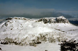
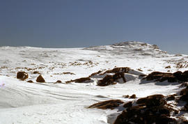
Colour photograph shows snow cover on the Rodway Range
Man skiing downhill on Mount Field West
Parte deArthur Knight Slides
Colour photograph shows man skiing downhill at Mount Field West, with two other figures behind him near the summit of mountain
View of sunset from Rodway Range
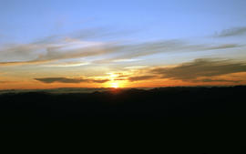
Parte deArthur Knight Slides
Colour photograph shows sunset as viewed from Rodway Range
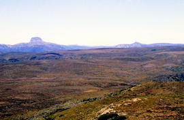
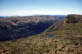
View of heathland near Mount Bowes
Parte deArthur Knight Slides
Colour photograph shows heathland looking southwest from near Mount Bowes
The Druids as viewed from Woody Island
Parte deArthur Knight Slides
Colour photograph shows The Druids as viewed from Woody Island
Parte deArthur Knight Slides
Colour photograph shows The Watcher
Adventure Bay near Cape Queen Elizabeth
Parte deArthur Knight Slides
View from headland of Adventure Bay near Cape Queen Elizabeth on Bruny Island.
Arthur Knight
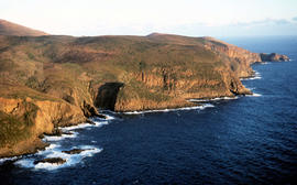
View of Cape Connella from the air
Parte deArthur Knight Slides
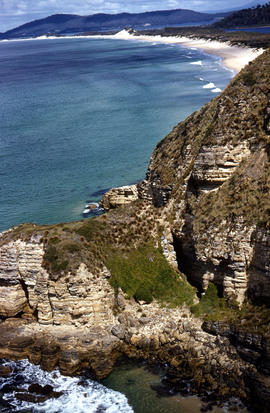
Colour aerial photograph of cliffs of Cape Connella, viewed from the air.
Setting sun shines on headland east of Cloudy Bay
Parte deArthur Knight Slides
Colour photograph of headland east of Cloudy Bay, illuminated by low setting sun.
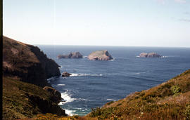
View of the Friars from shore near Pine Log Bight
Parte deArthur Knight Slides
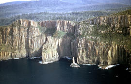
Colour photograph of the Friars, a small group of islands, off southern shore of Bruny Island, taken from shore near Pine Log Bight.

Parte deArthur Knight Slides
Colour photograph shows open paddock and mature eucalypt trees with Ben Lomond in the distance

Parte deArthur Knight Slides
Colour photograph shows cliffs near Stacks Bluff

Parte deArthur Knight Slides
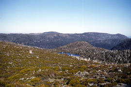
Colour photograph shows shoreline of Cloister Lagoon GIS: Latitude -4189 Longitude 14617 Gazetteer Australia Record_ID TAS02046

Parte deArthur Knight Slides
Colour photograph shows Lake Lea in foreground, with Cradle Mountain and Barn Bluff in distance

Parte deArthur Knight Slides
Colour photograph shows flecks of snow on upper ridges of Cradle Mountain and land around Dove Lake, some of it cloaked in deep shadow

Cradle Mountain from Hansons Peak
Parte deArthur Knight Slides
Colour photograph of Cradle Mountain as viewed from nearby Hansons Peak

Parte deArthur Knight Slides
Colour photograph shows shoreline of Crater Lake with sunlit cliffs on opposite bank

Parte deArthur Knight Slides
Colour photograph shows Volkswagen combi van being driven through floodwaters across Midland Highway 1964

Snow on banks of River Derwent 1986
Parte deArthur Knight Slides
Colour photograph shows snow on the shoreline of River Derwent 1986

Parte deArthur Knight Slides
Colour photograph shows icicles formed on Little Horn 1985

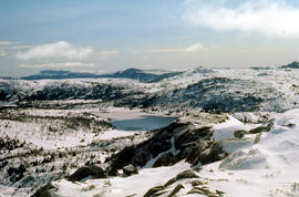
Lake Loane under snow cover 1978
Parte deArthur Knight Slides
Colour photograph shows Lake Loane beneath blanket of snow, from near the Horse Track 1978

Parte deArthur Knight Slides
Colour photograph shows waves and white caps on the surface of Lake Myrtle GIS: Latitude -4188 Longitude 14618 Gazetteer Australia Record_ID TAS02073
Parte deArthur Knight Slides
Colour photograph shows silhouette of Mount Anne, viewed at sunset
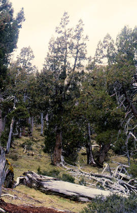
Parte deArthur Knight Slides
Colour photograph shows Pencil Pines growing in alpine forest near Dixons Kingdom hut
Tarn and Pencil Pines near Mountains of Jupiter
Parte deArthur Knight Slides
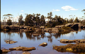
Colour photograph shows alpine vegetation surrounding Pool of Bethesda GIS: Latitude -4181 Longitude 14630 Gazetteer Record_ID TAS12063
Parte deArthur Knight Slides
Colour photograph shows patterned bark of snow gum near Cathedral Mountain
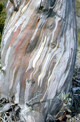
Bark of snow gum near Cathedral Mountain
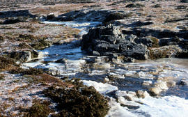
Parte deArthur Knight Slides
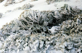
Colour photograph shows ice formations on tufts of native grass
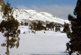
Parte deArthur Knight Slides
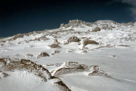
Colour photograph shows snow covering alpine vegetation
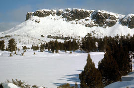
Parte deArthur Knight Slides
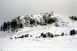
Colour photograph shows snow cover around Mount Rogoona
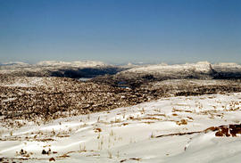
Snow on plateau below Mount Rogoona
Parte deArthur Knight Slides
Colour photograph shows southern shore of Lake Timk
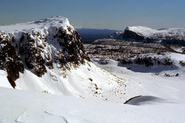
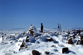
Summit of West Wall at Mount Jerusalem
Parte deArthur Knight Slides
Colour photograph shows sunrise at Cradle Mountain 1976
Parte deArthur Knight Slides
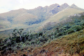
Colour photograph shows view of mountain range to the west of Mount Field West
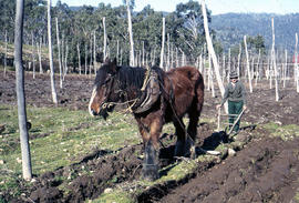
Man and horse ploughing at Westerway
Parte deArthur Knight Slides
Colour photograph shows a farmer ploughing a paddock at Westerway in a field strung with trellis frames for hop cultivation with a draught horse and plough
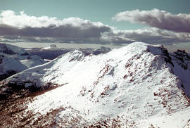
Parte deArthur Knight Slides
Colour photograph shows snow on Mount Olympus as viewed from near Narcissus hut, near Lake St Clair
Arthur Knight
Parte deArthur Knight Slides
Colour photograph shows snow cover on Mount Ossa
Arthur Knight
Parte deArthur Knight Slides
Colour photograph shows the Red Bridge, a convict built arch bridge across Elizabeth River at Campbell Town
Arthur Knight
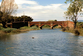
Parte deArthur Knight Slides
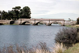
Colour photograph shows the arches of the sandstone bridge at Ross that leads across the Macquarie River
Arthur Knight
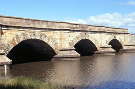
Parte deArthur Knight Slides
Colour photograph shows fast-flowing water of the Macquarie River at the Ross Bridge
Arthur Knight
Parte deArthur Knight Slides
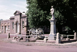
Colour photograph shows the Ross War Memorial
Arthur Knight