Mostrando 241 resultados

Descripción archivística
Arthur Knight Australia Con objetos digitales
Imprimir vista previa Ver :

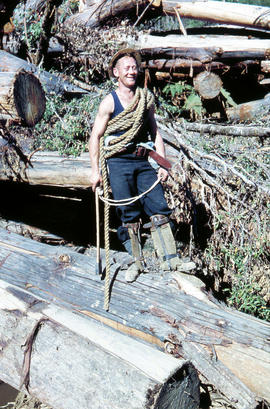
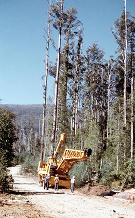
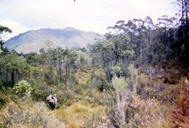
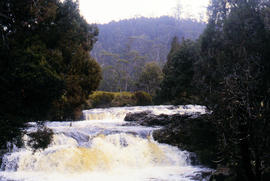
Rigger in the Florentine Valley

Colour photograph shows timber worker wearing hard hat, chaps and holding ropes and an axe, standing on fallen logs in the Florentine Valley

View of Russell Falls

Colour photograph shows Russell Falls as viewed from elevated vantage point in rainforest

Signs at entrance to Mount Field National Park

Colour photograph shows signs posted at entrance of Mount Field National Park, with distances and estimated travel times to Lake Dobson (9 1/4 miles), Lake Fenton (7 1/4 miles), Lady Barron Falls (1 1/2 mile), Camping Ground (250 yds), Rangers Cottage (150 Yds), Russell Falls 1/2 MILE 10 MIN, Lady Barron Falls Round Trip 3 1/2 MILES 1H 45 MIN

Four men standing around Skagit loader

Colour photograph shows timber workers in hard hats standing around an unladen Skagit loader with an operator visible in the cabin, on a dirt track in the bush

Snow skier plays trick on camera

Colour photograph shows the tracks of a snow skier, dressed in dark clothing, going around both sides of a tree on a snow-covered, lightly wooded hill

Marker on South Gordon walking track

Colour photograph shows unusual sign for South Gordon walking track turnoff, fashioned out of number plates, with three backpacks resting on ground nearby

Moss and pandani

Colour photograph shows mossy ground surrounding a group of pandani plants

Hut at Twilight Tarn

Colour photograph shows the rusting red roofing iron on hut visible above trees on the edge of Twilight Tarn

Bushwalker near Mount Lord

Colour photograph shows man in red and black check bush shirt standing in bush on Mount Lord, looking west. Man is standing amid tall specimens of Pandani, Richea pandanifolia

Trees reflected in Artists Pool

Colour photograph of Artists Pool, a waterhole near Cradle Mountain, with reflections of alpine plants on the water's surface

Bare Mountain

Colour photograph of Bare Mountain, with evidence of past bushfire damage to trees on lower slope GIS: Latitude -4149 Longitude 14590 Gazetteer Australia Record_ID TAS23466

Pointing out a dead bird

Colour photograph shows a person pointing at a dead bird on the ground near Bare Mountain, with new undergrowth shooting after a recent bushfire and several bushwalkers visible in the distance

Walkers near Barn Bluff

Colour photograph of two walkers trying to avoid slippery pathway with flecks of snow on ground and Barn Bluff in background

Chalice Lake and Mount Rogoona

Colour photograph of Chalice Lake and Mount Rogoona GIS: Latitude -4188 Longitude 14619 Gazetteer Record_ID TAS02032

Shoreline of Cloister Lagoon

Colour photograph shows shoreline of Cloister Lagoon GIS: Latitude -4189 Longitude 14617 Gazetteer Australia Record_ID TAS02046

Looking south to Cradle Mountain

Colour photograph shows the heathland on the Central Plateau, south of Cradle Mountain, with the mountain peaks visible in the distance

Cradle Mountain and Dove Lake

Colour photograph shows flecks of snow on upper ridges of Cradle Mountain and land around Dove Lake, some of it cloaked in deep shadow

View across Lake Lea

Colour photograph shows Lake Lea in foreground, with Cradle Mountain and Barn Bluff in distance

Crater Lake

Colour photograph shows Crater Lake

Close up of Crater Lake

Colour photograph shows shoreline of Crater Lake with sunlit cliffs on opposite bank

Culvert at Foggs Flat

Colour photograph shows a steel-plated culvert beneath a road at Foggs Flat

Cushion plants

Colour photograph shows bed of green cushion plants

Skiing shelter

Colour photograph shows two sets of skis and backpacks outside an alpine hut, covered in a snowdrift

Flooded Midland Highway 1964

Colour photograph shows Volkswagen combi van being driven through floodwaters across Midland Highway 1964

Hut at Lake Meston 1977

Colour photograph shows hut at Lake Meston built of logs, shingles and with tin plate chimney People sitting outside hut eating

Knyvet Falls 1984

Colour photograph of limited water flow across Knyvet Falls 1984 GIS: Latitude -4159 Longitude 14593 Gazetteer Australia Record_ID TAS06008

Shoreline of Lake Chalice 1979

Colour photograph shows the rocky shoreline of Chalice Lake GIS: Latitude -4188 Longitude 14615 Gazetteer Australia Record_ID TAS02044

White caps on Lake Myrtle

Colour photograph shows waves and white caps on the surface of Lake Myrtle GIS: Latitude -4188 Longitude 14618 Gazetteer Australia Record_ID TAS02073

Lake Timk and Mount Anne

Colour photograph shows Lake Timk and Mount Anne in distance GIS: Latitude -4293 Longitude 14646 Gazetteer Australia Record_ID TAS16882

Mount Anne at sunrise

Colour photograph shows Mount Anne at sunrise as viewed from across Lake Timk

Silhouette of Mount Anne

Colour photograph shows afternoon reflection of Mount Anne on the surface of water of Lake Timk

Mount Rogoona

Colour photograph shows Mount Rogoona with Lake Myrtle obscured by light alpine forest vegetation on ridge

Paddys Lake

Colour photograph shows whitewater section of Pencil Pine Creek

Pencil Pine Creek Falls

Colour photograph shows Pencil Pines growing in alpine forest near Dixons Kingdom hut

Pencil Pines near Dixons Kingdom

Colour photograph shows Piesse Vale at Ben Lomond plateau dusted with snow GIS Latitude -4154 Longitude 14763 Gazetteer Record_ID TAS13722

Resultados 101 a 200 de 241