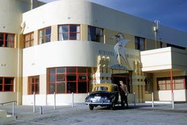
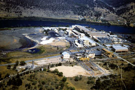
Wrest Point Hotel 1952
Add to clipboard
Photograph depicts forecourt of Wrest Point Hotel, Sandy Bay, showing front door with decorative masonry, with five dolphins, ship with St George Cross atop front door. Man in brown uniform standing alongside a Holden FX with dark body paintwork and a yellow painted roof, a taxi affiliated with Hobart's Yellow Cabs, Tasmanian licence plate WXG 772.
Hal Wyatt
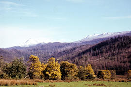
Blossom and snow at Fitzgerald
Add to clipboard
Colour photograph shows yellow blossoms on a stand of wattle trees in foreground and snow on hills behind, at Fitzgerald, near Maydena
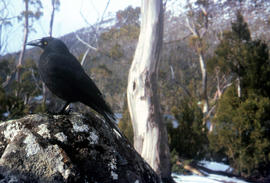
Black jay on a rock
Add to clipboard
Colour photograph shows a black jay, or black currawong, resting on a rock near Lake Dobson
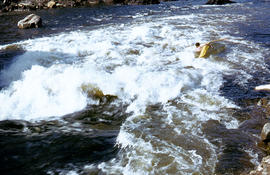
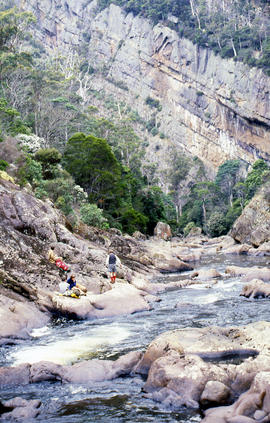
Kayaker below Repulse Dam
Add to clipboard
Colour photograph shows a kayaker falling into the Derwent River, below the site of the Repulse Dam, in 1964
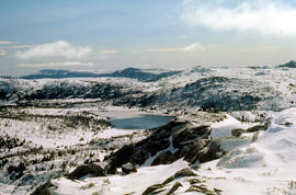
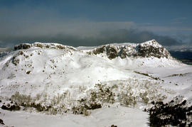
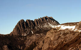
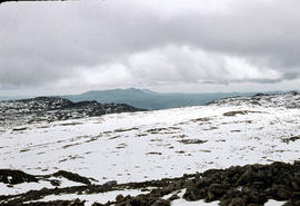
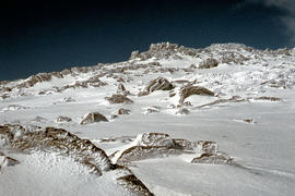
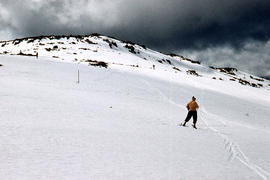
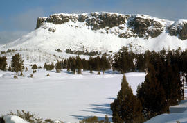
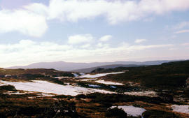
West Wall 1978
Add to clipboard
Colour photograph shows snow cover surround Lake Thor and Western Bluff
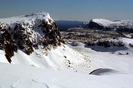
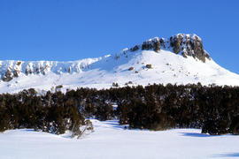
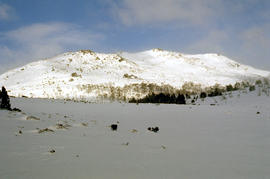
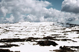
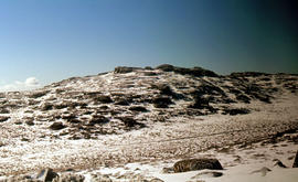
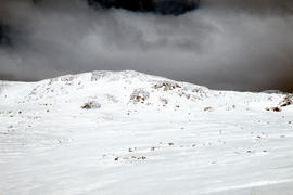
Snow near Mount Ophel
Add to clipboard
Colour photograph shows snow cover above thick alpine forest at the Wailing Wall near Mount Jerusalem
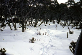
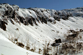
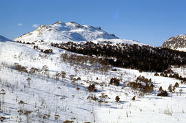
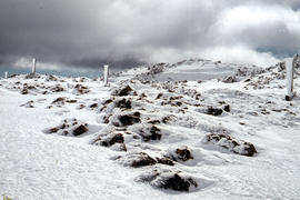
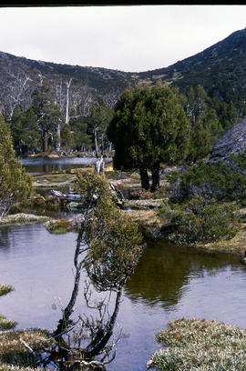
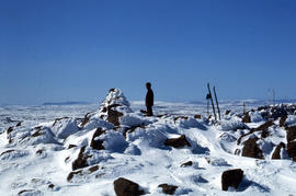
Trappers hut in snow
Add to clipboard
Colour photograph shows alpine vegetation and snowcover below Mount Ophel
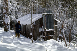
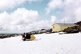
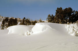
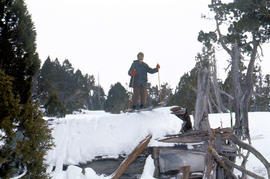
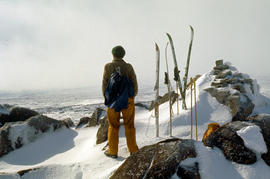
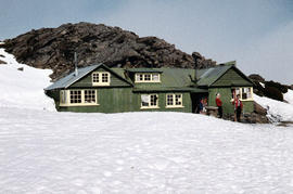
Skier at trappers hut
Add to clipboard
Colour photograph shows three snow skiers outside a trapper's hut in the snow
The Wailing Wall 1978
Add to clipboard
Colour photograph shows skier standing outside trapper's hut in the snow
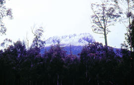
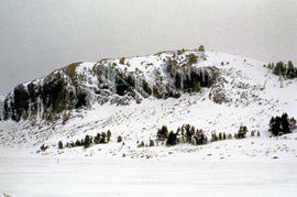
Stacks Bluff from Mangana
Add to clipboard
Colour photograph shows snow cover on Stacks Bluff, photographed from nearby forest Low contrast in image
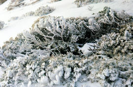
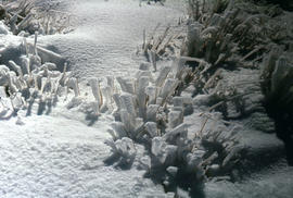
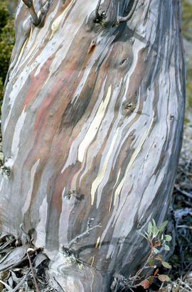
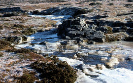
Ice and snow formations
Add to clipboard
Colour photograph shows patterned bark of snow gum near Cathedral Mountain
Skiers at Ben Lomond
Add to clipboard
Colour photograph shows ski runs near summit of Ben Lomond 1960
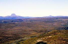
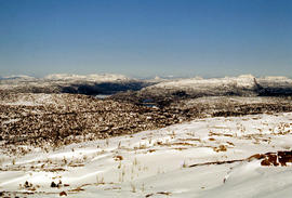
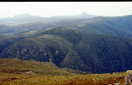
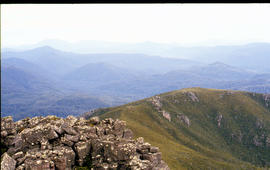
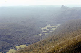
Ragged Jack
Add to clipboard
Colour photograph shows view of forest and mountain ranges from Mayday Mountain
Pool of Bethesda
Add to clipboard
Colour photograph shows snow covering the Pool of Siloam near The Temple below Mount Jerusalem
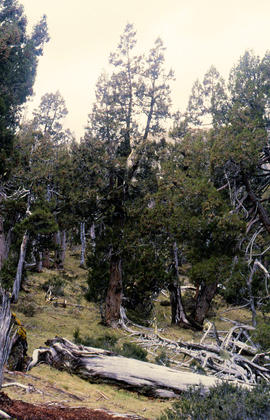
Pencil Pines near Dixons Kingdom
Add to clipboard
Colour photograph shows Piesse Vale at Ben Lomond plateau dusted with snow GIS Latitude -4154 Longitude 14763 Gazetteer Record_ID TAS13722
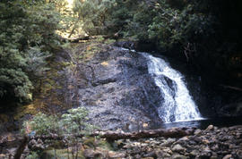
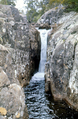
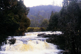
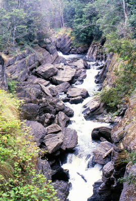
Pencil Pine Creek Falls
Add to clipboard
Colour photograph shows Pencil Pines growing in alpine forest near Dixons Kingdom hut
Paddys Lake
Add to clipboard
Colour photograph shows whitewater section of Pencil Pine Creek
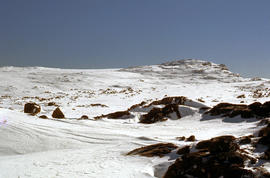
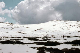
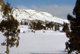
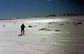
Skier at Piesse Vale
Add to clipboard
Colour photograph of view from snow capped Cradle Mountain looking north
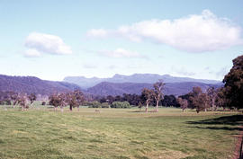
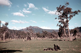
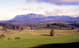
Farmland near Mount Roland
Add to clipboard
Colour photograph shows cloud above mountain ranges, looking west to Mount Heemskirk from Mount Murchison
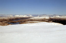
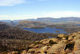
Mount Rogoona
Add to clipboard
Colour photograph shows Mount Rogoona with Lake Myrtle obscured by light alpine forest vegetation on ridge
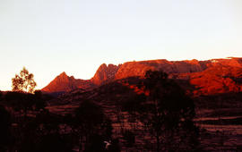
Silhouette of Mount Anne
Add to clipboard
Colour photograph shows afternoon reflection of Mount Anne on the surface of water of Lake Timk
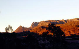
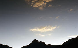
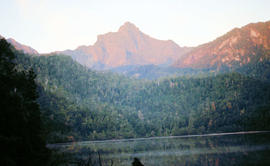
Mount Anne at sunrise
Add to clipboard
Colour photograph shows silhouette of Mount Anne, viewed at sunset
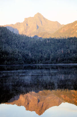
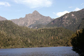
Mount Anne at sunrise
Add to clipboard
Colour photograph shows Mount Anne at sunrise as viewed from across Lake Timk
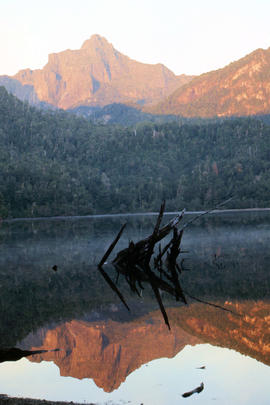
Lake Timk and Mount Anne
Add to clipboard
Colour photograph shows Lake Timk and Mount Anne in distance GIS: Latitude -4293 Longitude 14646 Gazetteer Australia Record_ID TAS16882
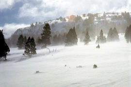
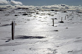
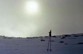
Morning mist on Ben Lomond 1962
Add to clipboard
Colour photograph shows pair of gloves on a set of ski poles pitched into snow atop Ben Lomond, with mist covering the sun
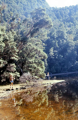
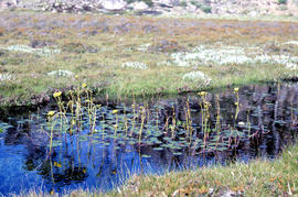
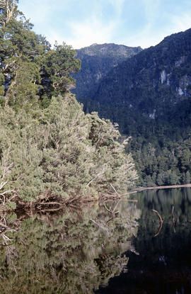
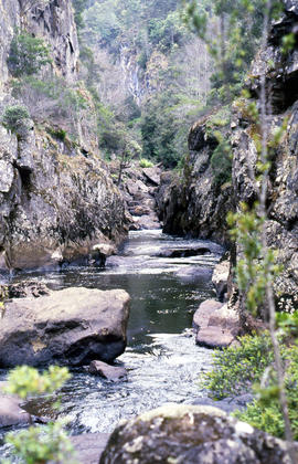
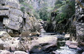
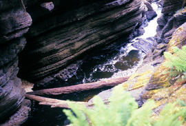
Rockpools in Leven Canyon
Add to clipboard
Colour photograph shows rockpools in the Leven River at Leven Canyon, surrounded by steep rockwalls and temperate rainforest
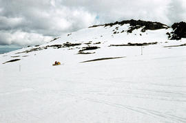
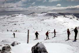
Snow skiing below Legges Tor
Add to clipboard
Colour photograph shows Legges Tor, the highest peak of Ben Lomond, with skiers visible on the nearby ski field
Lees Paddock and Mount Pillinger
Add to clipboard
Colour photograph shows the cleared land of Lees Paddocks in the upper Mersey Valley, surrounded by bush with Mount Pillinger in the background
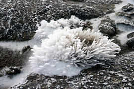
White caps on Lake Myrtle
Add to clipboard
Colour photograph shows waves and white caps on the surface of Lake Myrtle GIS: Latitude -4188 Longitude 14618 Gazetteer Australia Record_ID TAS02073
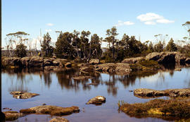
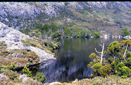
Shoreline of Lake Chalice 1979
Add to clipboard
Colour photograph shows the rocky shoreline of Chalice Lake GIS: Latitude -4188 Longitude 14615 Gazetteer Australia Record_ID TAS02044
Knyvet Falls 1984
Add to clipboard
Colour photograph of limited water flow across Knyvet Falls 1984 GIS: Latitude -4159 Longitude 14593 Gazetteer Australia Record_ID TAS06008