- AU TAS UTAS ITCCD 2017/2-103
- Item
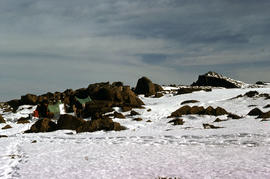
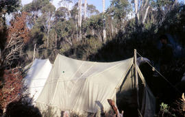
Part of Arthur Knight Slides
Colour photograph shows tents pegged on snow covered ground at Mount Field West
Part of Arthur Knight Slides
Colour photograph shows tents pegged on snow covered ground at Mount Field West
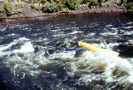
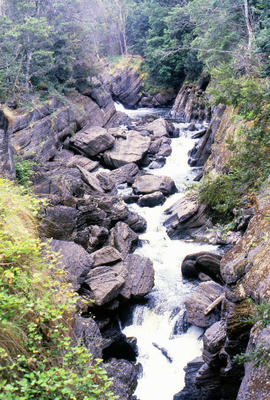
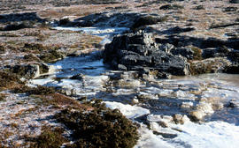
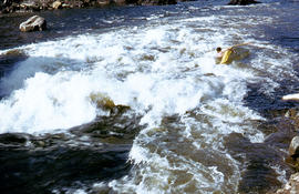
Kayaking in rapids of Derwent River
Part of Arthur Knight Slides
Colour photograph shows a lone kayaker navigating whitewater on the Derwent River below the Repulse Dam site
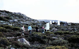
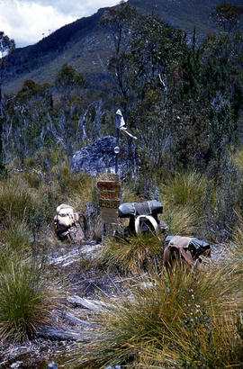
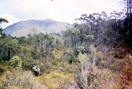
Walkers carrying roofing iron to K Col
Part of Arthur Knight Slides
Colour photograph shows bushwalkers carrying roofing iron along a path to the ridgeline of K Col near Mount Field West as part of project to build a hut to shelter bushwalkers and skiers. Hobart Walking Club's F.A. Peterson Memorial Hut was opened in 1960
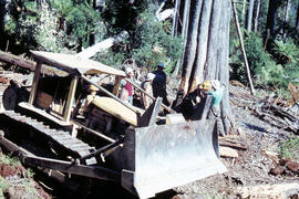
Caterpillar bulldozer in Florentine Valley
Part of Arthur Knight Slides
Colour photograph shows Caterpillar Diesel D7 series bulldozer and timber workers at the base of a tree being felled by chainsaw in the Florentine Valley
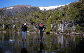
Part of Arthur Knight Slides
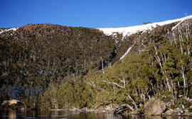
Colour photograph shows man and woman standing on frozen surface of Eagle Tarn, with snow-topped mountain ridge in distance
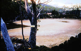
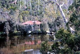
Part of Arthur Knight Slides
Colour photograph shows partially dry lakebed of Eagle Tarn, in Mount Field National Park, with hut visible on the opposite shoreline. Sign nailed to tree reads: EAGLE TARN 3390FT
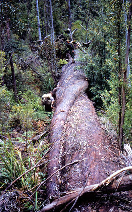
Bushwalkers clamber on fallen tree
Part of Arthur Knight Slides
Colour photograph shows bushwalkers climbing on or standing beside trunk of fallen tree
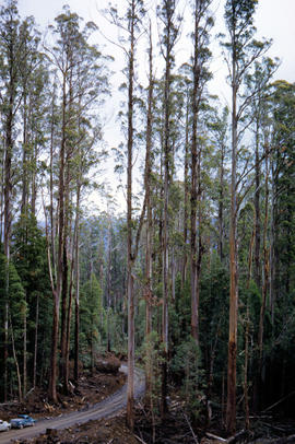
Gravel road in Florentine Valley
Part of Arthur Knight Slides
Colour photograph shows gravel road in Florentine Valley
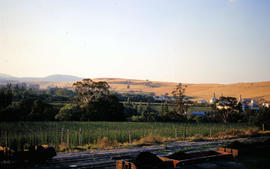
Part of Arthur Knight Slides
Colour photograph shows hop fields, farm buildings and dwellings at Glenora, 1959
Part of Arthur Knight Slides
Colour photograph shows low cloud obscuring the forest and ridgelines where Lake Edgar is visible in the distance
Part of Arthur Knight Slides
Colour photograph shows Lake Fenton
Bushwalkers stand atop and beside fallen tree
Part of Arthur Knight Slides
Colour photograph shows bushwalkers atop or standing beside a fallen tree
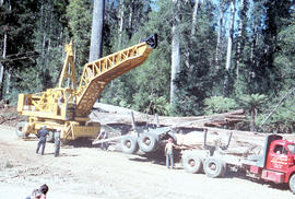
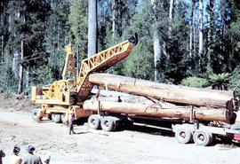
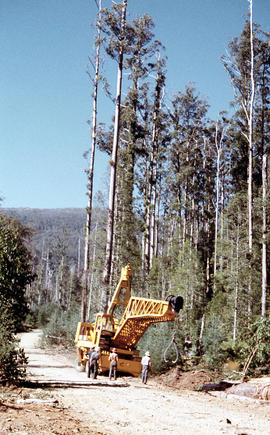
Loading a semi-trailer with logs in Florentine Valley
Part of Arthur Knight Slides
Colour photograph shows a crane being used to load up a semi-trailer to carry logs from the Florentine Valley. inscription on driver's door reads, L.J. Reynolds, HAULAGE CONTRACTOR, Maydena, Phone 217
Bark peels off log being loaded onto semi-trailer
Part of Arthur Knight Slides
Colour photograph shows a timber work cast in shadow as a log is lifted by a crane being used to load up a semi-trailer to carry logs from the Florentine Valley. Inscription on driver's door reads L.J. Reynolds, HAULAGE CONTRACTOR, Maydena, Phone 217
Logs from the Florentine Valley
Part of Arthur Knight Slides
Colour photograph shows a crane being used to load logs on a semi-trailer in the Florentine Valley. Inscription on driver's door reads L.J. Reynolds, HAULAGE CONTRACTOR, Maydena, Phone 217. Visible at lower left of image are people in street or travelling clothes on an outing to view timber workers in the bush
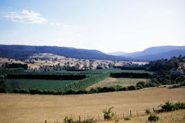
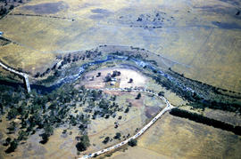
Part of Arthur Knight Slides
An aerial colour photograph shows distinctive shelter belts around cultivated hop fields alongside River Derwent at Bushy Park, Glenora and Macquarie Plains. Long shadows being cast from the low sun to the west
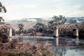
Gap across River Derwent at Macquarie Plains bridge
Part of Arthur Knight Slides
Colour photograph shows gap in the railway track at Macquarie Plains railway bridge
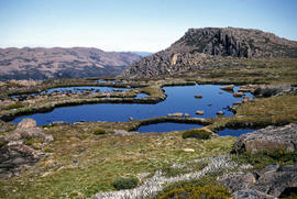
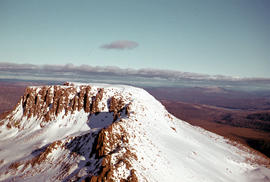
Part of Arthur Knight Slides
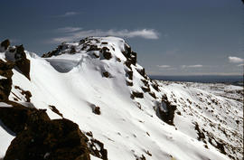
Colour photograph shows small tarns on alpine plateau at Mount Field West
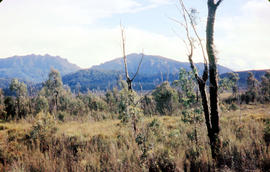
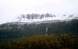
Trees on slope of Mount Mawson
Part of Arthur Knight Slides
Colour photograph shows mature forest, amid some patches of dead tree cover, on steep slope at base of Mount Mawson
Ridgeline of Mount Mawson as viewed from Lake Dobson
Part of Arthur Knight Slides
Colour photograph shows snow on the ridgeline of Mount Mawson as viewed from Lake Dobson
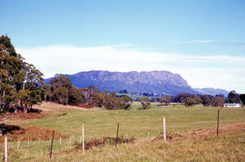
Mount Roland as viewed from paddocks near Sheffield
Part of Arthur Knight Slides
Colour photograph shows Mount Roland, south of Sheffield, with fenced pasture and bush
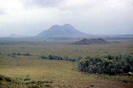
Storm approaches Mount Solitary
Part of Arthur Knight Slides
Colour photograph shows storm approaching Mount Solitary
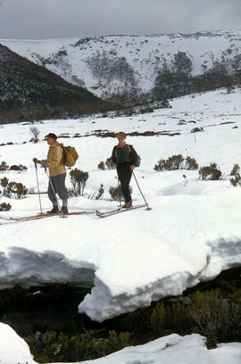
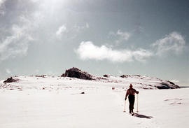
Part of Arthur Knight Slides
Colour photograph shows two snow skiiers navigating patchy snow at National Park, a location in Mount Field National Park
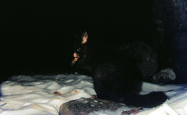
Part of Arthur Knight Slides
Colour photograph shows a possum eating something in the snow at Lake Dobson 1968
Part of Arthur Knight Slides
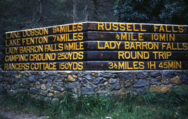
Colour photograph shows Russell Falls as viewed from elevated vantage point in rainforest
Four men standing around Skagit loader
Part of Arthur Knight Slides
Colour photograph shows timber workers in hard hats standing around an unladen Skagit loader with an operator visible in the cabin, on a dirt track in the bush
Snow skier plays trick on camera
Part of Arthur Knight Slides
Colour photograph shows the tracks of a snow skier, dressed in dark clothing, going around both sides of a tree on a snow-covered, lightly wooded hill
Part of Arthur Knight Slides
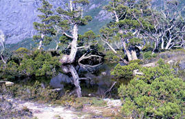
Colour photograph shows mossy ground surrounding a group of pandani plants
Part of Arthur Knight Slides
Colour photograph shows setting sun from the summit of Mount Field West
The Druids near Huon River crossing
Part of Arthur Knight Slides
Colour photograph shows The Druids from near the Huon River crossing
Tents pitched at Mount Bowes campsite
Part of Arthur Knight Slides
Colour photograph shows two canvas tents pitched in hilly scrubland at Mount Bowes
Part of Arthur Knight Slides
Colour photograph shows bushwalker with backpack in heath and woodland walking towards the Gordon River
Bushwalking near Sandfly Creek
Part of Arthur Knight Slides
Colour photograph shows two bushwalkers with backpacks near a track to Sandfly Creek
Walkers carrying building materials to K Col
Part of Arthur Knight Slides
Colour photograph shows walkers carrying building materials to build a hut to shelter bushwalkers
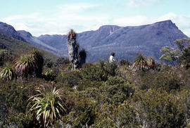
Part of Arthur Knight Slides
Colour photograph shows man in red and black check bush shirt standing in bush on Mount Lord, looking west. Man is standing amid tall specimens of Pandani, Richea pandanifolia
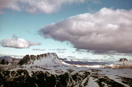
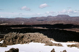
View from Mount Field West across glacial valley
Part of Arthur Knight Slides
Colour photograph shows glacial valley from atop Mount Field West
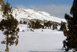
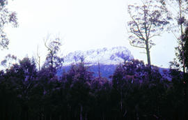
Snow on Cradle Mountain and Barn Bluff
Part of Arthur Knight Slides
Colour photograph shows snowfall on Cradle Mountain and Bluff
Arthur Knight
Part of Arthur Knight Slides
Colour photograph shows profile of Mount Olympus
Arthur Knight
Snow on Mount Olympus from Narcissus hut
Part of Arthur Knight Slides
Colour photograph shows walkers resting in the bush below Mount Olympus
Arthur Knight
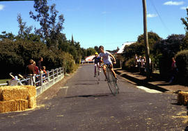
Cyclists sprint on penny farthing bicycles
Part of Arthur Knight Slides
Colour photograph shows cyclists in sprint at penny farthing championships at Evandale
Arthur Knight
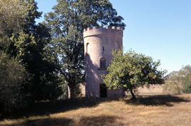
Part of Arthur Knight Slides
Colour photograph shows brick birdhouse, or dovecote, on the grounds of Burlington, Cressy
Arthur Knight
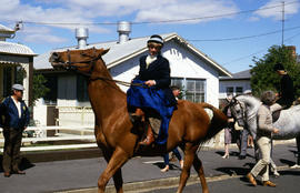
Horse riding at Evandale penny farthing races
Part of Arthur Knight Slides
Colour photographs riders on horseback, including one riding side saddle, at the penny farthing races at Evandale
Arthur Knight
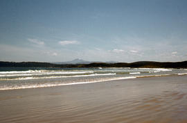
Part of Arthur Knight Slides
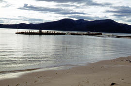
Colour photograph taken from beach at Cloudy Bay on Bruny Island, looking west to Adamsons Peak on Tasmanian mainland
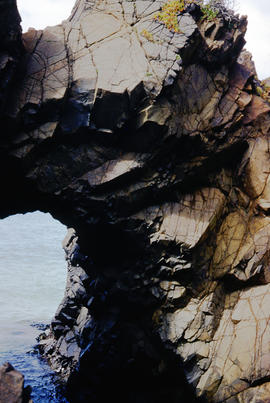
Cape Elizabeth arch on North Bruny Island
Part of Arthur Knight Slides
Colour photograph of archway at Cape Elizabeth on shoreline at North Bruny Island
Arthur Knight
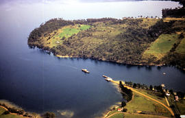
Aerial picture of boat in Barnes Bay
Part of Arthur Knight Slides
Colour photograph from the air showing a boat in Barnes Bay approaching or leaving jetty.
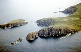
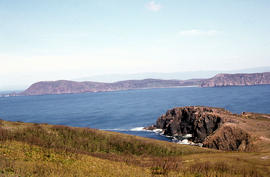
Aerial view of Cape Bruny from south-east
Part of Arthur Knight Slides
Colour photograph of Cape Bruny taken from the air. Photograph depicts coastline of South Bruny Island including lighthouse, Courts Island, Lighthouse Bay
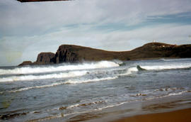
View of Cape Bruny and lighthouse from Lighthouse Bay
Part of Arthur Knight Slides
Colour photograph of waves breaking in Lighthouse Bay, with cliffs and headland of Cape Bruny and Bruny Island Lighthouse in background. Discolouration in scanned image from original slide.
View of Cape Bruny and lighthouse from Lighthouse Bay
Part of Arthur Knight Slides
Colour photograph of cliffs of Cape Connella, South Bruny Island
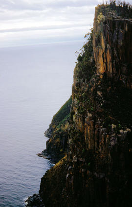
View of shoreline at base of Cape Connella, looking down cliff face
Part of Arthur Knight Slides
Colour photograph of shoreline at base of Cape Connella, South Bruny Island, looking down the cliff face.
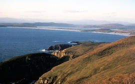
View of Cloudy Bay and West Cloudy Bay
Part of Arthur Knight Slides
Colour photograph of Cloudy Bay and West Cloudy Bay, Bruny Island.
View of Cloudy Bay from East Cloudy Head
Part of Arthur Knight Slides
Colour photograph of Cloudy Bay from East Cloudy Head
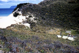
View of Bruny Island campsite of Hobart Walking Club 1955
Part of Arthur Knight Slides
Colour photograph of heath and sand dunes, site of Hobart Walking Club campsite near Cape Queen Elizabeth on Bruny Island,1955
Section of old bridge at Alonnah
Part of Arthur Knight Slides
Colour photograph of old Hobart Bridge section tethered offshore at Alonnah

Staircase in Bruny Island Lighthouse
Part of Arthur Knight Slides
Colour photograph taken inside Bruny Island Lighthouse showing metal staircase
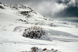
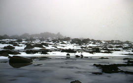
Aftermath of blizzard on Ben Lomond
Part of Arthur Knight Slides
Colour photograph shows snow on the upper slopes of Ben Lomond after a blizzard
Trees reflected in Artists Pool
Part of Arthur Knight Slides
Colour photograph of Artists Pool, a waterhole near Cradle Mountain, with reflections of alpine plants on the water's surface

Part of Arthur Knight Slides
Colour photograph shows a person pointing at a dead bird on the ground near Bare Mountain, with new undergrowth shooting after a recent bushfire and several bushwalkers visible in the distance

Part of Arthur Knight Slides
Colour photograph of two walkers trying to avoid slippery pathway with flecks of snow on ground and Barn Bluff in background

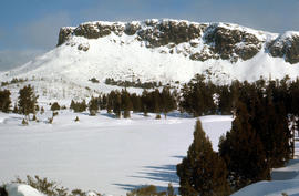
Barn Bluff as viewed from Cradle Mountain
Part of Arthur Knight Slides
Colour photograph of Barn Bluff as viewed form Cradle Mountain with some snow remaining on the ridgelines of the cirque
Part of Arthur Knight Slides
Colour photograph shows snow on Ben Lomond
Part of Arthur Knight Slides
Colour photograph shows Ben Lomond plateau with partial snow cover and blackened ground
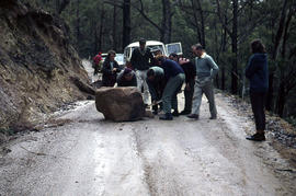
Boulder blocks Storeys Creek Rd 1964
Part of Arthur Knight Slides
Colour photographs shows motorists trying to clear a boulder from Storeys Creek Road after a rock fall

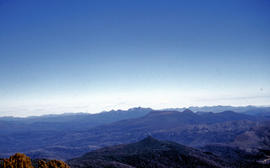
Central Highlands from Cradle Mountain
Part of Arthur Knight Slides
Colour photograph shows mountains of Central Highlands as viewed from Cradle Mountain

Misty morning at Cloister Lagoon
Part of Arthur Knight Slides
Colour photograph shows mist above the surface of Cloister Lagoon just before daybreak

Cradle Mountain from Dove Lake
Part of Arthur Knight Slides
Colour photograph shows light dusting of snow on Cradle Mountain from Dove Lake

Part of Arthur Knight Slides
Colour photograph shows ridge of rock from Dove Lake
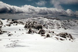
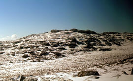
Snow cover on Ben Lomond Plateau
Part of Arthur Knight Slides
Colour photograph shows snow cover on Ben Lomond Plateau

Pencil Pines on shore of Crater Lake
Part of Arthur Knight Slides
Colour photograph shows Crater Lake, with remnants of snow on rock ledge

Part of Arthur Knight Slides
Colour photograph shows Crater Lake

Part of Arthur Knight Slides
Colour photograph shows bed of green cushion plants
Part of Arthur Knight Slides
Colour photograph shows wind moving snow in drift at sunset on Ben Lomond 1962
Snowdrift against rocks at Ben Lomond
Part of Arthur Knight Slides
Colour photograph shows snowdrift against rocks on Ben Lomond 1962

Wildflowers on Cathedral Mountain
Part of Arthur Knight Slides
Colour photograph of wildflower in alpine environment
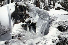
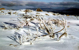
Ice formation on rocks at Ben Lomond 1962
Part of Arthur Knight Slides
Colour photograph shows ice formation on rocks atop Ben Lomond 1962

Snowfall at Jaffa Vale and Mount Olympus
Part of Arthur Knight Slides
Colour photograph shows tracks of snow skiers at Jaffa Vale and Mount Olympus

Part of Arthur Knight Slides
Colour photograph of limited water flow across Knyvet Falls 1984 GIS: Latitude -4159 Longitude 14593 Gazetteer Australia Record_ID TAS06008

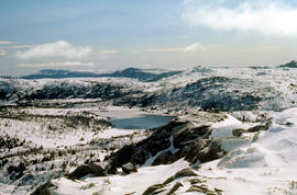
Shoreline of Lake Chalice 1979
Part of Arthur Knight Slides
Colour photograph shows the rocky shoreline of Chalice Lake GIS: Latitude -4188 Longitude 14615 Gazetteer Australia Record_ID TAS02044
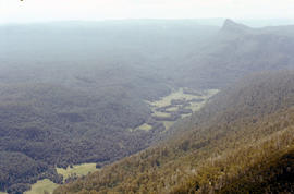
Lees Paddock and Mount Pillinger
Part of Arthur Knight Slides
Colour photograph shows the cleared land of Lees Paddocks in the upper Mersey Valley, surrounded by bush with Mount Pillinger in the background
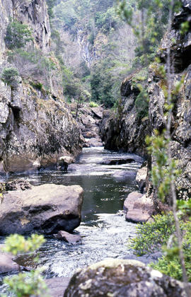
Portrait format photograph of Leven Canyon
Part of Arthur Knight Slides
Colour portrait format photograph shows Leven River spilling in to narrow gorge in the part of the river known as Leven Canyon
Part of Arthur Knight Slides
Colour photograph shows whitewater in narrow section of Leven Canyon
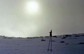
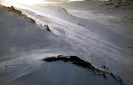
Morning mist on Ben Lomond 1962
Part of Arthur Knight Slides
Colour photograph shows pair of gloves on a set of ski poles pitched into snow atop Ben Lomond, with mist covering the sun
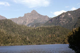
Cliffs of Mount Anne above Lake Timk
Part of Arthur Knight Slides
Colour photograph shows the cliffs of Mount Anne above Lake Timk

Part of Arthur Knight Slides
Colour photograph shows Lake Timk and Mount Anne in distance GIS: Latitude -4293 Longitude 14646 Gazetteer Australia Record_ID TAS16882

Reflection of Mount Anne on surface of Lake Timk
Part of Arthur Knight Slides
Colour portrait format photograph shows reflection of Mount Anne on the surface of Lake Timk

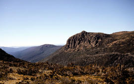
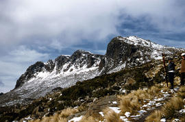
Mount Ossa and Cathedral Mountain
Part of Arthur Knight Slides
Colour photograph shows rocky peak of Mount Rogoona, with alpine plain in foreground

Part of Arthur Knight Slides
Colour photograph shows Mount Rogoona with Lake Myrtle obscured by light alpine forest vegetation on ridge

Panoramic view of Mount Rogoona
Part of Arthur Knight Slides
Colour photograph shows farmland in the Kentish area with Mount Roland in background

View across Cradle Mountain ridges to the north
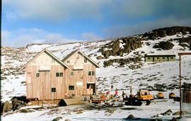
Part of Arthur Knight Slides
Colour photograph shows people standing outside Northern Tasmanian Alpine Club hut at Ben Lomond, one holding snow skis and poles
Piesse Vale on Ben Lomond plateau
Part of Arthur Knight Slides
Colour photograph shows plateau near Cradle Mountain
Creek on plateau above Cradle Mountain
Part of Arthur Knight Slides
Colour photograph shows plateau near summit of Ben Lomond
Pool of Siloam & The Temple 1978
Part of Arthur Knight Slides
Colour photograph shows snow covering Pool of Siloam near the West Wall of Mount Jerusalem
Pool of Siloam and the West Wall of Mount Jerusalem
Part of Arthur Knight Slides
Colour photograph shows dolerite peak of Ragged Jack, near Ben Lomond, viewed across from lightly timbered farmland
Part of Arthur Knight Slides
Colour photograph shows ski runs near summit of Ben Lomond 1960
Part of Arthur Knight Slides
Colour photograph of Strickland Valley near Ben Lomond, with partial snow cover, 1960
Part of Arthur Knight Slides
Colour photograph shows heavy snow cover on forest at West Wall near Mount Jerusalem
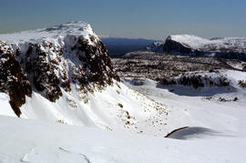
Western Bluff & Lake Thor 1978
Part of Arthur Knight Slides
Colour photograph shows view west from Back Mountain 1983
Part of Arthur Knight Slides
Colour photograph shows a kayaker falling into the Derwent River, below the site of the Repulse Dam, in 1964
Part of Arthur Knight Slides
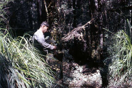
Colour photograph shows man repairing boots in shade of forest
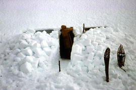
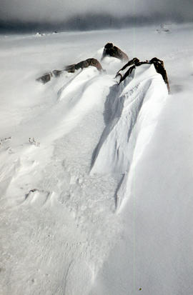
Part of Arthur Knight Slides
Colour photograph shows a snow cave excavation
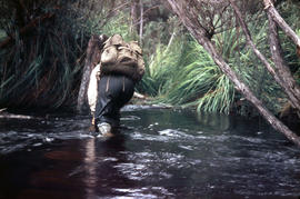
Part of Arthur Knight Slides
Colour photograph shows a bushwalker fighting to stay upright in the current while fording Sandfly Creek