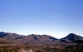
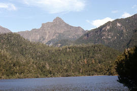
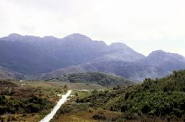
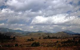
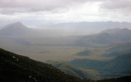
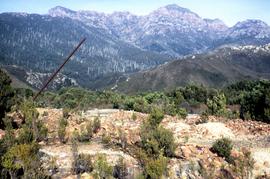
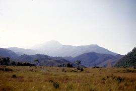
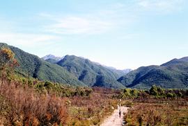
Across the King River Valley 63
- AU TAS UTAS ITCCD 2017/3-AK16
- Item
- 1963
Part of Hal Wyatt Collection
Colour photograph of landscape, King River Valley, mountains, skeletal tree trunks, dotted on mountain foothills and heathland
Hal Wyatt
28 results directly related Exclude narrower terms
Across the King River Valley 63
Part of Hal Wyatt Collection
Colour photograph of landscape, King River Valley, mountains, skeletal tree trunks, dotted on mountain foothills and heathland
Hal Wyatt
Across the King River Valley 63 02
Part of Hal Wyatt Collection
Colour photograph of landscape, King River Valley, mountains and heathland scrub.
Hal Wyatt
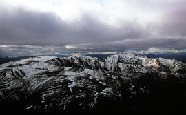
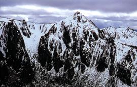
Part of Hal Wyatt Collection
Colour aerial photograph of Denison Range, capped in snow
Part of Hal Wyatt Collection
Colour aerial photograph of the Spires mountain range
Cliffs of Mount Anne above Lake Timk
Part of Arthur Knight Slides
Colour photograph shows the cliffs of Mount Anne above Lake Timk
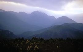
Clouds over Mount Jukes at Crotty 1970
Part of Hal Wyatt Collection
Colour photograph depicts sun peeking through cloud at Mount Jukes near Crotty.
Hal Wyatt
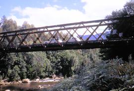
Crossing King River railway bridge 1970
Part of Hal Wyatt Collection
Colour photograph shows a person and two motor vehicles on the span of steel truss bridge built for the North Mount Lyell railway to cross the King River, near Crotty, taken in 1970; bridge later submerged by Lake Burbury.
Hal Wyatt
Part of Hal Wyatt Collection
Colour photograph shows low heath and scrub, heavily timbered foothills and rocky outcrops atop Mount Jukes, near Crotty.
Hal Wyatt
Crotty Main Street January 1970
Part of Hal Wyatt Collection
Colour photograph depicts gravel track in bush clearing at base of mountain range, the former main street of the town of Crotty, taken in 1970.
Hal Wyatt
Crotty near Mount Lyell rail spur
Part of Hal Wyatt Collection
Colour photograph shows people walking on wheel path created on gravel track, at Crotty, near Mount Lyell rail spur.
Hal Wyatt
Crotty track to King River Gorge
Part of Hal Wyatt Collection
Colour photograph shows gravel track winding through low heathland scrub near Crotty.
Hal Wyatt

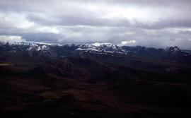
Part of Hal Wyatt Collection
Colour photograph shows Denison Range covered in patchy snow
Edward le Rossignol: Scrip certificates
This collection is comprised of scrip certificates of shares issued to Edward le Rossignol of New Town in Tasmanian mines: Royal Mint Gold Mining Company, North Mount Cameron; Savage River Silver Prospecting Company; City Prospecting Association, West Coast; Sunrise Prospecting Association; Godkin Silver Mining Co., Whyte River Tasmania; New Waverly Gold Mining Co., Lefroy, Tasmania; South Oceana Silver Mining Co. , Zeehan.
Edward le Rossignol
Letter written by Frederick K. Astell a miner from Zeehan to his uncle, referring to a downfall in the share market, friends and family, the Waratah to Zeehan railway would be a boon to the coast if constructed, house on Argent Tram property, changes and building at Zeehan, Zeehan and Queen mines lodes good, working underground at Western, then underground boss at North East Dundas.
Frederick K. Astell
Part of Walker Family Papers
Photograph thought to be the town of Gormanston c1885-90
James Backhouse Walker
This collection is a sample of images of Queenstown, Zeehan and Macquarie Harbour, sourced from the Colin Dennison image collection. Most of the images were originally created prior to 1956 and have been sourced from private Tasmanian collections. Most of the images have been obtained by scanning photographs either donated to or purchased by Mr Dennison or copied by him with the permission of families, one or more of whose members took the photographs. Some of the images can be identified as copies of original images created by government departments which were discarded and destroyed.
Colin Dennison (Curator)

Part of Arthur Knight Slides
Colour photograph shows Lake Timk and Mount Anne in distance GIS: Latitude -4293 Longitude 14646 Gazetteer Australia Record_ID TAS16882
Part of Hal Wyatt Collection
Colour photograph shows mountain range at Crotty, taken 1970.
Hal Wyatt
Part of Hal Wyatt Collection
Colour photograph shows low heath and scrub near Crotty, looking east to mountain range in distance.
Hal Wyatt
Part of Hal Wyatt Collection
Colour photograph shows man in gumboots sitting on a log, casting a fishing line into a dam near Waratah 1960.
Hal Wyatt
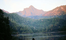
Part of Arthur Knight Slides
Colour photograph shows Mount Anne at sunrise as viewed from across Lake Timk
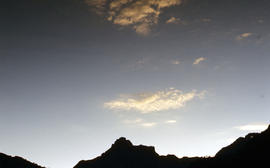
Part of Arthur Knight Slides
Colour photograph shows silhouette of Mount Anne, viewed at sunset
Part of Walker Family Papers
Photograph of the Mount Bischoff in the early days, undated but thought to be c1885-1890
James Backhouse Walker
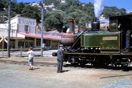
Mount Lyell No. 2 Abt locomotive at Queenstown
Part of Hal Wyatt Collection
Colour photograph of Mount Lyell No. 2 Abt railway locomotive, two people walking beside tracks, Evans groceries and general store visible in background.
Hal Wyatt
Part of Arthur Knight Slides
Colour photograph taken from elevated mountain ridge, shows valley floor looking west to Mount Solitary and original shoreline of Lake Pedder
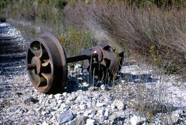
Narrow gauge rail wheels at Crotty
Part of Hal Wyatt Collection
Colour photograph shows rusted rail wheels from defunct narrow gauge rail line at Crotty
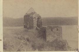
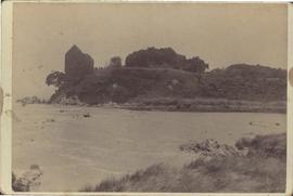
Penitentiary Building , Sarah Island
Part of George Musgrave Parker : Correspondence and research records
Sarah Island was also known by many in the late twentieth century as Settlement Island and the brick and stone penitentiary building was thought to have been constructed in 1828. Cabinet card
George Musgrave Parker
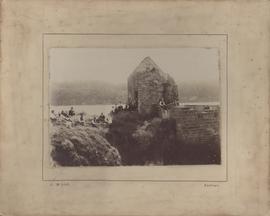
Penitentiary Building , Sarah Island
Part of George Musgrave Parker : Correspondence and research records
Sarah Island was also known by many in the late twentieth century as Settlement Island and the brick and stone penitentiary building was thought to have been constructed in 1828
Photograph by J. Mills, Zeehan. John Mills worked as a photographer in Zeehan from 1896-1900
George Musgrave Parker
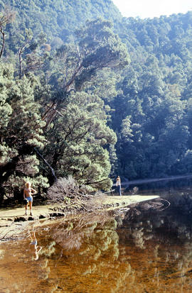
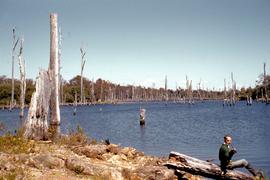
People on shore of Lake Timk 1974
Part of Arthur Knight Slides
Colour photograph shows people on western shore of Lake Timk 1974
Part of Walker Family Papers
Photograph of People's Park Strahan, initialed "J M W". Glossy print, amateurishly mounted
James Backhouse Walker
Part of Walker Family Papers
Photograph taken of Port Davey, South West Tasmania landing from a boat, dated 28th August 1898
James Backhouse Walker
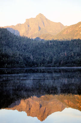
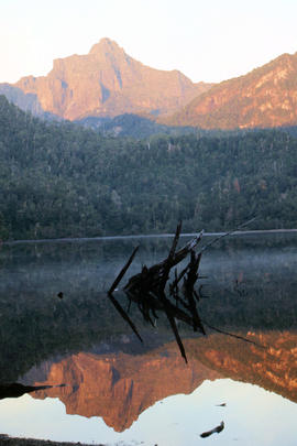
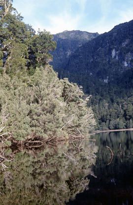
Portrait format view of reflection of Mount Anne on surface of Lake Timk
Part of Arthur Knight Slides
Colour photograph shows peaks in the Du Cane mountain range including Mount Geyron, as viewed from Cathedral Mountain

Reflection of Mount Anne on surface of Lake Timk
Part of Arthur Knight Slides
Colour portrait format photograph shows reflection of Mount Anne on the surface of Lake Timk
Remnants of smelters at Crotty and Mount Jukes
Part of Hal Wyatt Collection
Colour photograph shows rusting steel column and rubble on site of former Crotty smelters with Mount Jukes in background.
Hal Wyatt
Part of Walker Family Papers
Photograph of Sarah Island, convict settlement. Photographed "from a watercolour in the possession of James B Walker, made by a prisoner at the settlement and given to George Washington Walker on his visit
there in the year 1832" (endorsed ms by? J B Walker)
James Backhouse Walker
Part of Arthur Knight Slides
Colour photograph shows afternoon reflection of Mount Anne on the surface of water of Lake Timk
Southern shore of Lake Timk 1974
Part of Arthur Knight Slides
Colour photograph shows view of Stacks Bluff from open paddocks and farmland at Mangana
Stone at Trial Harbour with round carvings
Part of George Musgrave Parker : Correspondence and research records
Photograph taken by Douglas Rae.
George Musgrave Parker
Storm approaches Mount Solitary
Part of Arthur Knight Slides
Colour photograph shows storm approaching Mount Solitary
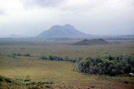
View from Mount Murchison to Mount Heemskirk
Part of Arthur Knight Slides
Colour photograph shows snow skier at Piesse Vale on Ben Lomond plateau GIS Latitude -4154 Longitude 14763 Gazetteer Record_ID TAS13722 Source: https://wwwparkstasgovau/fileaspx?id=6392
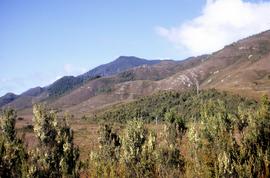
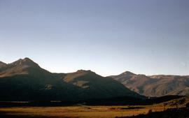
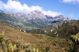
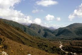
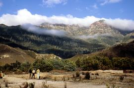
View of hills around Crotty 1970
Part of Hal Wyatt Collection
Colour photograph shows track cut into foothills at Crotty, 1970.
Hal Wyatt
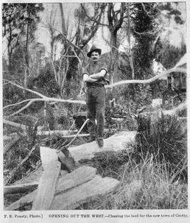
View of male axeman standing on fallen timber in the bush, Crotty, Tasmania.
Part of Images of West Coast Tasmania
Image likely sourced from a newspaper or publication as it contains printed legend at the bottom: Opening out of the west - clearing the land for the new town of Crotty. Photographer identified. Primitive buildings just visible in the background. It is likely the image is older than 1902.
F.E. Pousty
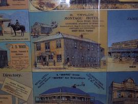
View of Montagu Hotel, Bowes street Queenstown Tasmania
Part of Images of West Coast Tasmania
Image is only one of a number of businesses on a colour advertising sheet. Others shown include Royal Hotel and JB Wood, hairdresser.
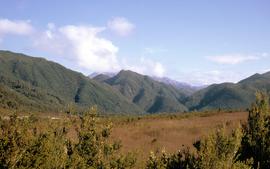
View of Mount Huxley near Crotty
Part of Hal Wyatt Collection
Colour photograph of Mount Huxley and Crotty at sunset, 1970.
Hal Wyatt
View of Mount Jukes from site of former Crotty smelters
Part of Hal Wyatt Collection
Colour photograph shows three people standing on a former industrial site at Crotty, in front of Mount Jukes, a rocky mountaintop with heavily timbered foothills.
Hal Wyatt
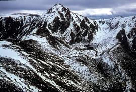
Part of Hal Wyatt Collection
Colour aerial photograph of snow-topped ridge of Reeds Peak
View of snow on ground at Reeds Peak and nearby lakes
Part of Hal Wyatt Collection
Colour aerial photograph of Reeds Peak with lakes in foothills
Part of Hal Wyatt Collection
Colour photograph shows people walking on gravel track at Crotty, 1963.
Hal Wyatt
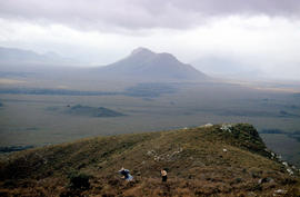
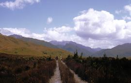
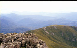
Walkers on ridge overlooking Mount Solitary
Part of Arthur Knight Slides
Colour photograph shows some bushwalkers on a ridge overlooking the valley towards Mount Solitary
Part of Walker Family Papers
Photograph of the town of Waratah, Tasmania (visited by J B Walker 1887) c1878-88
James Backhouse Walker