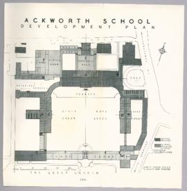
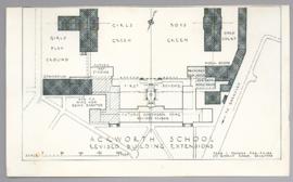
Ackworth School development plan drawn by John L Denman F.I.R.B.A. 27 Queens Road Brighton. Dated 1946. showing the location of existing buildings, existing buildings altered and new buildings.
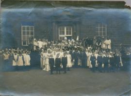
Photograph album of scenes and people taken in South Africa during the Boer War including soldiers on board ship, scenery and settlers, c1899-1902 (also copy prints of 9 photos in album (ticked in album).
Scenes of South Africa reprinted from Natal Mercury, no date c1902-1910.
First Imperial Bushmen (mounted) in Hobart, c1899-1902. 4-5. Soldiers on board ship, wearing forage caps or helmuts, no date.
Boer War veterans by War Memorial, Hobart, c1948-1952. 7-8. Boer War veterans by train on way to reunion, 31 May 1952.
Reunion group, Hillwood, 8 March 1953.
Opening R.S.L. Smithton, no date.
Tasmanian South African Returned Soldiers Association
Four photographs dated October 1950, of the Friends Meeting House at Dolobran in Montgomeryshire, Wales. Built in 1701 by Charles Lloyd (1662–1747) of Dolobran, whose father Charles Lloyd (1637–1698) of Dolobran was the first in the family to become a Quaker. It consists of a tiny isolated chapel built of red-brick with drip courses over the cambered windows and comprising also a two-bay cottage under the same roof. Photographs addressed to Hugh Doncaster, Woodbrooke.
Various photographs of Harrington Street - St. Marys Cathedral, Wilmot Terrace; Pressland House (formerly J P Cowles School); Goulburn St. ; St John the Baptist Church. Photographs by Winter Baily and Anson Bros.
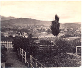
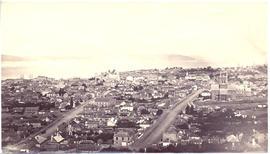
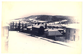
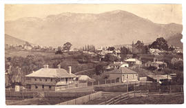
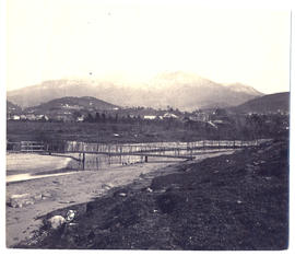
Photograph from the collection of James Backhouse Walker of a view of Hobart from Huon Road looking east in about 1879, according to notes on the reverse.
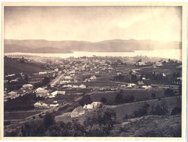
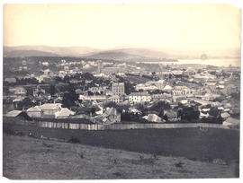
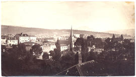
Photograph from the collection of James Backhouse Walker of a view of Hobart from the top of Murray St in about 1876 according to notes on the reverse. The photographer is Henry Hall Baily who had studios in Elizabeth and Liverpool Streets Hobart from 1865 until 1918.
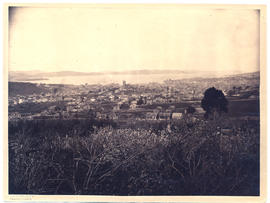
Photograph from the collection of James Backhouse Walker of a view of Hobart from West Hobart looking east toward the river, showing Holy Trinity Church. The photographer is Henry Hall Baily who had studios in Elizabeth and Liverpool Streets Hobart from 1865 until 1918..
Photograph from the collection of James Backhouse Walker of a view of Hobart looking South East with a garden in the foreground and Elizabeth Street in the middle distance. The photographer is Alfred Winter who had studios in Bathurst, Elizabeth and Liverpool Streets from 1874-1880.
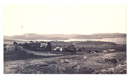
Photograph from the collection of James Backhouse Walker of Hobart viewing over St. Davids Park, probably from Hampden Road, (in about 1878 according to a note on the reverse). The photographer is Henry Hall Baily who had studios in Elizabeth and Liverpool Streets Hobart from 1865 until 1918.
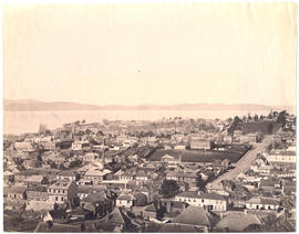
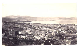
Photograph from the collection of James Backhouse Walker of an elevated view of Hobart looking east taken near Browne Street, (about 1876, according to a note on the reverse). Warwick Street in the foreground. Photographed by Henry Hall Baily who had studios in Elizabeth and Liverpool Streets, Hobart from 1865 until 1918.
Photograph from the collection of James Backhouse Walker of a view of Hobart, looking towards St. George's Hill, Battery Point. Showing St Georges Church and James Luckman's windmill probably taken in the 1870s.
Photographs of Lake St. Clair at the southern end of the Cradle Mountain-Lake St Clair National Park. Is part of the Tasmanian Wilderness World Heritage Area. The Cradle Mountain-Lake St Clair area was declared a scenic reserve in 1922, a wildlife reserve in 1927, a national park in 1947 and a world heritage area from 1982.
Photographs of Maatsuyker Island located 5.5 kilometres off the south coast of Tasmania. The island comprises part of the Southwest National Park and is a Tasmanian Wilderness World Heritage Site. The Maatsuyker Island Lighthouse, the southernmost Australian lighthouse, is located on the southern tip of the island
Various photographs of Macquarie Street, looking north taken c1877-1893-4. Photographed by Beattie (electric tram car), Winter, Anson Bros, and H H Baily
Photographs of Mt Wellington, Huon Road, Fern Tree Bower, Waterworks. Taken c1870-1882 by photographers Anson Bros., Baily and Albert Sargeant Photographers
Photograph from the collection of James Backhouse Walker of a view of Mt. Wellington from St. George's Hill with Hawthorn Cottage in the foreground and Bishopscourt - Garden Crescent and Davey Street Chapel in the background (according to notes on the reverse). The photographer was the Anson Brothers, whose firm was located in Liverpool, Collins and Elizabeth Streets between 1878 and 1891.
Photograph from the collection of James Backhouse Walker of a view of Mt. Wellington from the foot of St. George's Hill in about 1870. The view is from the corner of Albeura St and Sandy Bay Rd. The photographer's name, Woolley, is recorded in a note on the reverse and presumably refers to Charles Alfred.
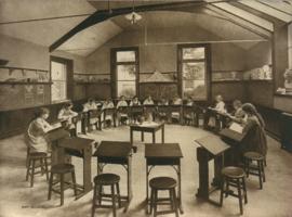
Photograph of an art class at Ackworth School. Showing female pupils in a circle drawing still life. Presented in a folder of images produced by E.T.W. Dennis & Sons Ltd. Art Printers, 42 Holborn Viaduct. London E.C. Works, Scarborough
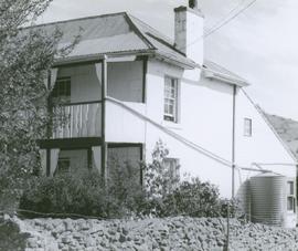
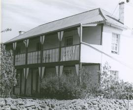
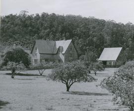
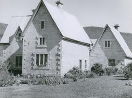
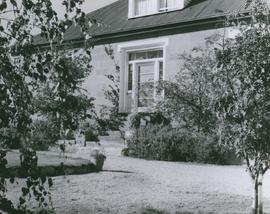
Photograph of Braeside from the South West, Broadmarsh. Taken April 1960. Now known as Stonefield' , 'Braeside' was built in 1824, located at 266 Elderslie Rd, Lower Broadmarsh. A good example of a two storey Georgian home with a separate kitchen wing
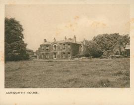
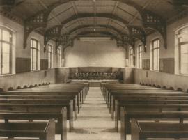
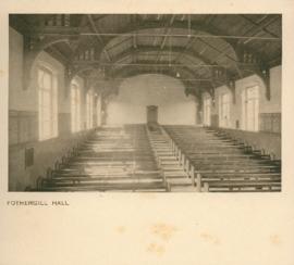
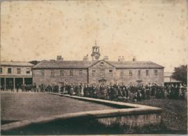
Photograph of Fothergill Hall at Ackworth School. Presented in a folder of images produced by E.T.W. Dennis & Sons Ltd. Art Printers, 42 Holborn Viaduct. London E.C. Works, Scarborough
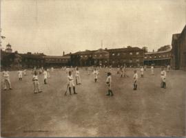
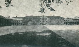
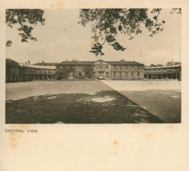
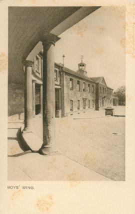
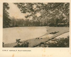
Photograph of the boys playground at Ackworth School. Presented in a folder of images produced by E.T.W. Dennis & Sons Ltd. Art Printers, 42 Holborn Viaduct. London E.C. Works, Scarborough
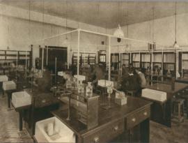
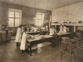
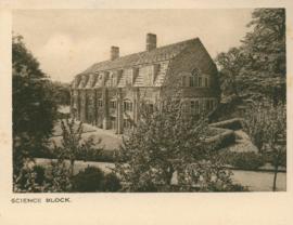
Photograph of the Chemical Laboratory and pupils at the Ackworth School. Presented in a folder of images produced by E.T.W. Dennis & Sons Ltd. Art Printers, 42 Holborn Viaduct. London E.C. Works, Scarborough
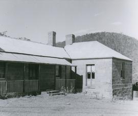
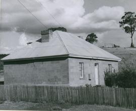
Photograph of the old prison station, Broadmarsh, Tasmania. Taken April 1960. In 1842 Invercarron became the site of the Broadmarsh Convict Probation Station, which was deemed to be such a disaster [La Trobe’s 1847 report cited ‘utter abandonment of all order and decency’] that it was closed in 1847
Photograph of the old prison station, Broadmarsh, Tasmania. Taken April 1960. In 1842 Invercarron became the site of the Broadmarsh Convict Probation Station, which was deemed to be such a disaster [La Trobe’s 1847 report cited ‘utter abandonment of all order and decency’] that it was closed in 1847.
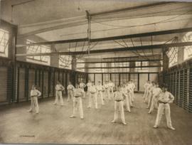
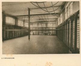
Photograph of boys in the gymnasium at Ackworth School. Presented in a folder of images produced by E.T.W. Dennis & Sons Ltd. Art Printers, 42 Holborn Viaduct. London E.C. Works, Scarborough
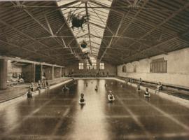
Photograph of boys in the swimming bath at Ackworth School. Presented in a folder of images produced by E.T.W. Dennis & Sons Ltd. Art Printers, 42 Holborn Viaduct. London E.C. Works, Scarborough
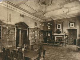
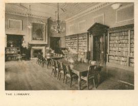
Photograph of the Centre Library at Ackworth School. Presented in a folder of images produced by E.T.W. Dennis & Sons Ltd. Art Printers, 42 Holborn Viaduct. London E.C. Works, Scarborough
Photograph of a cookery class at Ackworth School. Showing girls in smocks in the kitchen. Presented in a folder of images produced by E.T.W. Dennis & Sons Ltd. Art Printers, 42 Holborn Viaduct. London E.C. Works, Scarborough
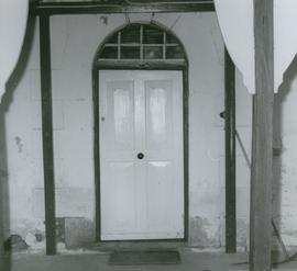
Photograph of doorway at Braeside, Broadmarsh. Taken April 1960. Now known as Stonefield' , 'Braeside' was built in 1824, located at 266 Elderslie Rd, Lower Broadmarsh. A good example of a two storey Georgian home with a separate kitchen wing
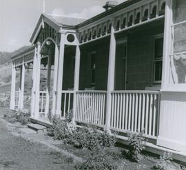
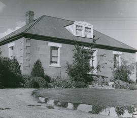
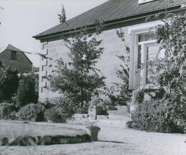
Photograph of doorway at Strathelie, Broadmarsh. Taken April 1960. Located at 974 Elderslie Road Broadmarsh. Strathelie is a very impressive late Georgian house thought to be built by Thomas Johnston in 1851. Constructed of silver grey sandstone, featuring a parapeted facade, enclosed rear courtyard, fine front door and front verandah with slender iron columns. The house is complemented by particularly fine outbuildings comprising stone barn with arched openings and brick stable forming a u-shape about a central yard.
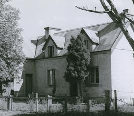
Photograph of front view of Braeside, Broadmarsh. Taken April 1960. Now known as Stonefield' , 'Braeside' was built in 1824, located at 266 Elderslie Rd, Lower Broadmarsh. A good example of a two storey Georgian home with a separate kitchen wing
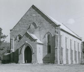
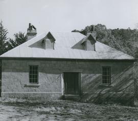
Photograph of font view of St Augustine's Anglican Church, Broadmarsh, Tasmania. Taken April 1960 Consecrated 15 September 185. Located 1 2 Grahams Creek Road, Broadmarsh, now a private residence.
Photograph of northern wall of Braeside, Broadmarsh. Taken April 1960. Now known as Stonefield' , 'Braeside' was built in 1824, located at 266 Elderslie Rd, Lower Broadmarsh. A good example of a two storey Georgian home with a separate kitchen wing
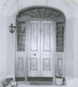
Photograph of the front door of Roydon, Broadmarsh. Taken April 1960. Located at 58 Clifton Vale Road, Elderslie. Sandstone farm house with a central door and flanking double hung windows, an attic level and weatherboard addition to the rear. The building has a hipped roof and narrow boxed eaves. The sandstone stables feature a half hipped roof, sandstone walls and an iron roof. The building is a floor and a half and is still in use as a stable. There are some other early buildings on the site.
Photograph of front view of Roydon, Broadmarsh. Taken April 1960. Located at 58 Clifton Vale Road, Elderslie. Sandstone farm house with a central door and flanking double hung windows, an attic level and weatherboard addition to the rear. The building has a hipped roof and narrow boxed eaves. The sandstone stables feature a half hipped roof, sandstone walls and an iron roof. The building is a floor and a half and is still in use as a stable. There are some other early buildings on the site.
Photograph of the front door of Roydon, Broadmarsh. Taken April 1960. Located at 58 Clifton Vale Road, Elderslie. Sandstone farm house with a central door and flanking double hung windows, an attic level and weatherboard addition to the rear. The building has a hipped roof and narrow boxed eaves. The sandstone stables feature a half hipped roof, sandstone walls and an iron roof. The building is a floor and a half and is still in use as a stable. There are some other early buildings on the site.
Photograph of St Augustine's Anglican Church and rectory, Broadmarsh, Tasmania. Taken April 1960 Consecrated 15 September 185. Located 1 2 Grahams Creek Road, Broadmarsh, now a private residence.
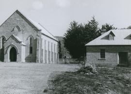
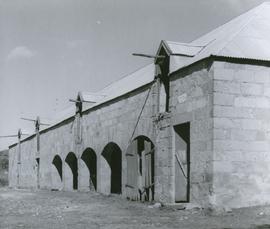
Photograph of stables at Strathelie, Broadmarsh. Taken April 1960. Located at 974 Elderslie Road Broadmarsh. Strathelie is a very impressive late Georgian house thought to be built by Thomas Johnston in 1851. Constructed of silver grey sandstone, featuring a parapeted facade, enclosed rear courtyard, fine front door and front verandah with slender iron columns. The house is complemented by particularly fine outbuildings comprising stone barn with arched openings and brick stable forming a u-shape about a central yard.
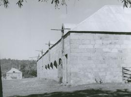
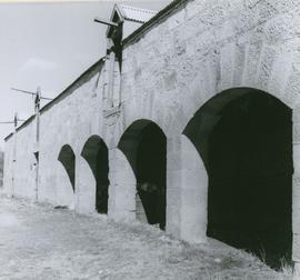
Photograph view of arches at the stables, Strathelie, Broadmarsh. Taken April 1960. Located at 974 Elderslie Road Broadmarsh. Strathelie is a very impressive late Georgian house thought to be built by Thomas Johnston in 1851. Constructed of silver grey sandstone, featuring a parapeted facade, enclosed rear courtyard, fine front door and front verandah with slender iron columns. The house is complemented by particularly fine outbuildings comprising stone barn with arched openings and brick stable forming a u-shape about a central yard.
Photograph of stables at Strathelie, Broadmarsh. Taken April 1960. Located at 974 Elderslie Road Broadmarsh. Strathelie is a very impressive late Georgian house thought to be built by Thomas Johnston in 1851. Constructed of silver grey sandstone, featuring a parapeted facade, enclosed rear courtyard, fine front door and front verandah with slender iron columns. The house is complemented by particularly fine outbuildings comprising stone barn with arched openings and brick stable forming a u-shape about a central yard.
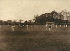
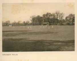
Photograph of the boys cricket ground at Ackworth School. Presented in a folder of images produced by E.T.W. Dennis & Sons Ltd. Art Printers, 42 Holborn Viaduct. London E.C. Works, Scarborough
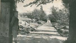
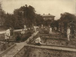
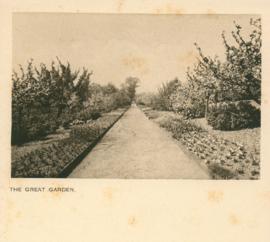
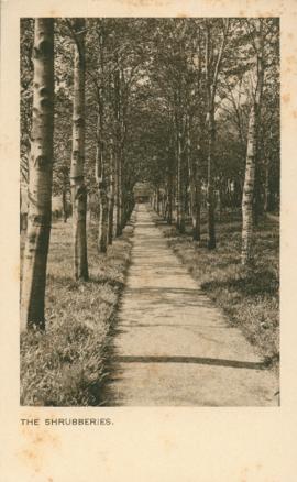
Photograph of the boys garden at Ackworth School. Presented in a folder of images produced by E.T.W. Dennis & Sons Ltd. Art Printers, 42 Holborn Viaduct. London E.C. Works, Scarborough
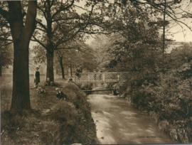
Photograph of the Canal Bridge at Ackworth School. Showing boy and girl pupils non the bridge and on the bank. Presented in a folder of images produced by E.T.W. Dennis & Sons Ltd. Art Printers, 42 Holborn Viaduct. London E.C. Works, Scarborough
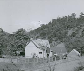
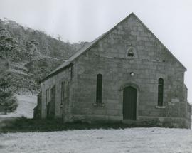
Photograph of the Congregational Church, Broadmarsh, Tasmania. Taken April 1960. Two churches were established at Broadmarsh, an Anglican church, St Augustine's in 1847 and a Congregational church in1861. Location 1497 Elderslie Road. The Broadmarsh Uniting (Congregational) Church was built in 1861 on land owned by William Gunn, at ‘Arndell’.
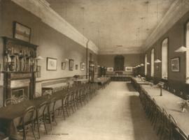
Photograph of the girls' dining room at Ackworth School. Presented in a folder of images produced by E.T.W. Dennis & Sons Ltd. Art Printers, 42 Holborn Viaduct. London E.C. Works, Scarborough
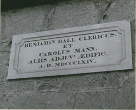
Photograph of the plaque on side of the rectory of St Augustine's Anglican Church, Broadmarsh, Tasmania. Taken April 1960. " "Benjamin Ball Clericus. et Carolus Mann. Aliis Adjuv's Aedific A.D. MDCCCLXIV"
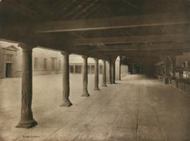
Photograph of the shed and the court yard at Ackworth School. Presented in a folder of images produced by E.T.W. Dennis & Sons Ltd. Art Printers, 42 Holborn Viaduct. London E.C. Works, Scarborough
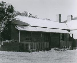
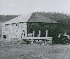
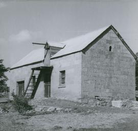
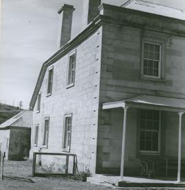
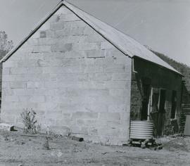
Photograph of the stable at the old prison station, Broadmarsh, Tasmania. Taken April 1960. In 1842 Invercarron became the site of the Broadmarsh Convict Probation Station, which was deemed to be such a disaster [La Trobe’s 1847 report cited ‘utter abandonment of all order and decency’] that it was closed in 1847.