Arthur Knight Slides
Ajouter au presse-papier
AU TAS UTAS ITCCD 2017/2
Collection
1950 - 1980
Arthur Knight
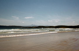
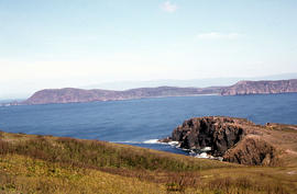
Adamsons Peak from Cloudy Bay
Ajouter au presse-papier
Colour photograph taken from beach at Cloudy Bay on Bruny Island, looking west to Adamsons Peak on Tasmanian mainland
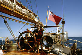
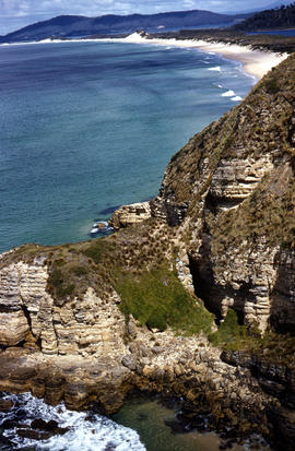
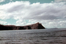
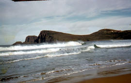
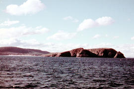
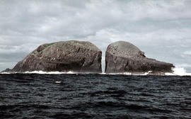
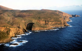
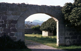
View of Cape Bruny and lighthouse from Lighthouse Bay
Ajouter au presse-papier
Colour photograph of waves breaking in Lighthouse Bay, with cliffs and headland of Cape Bruny and Bruny Island Lighthouse in background. Discolouration in scanned image from original slide.
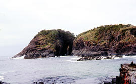
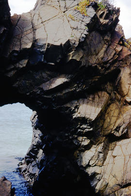
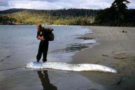
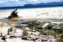
Wreck on beach near Mars Bluff
Ajouter au presse-papier
Colour photograph of rotting timbers from wreck of boat, half-buried in the sand near shallow creek on beach near Mars Bluff, Bruny Island, Photograph possibly taken 1963.
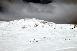
Bare Mountain
Ajouter au presse-papier
Colour photograph of Bare Mountain, with evidence of past bushfire damage to trees on lower slope GIS: Latitude -4149 Longitude 14590 Gazetteer Australia Record_ID TAS23466
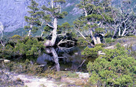
Trees reflected in Artists Pool
Ajouter au presse-papier
Colour photograph of Artists Pool, a waterhole near Cradle Mountain, with reflections of alpine plants on the water's surface
Pointing out a dead bird
Ajouter au presse-papier
Colour photograph shows a person pointing at a dead bird on the ground near Bare Mountain, with new undergrowth shooting after a recent bushfire and several bushwalkers visible in the distance
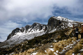
Walkers near Barn Bluff
Ajouter au presse-papier
Colour photograph of two walkers trying to avoid slippery pathway with flecks of snow on ground and Barn Bluff in background
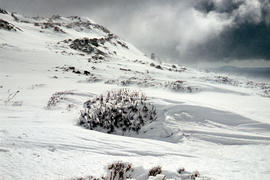
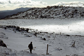
Man with skis on Mount Barrow
Ajouter au presse-papier
Colour photograph shows heavy snow cover on Mount Barrow with man carrying skis next to guideposts alongside road
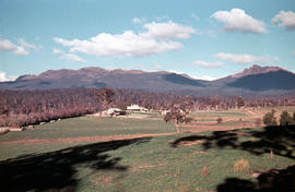
Open paddocks near Ben Lomond
Ajouter au presse-papier
Colour photograph shows open paddock and mature eucalypt trees with Ben Lomond in the distance
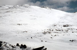
Ben Lomond plateau
Ajouter au presse-papier
Colour photograph shows Ben Lomond plateau with partial snow cover and blackened ground
View of Ben Lomond
Ajouter au presse-papier
Colour photograph shows open farmland in the foothills of Ben Lomond
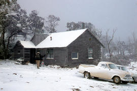
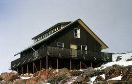
Carr Villa Chalet at Ben Lomond 1962
Ajouter au presse-papier
Colour photograph shows two people inspecting a gas cylinder outside the Carr Villa Chalet atop the treeline at Ben Lomond
Chalice Lake and Mount Rogoona
Ajouter au presse-papier
Colour photograph of Chalice Lake and Mount Rogoona GIS: Latitude -4188 Longitude 14619 Gazetteer Record_ID TAS02032
Shoreline of Cloister Lagoon
Ajouter au presse-papier
Colour photograph shows shoreline of Cloister Lagoon GIS: Latitude -4189 Longitude 14617 Gazetteer Australia Record_ID TAS02046
View across Lake Lea
Ajouter au presse-papier
Colour photograph shows Lake Lea in foreground, with Cradle Mountain and Barn Bluff in distance
Cradle Mountain and Dove Lake
Ajouter au presse-papier
Colour photograph shows flecks of snow on upper ridges of Cradle Mountain and land around Dove Lake, some of it cloaked in deep shadow
Looking south to Cradle Mountain
Ajouter au presse-papier
Colour photograph shows the heathland on the Central Plateau, south of Cradle Mountain, with the mountain peaks visible in the distance
Close up of Crater Lake
Ajouter au presse-papier
Colour photograph shows shoreline of Crater Lake with sunlit cliffs on opposite bank
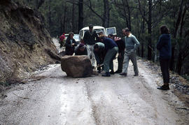
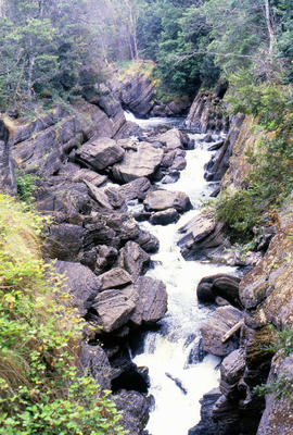
Culvert at Foggs Flat
Ajouter au presse-papier
Colour photograph shows a steel-plated culvert beneath a road at Foggs Flat
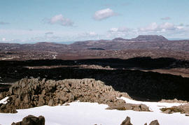
Crater Lake
Ajouter au presse-papier
Colour photograph shows Crater Lake
Cushion plants
Ajouter au presse-papier
Colour photograph shows bed of green cushion plants
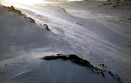
Skiing shelter
Ajouter au presse-papier
Colour photograph shows two sets of skis and backpacks outside an alpine hut, covered in a snowdrift
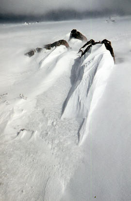
Alpine hut covered in snowdrift
Ajouter au presse-papier
Colour photograph shows footprints in snow leading to an alpine hut in a clearing, partially covered by snowdrift
Flooded Midland Highway 1964
Ajouter au presse-papier
Colour photograph shows Volkswagen combi van being driven through floodwaters across Midland Highway 1964
Hut at Lake Meston 1977
Ajouter au presse-papier
Colour photograph shows hut at Lake Meston built of logs, shingles and with tin plate chimney People sitting outside hut eating
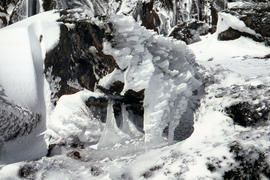
Ice formation on bush
Ajouter au presse-papier
Colour photograph shows ice formed on plants, location unknown
Knyvet Falls 1984
Ajouter au presse-papier
Colour photograph of limited water flow across Knyvet Falls 1984 GIS: Latitude -4159 Longitude 14593 Gazetteer Australia Record_ID TAS06008
Reflections upon surface of Lake Chalice 1979
Ajouter au presse-papier
Colour photograph shows reflections of alpine vegetation in Chalice Lake 1979 GIS: Lake Latitude -4188 Longitude 14615 Gazetteer Australia Record_ID TAS02044
Shoreline of Lake Chalice 1979
Ajouter au presse-papier
Colour photograph shows the rocky shoreline of Chalice Lake GIS: Latitude -4188 Longitude 14615 Gazetteer Australia Record_ID TAS02044
White caps on Lake Myrtle
Ajouter au presse-papier
Colour photograph shows waves and white caps on the surface of Lake Myrtle GIS: Latitude -4188 Longitude 14618 Gazetteer Australia Record_ID TAS02073
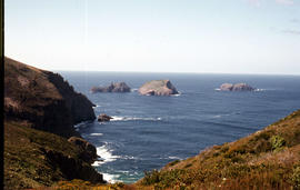
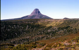
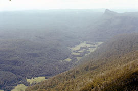
Lees Paddock and Mount Pillinger
Ajouter au presse-papier
Colour photograph shows the cleared land of Lees Paddocks in the upper Mersey Valley, surrounded by bush with Mount Pillinger in the background
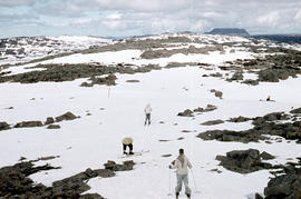
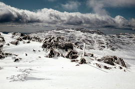
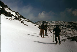
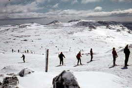
Snow skiing below Legges Tor
Ajouter au presse-papier
Colour photograph shows Legges Tor, the highest peak of Ben Lomond, with skiers visible on the nearby ski field
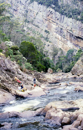
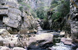
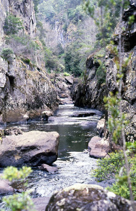
Rockpools in Leven Canyon
Ajouter au presse-papier
Colour photograph shows rockpools in the Leven River at Leven Canyon, surrounded by steep rockwalls and temperate rainforest