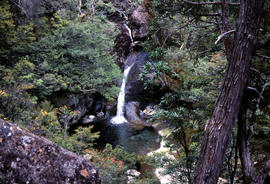
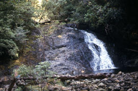
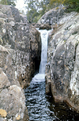
Waterfall on track to Meander Valley Falls
Add to clipboard
Colour photograph shows water spilling into a pool beside track to Meander Falls, with overhanging trees and vegetation surrounding stream
Arthur Knight
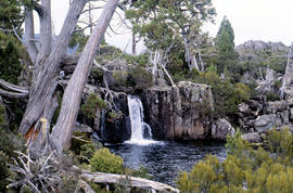
Waterfall at Pine Tree Creek
Add to clipboard
Colour photograph shows waterfall flowing across rock face in Central Highlands, with pencil pines surrounding rock pool
Arthur Knight
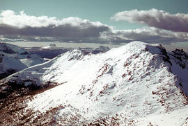
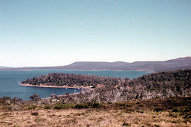
Foothills of Mount Olympus
Add to clipboard
Colour photograph shows snow on Mount Olympus as viewed from near Narcissus hut, near Lake St Clair
Arthur Knight
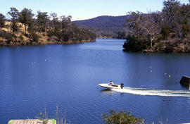
Boat on Lake Trevallyn
Add to clipboard
Colour photograph shows Lake St Clair as viewed from Mount Manfred
Arthur Knight
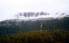
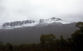
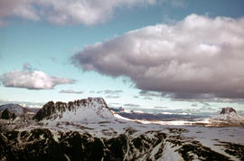
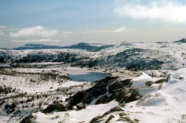
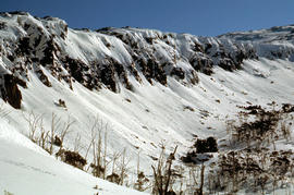
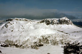
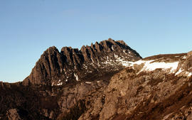
West Wall 1978
Add to clipboard
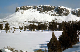
Colour photograph shows snow cover surround Lake Thor and Western Bluff
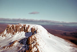
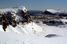
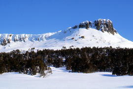
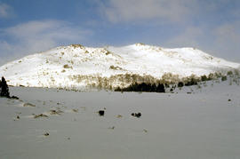
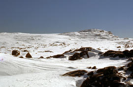
Snow near Mount Ophel
Add to clipboard
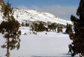
Colour photograph shows snow cover above thick alpine forest at the Wailing Wall near Mount Jerusalem
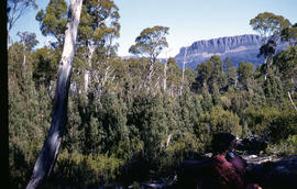
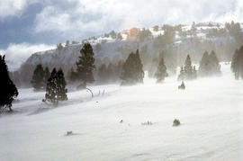
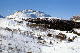
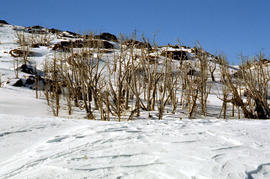
Trappers hut in snow
Add to clipboard
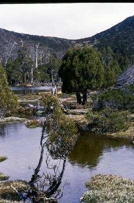
Colour photograph shows alpine vegetation and snowcover below Mount Ophel
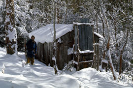
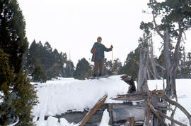
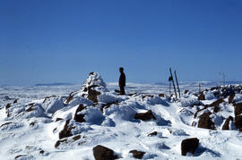
Skier at trappers hut
Add to clipboard
Colour photograph shows three snow skiers outside a trapper's hut in the snow
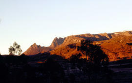
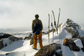
The Wailing Wall 1978
Add to clipboard
Colour photograph shows skier standing outside trapper's hut in the snow
Pool of Bethesda
Add to clipboard
Colour photograph shows snow covering the Pool of Siloam near The Temple below Mount Jerusalem
Pencil Pines near Dixons Kingdom
Add to clipboard
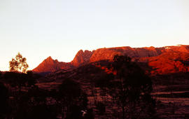
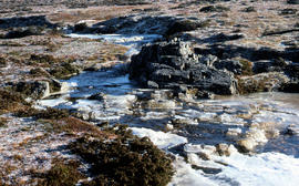
Colour photograph shows Piesse Vale at Ben Lomond plateau dusted with snow GIS Latitude -4154 Longitude 14763 Gazetteer Record_ID TAS13722
Pencil Pine Creek Falls
Add to clipboard
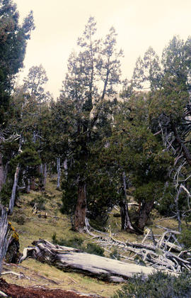
Colour photograph shows Pencil Pines growing in alpine forest near Dixons Kingdom hut
Paddys Lake
Add to clipboard
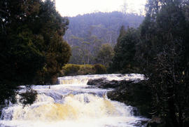
Colour photograph shows whitewater section of Pencil Pine Creek
Mount Rogoona
Add to clipboard
Colour photograph shows Mount Rogoona with Lake Myrtle obscured by light alpine forest vegetation on ridge
White caps on Lake Myrtle
Add to clipboard
Colour photograph shows waves and white caps on the surface of Lake Myrtle GIS: Latitude -4188 Longitude 14618 Gazetteer Australia Record_ID TAS02073
Shoreline of Lake Chalice 1979
Add to clipboard
Colour photograph shows the rocky shoreline of Chalice Lake GIS: Latitude -4188 Longitude 14615 Gazetteer Australia Record_ID TAS02044
Knyvet Falls 1984
Add to clipboard
Colour photograph of limited water flow across Knyvet Falls 1984 GIS: Latitude -4159 Longitude 14593 Gazetteer Australia Record_ID TAS06008
Hut at Lake Meston 1977
Add to clipboard
Colour photograph shows hut at Lake Meston built of logs, shingles and with tin plate chimney People sitting outside hut eating
Skiing shelter
Add to clipboard
Colour photograph shows two sets of skis and backpacks outside an alpine hut, covered in a snowdrift
Alpine hut covered in snowdrift
Add to clipboard
Colour photograph shows footprints in snow leading to an alpine hut in a clearing, partially covered by snowdrift
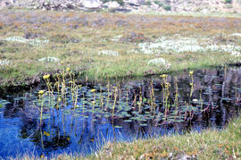
Cushion plants
Add to clipboard
Colour photograph shows bed of green cushion plants
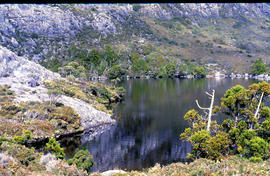
Close up of Crater Lake
Add to clipboard
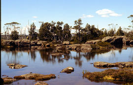
Colour photograph shows shoreline of Crater Lake with sunlit cliffs on opposite bank
Crater Lake
Add to clipboard
Colour photograph shows Crater Lake
View across Lake Lea
Add to clipboard
Colour photograph shows Lake Lea in foreground, with Cradle Mountain and Barn Bluff in distance
Cradle Mountain and Dove Lake
Add to clipboard
Colour photograph shows flecks of snow on upper ridges of Cradle Mountain and land around Dove Lake, some of it cloaked in deep shadow
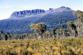
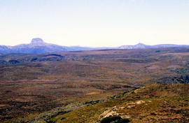
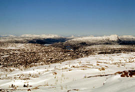
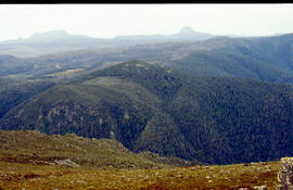
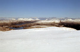
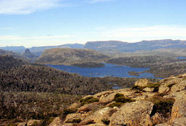
Looking south to Cradle Mountain
Add to clipboard
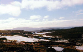
Colour photograph shows the heathland on the Central Plateau, south of Cradle Mountain, with the mountain peaks visible in the distance
Shoreline of Cloister Lagoon
Add to clipboard
Colour photograph shows shoreline of Cloister Lagoon GIS: Latitude -4189 Longitude 14617 Gazetteer Australia Record_ID TAS02046
Chalice Lake and Mount Rogoona
Add to clipboard
Colour photograph of Chalice Lake and Mount Rogoona GIS: Latitude -4188 Longitude 14619 Gazetteer Record_ID TAS02032